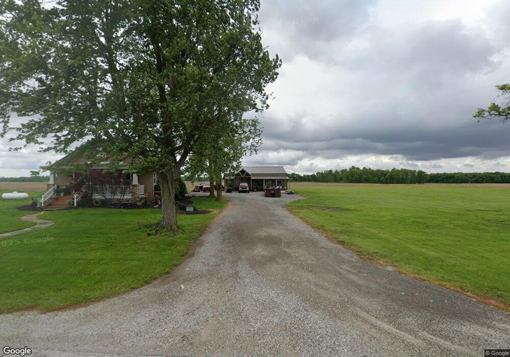
5132 State Route 117 Rockford, OH 45882
Estimated Value: $215,000 - $259,000
3
Beds
1
Bath
1,111
Sq Ft
$211/Sq Ft
Est. Value
About This Home
This home is located at 5132 State Route 117, Rockford, OH 45882 and is currently estimated at $234,593, approximately $211 per square foot. 5132 State Route 117 is a home located in Mercer County with nearby schools including Parkway Elementary School, Parkway Middle School, and Parkway High School.
Ownership History
Date
Name
Owned For
Owner Type
Purchase Details
Closed on
Dec 5, 2016
Sold by
Harner Steve P and Harner Jenna R
Bought by
Harner Steve P and Harner Jenna R
Current Estimated Value
Home Financials for this Owner
Home Financials are based on the most recent Mortgage that was taken out on this home.
Original Mortgage
$75,000
Outstanding Balance
$48,430
Interest Rate
3.47%
Mortgage Type
New Conventional
Estimated Equity
$186,163
Purchase Details
Closed on
Jan 26, 2012
Sold by
Kerns Tom A
Bought by
Harner Steve P
Home Financials for this Owner
Home Financials are based on the most recent Mortgage that was taken out on this home.
Original Mortgage
$32,250
Interest Rate
3.91%
Mortgage Type
Seller Take Back
Purchase Details
Closed on
Dec 28, 2009
Sold by
The Bank Of New York Mellon
Bought by
Kerns Tom A
Purchase Details
Closed on
Sep 21, 2009
Sold by
Spall Brian and Spall Joyce
Bought by
The Bank Of New York Mellon
Create a Home Valuation Report for This Property
The Home Valuation Report is an in-depth analysis detailing your home's value as well as a comparison with similar homes in the area
Home Values in the Area
Average Home Value in this Area
Purchase History
| Date | Buyer | Sale Price | Title Company |
|---|---|---|---|
| Harner Steve P | -- | Attorney | |
| Harner Steve P | $35,314 | Attorney | |
| Kerns Tom A | $24,000 | Attorney | |
| The Bank Of New York Mellon | $28,000 | Attorney |
Source: Public Records
Mortgage History
| Date | Status | Borrower | Loan Amount |
|---|---|---|---|
| Open | Harner Steve P | $75,000 | |
| Closed | Harner Steve P | $32,250 |
Source: Public Records
Tax History Compared to Growth
Tax History
| Year | Tax Paid | Tax Assessment Tax Assessment Total Assessment is a certain percentage of the fair market value that is determined by local assessors to be the total taxable value of land and additions on the property. | Land | Improvement |
|---|---|---|---|---|
| 2024 | $2,549 | $73,290 | $13,580 | $59,710 |
| 2023 | $2,549 | $73,290 | $13,580 | $59,710 |
| 2022 | $2,173 | $50,510 | $12,640 | $37,870 |
| 2021 | $2,140 | $50,510 | $12,640 | $37,870 |
| 2020 | $1,093 | $50,510 | $12,640 | $37,870 |
| 2019 | $1,635 | $39,910 | $11,800 | $28,110 |
| 2018 | $1,593 | $39,910 | $11,800 | $28,110 |
| 2017 | $1,353 | $39,910 | $11,800 | $28,110 |
| 2016 | $1,112 | $35,320 | $10,360 | $24,960 |
| 2015 | $1,098 | $29,790 | $10,360 | $19,430 |
| 2014 | $1,099 | $29,790 | $10,360 | $19,430 |
| 2013 | $1,319 | $32,450 | $11,270 | $21,180 |
Source: Public Records
Map
Nearby Homes
- 5062 Mercer van Wert County Line Rd
- 208 Market St
- 7957 W Bridge St
- 208 W Pearl St
- 0 Rockford West Rd Unit Lots 14- 28
- 0 Wilson Unit 1037059
- 0 Wilson Unit 306333
- 12029 Dutton Rd
- 108 S Ball Rd
- 15845 Uus 127
- 0 Drake St
- 206 Glenn St
- 8323 Deep Cut Rd
- 11164 Erastus Durbin Rd
- 9155 Us Route 127
- 9289 Wren Landeck Rd
- 12242 Dustman Rd
- 0 Stirn Rd Unit 308464
- 21108 State Route 116
- 21183 Ohio 116
- 5145 State Route 117
- 5079 State Route 117
- 5186 State Route 117
- 5061 State Route 117
- 12312 Frysinger Rd
- 5277 State Route 117
- 5453 Shindeldecker Rd
- 12428 Frysinger Rd
- 5135 Shelley Rd
- 120700 Frysinger Rd
- 5289 Shelley Rd
- 5009 Shelley Rd
- 5198 Shelley Rd
- 5341 Ohio 117
- 5341 State Route 117
- 5385 Shelley Rd
- 5432 State Route 117
- 5469 Shelley Rd
- 0 Shelley Rd Unit 208733
- 0 Shelley Rd Unit 208738