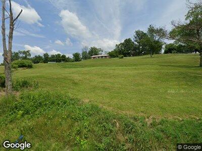
51323 State Route 145 Jerusalem, OH 43747
Estimated Value: $79,630 - $146,000
--
Bed
1
Bath
960
Sq Ft
$122/Sq Ft
Est. Value
About This Home
This home is located at 51323 State Route 145, Jerusalem, OH 43747 and is currently estimated at $117,408, approximately $122 per square foot. 51323 State Route 145 is a home located in Monroe County with nearby schools including Beallsville Elementary School, River Elementary School, and Beallsville High School.
Ownership History
Date
Name
Owned For
Owner Type
Purchase Details
Closed on
Sep 15, 2020
Sold by
Roberts Russell
Bought by
Smeal Dorothy
Current Estimated Value
Purchase Details
Closed on
Sep 12, 2020
Sold by
Crum Tina and Roberts Tina
Bought by
Hoff Jessica M
Purchase Details
Closed on
Mar 12, 2020
Sold by
Johnson Ruth A
Bought by
Hoff Jessica M
Purchase Details
Closed on
Apr 16, 2004
Bought by
Johnson Ruth A
Purchase Details
Closed on
Dec 18, 2001
Bought by
Johnson Ruth A
Create a Home Valuation Report for This Property
The Home Valuation Report is an in-depth analysis detailing your home's value as well as a comparison with similar homes in the area
Home Values in the Area
Average Home Value in this Area
Purchase History
| Date | Buyer | Sale Price | Title Company |
|---|---|---|---|
| Smeal Dorothy | -- | None Available | |
| Hoff Jessica M | $4,000 | None Available | |
| Hoff Jessica M | $6,200 | None Available | |
| Johnson Ruth A | -- | -- | |
| Johnson Ruth A | -- | -- |
Source: Public Records
Tax History Compared to Growth
Tax History
| Year | Tax Paid | Tax Assessment Tax Assessment Total Assessment is a certain percentage of the fair market value that is determined by local assessors to be the total taxable value of land and additions on the property. | Land | Improvement |
|---|---|---|---|---|
| 2024 | $583 | $19,750 | $6,860 | $12,890 |
| 2023 | $583 | $19,750 | $6,860 | $12,890 |
| 2022 | $583 | $19,750 | $6,860 | $12,890 |
| 2021 | $542 | $18,160 | $5,710 | $12,450 |
| 2020 | $542 | $18,160 | $5,710 | $12,450 |
| 2019 | $544 | $18,240 | $5,790 | $12,450 |
| 2018 | $802 | $16,690 | $4,830 | $11,860 |
| 2017 | $519 | $16,690 | $4,830 | $11,860 |
| 2016 | $244 | $16,690 | $4,830 | $11,860 |
| 2015 | $158 | $13,610 | $3,400 | $10,210 |
| 2014 | $158 | $13,610 | $3,400 | $10,210 |
| 2013 | $156 | $13,200 | $3,300 | $9,900 |
Source: Public Records
Map
Nearby Homes
- 53525 Somerton Hwy
- 50877 Moore Ridge Rd
- 0 State Route 145
- 50911 State Route 26
- 0 Brushy Hill Rd Unit 5118781
- 0 W (Lot 22 Block D) Rear (Wilson) Dr Unit 5058962
- 0 W (Lot 24 Block D) Rear (Wilson) Dr Unit 5058960
- 0 W (Lot 23 Block D) Rear (Wilson) Dr Unit 5058961
- 0 W (Lot 21 Block D) Rear (Wilson) Dr Unit 5058964
- 0 W (Lot 20 Block D) Rear (Wilson) Dr Unit 5058965
- 0 W (Wilson) Dr
- 0 E (Lot 28 Block D) Rear (Wilson) Dr Unit 5058956
- 0 E (Lot 27 Block D) Rear (Wilson) Dr
- 0 E (Lot 26 Block D) Rear (Wilson) Dr Unit 5058958
- 0 E (Lot 25 Block D) Rear (Wilson) Dr Unit 5058959
- 0 E (Lot 17 Block D) (Wilson) Dr Unit 5058849
- 0 E (Lot 36 Block D) Rear (Wilson) Dr Unit 5058955
- 0 E (Lot 43 Block D) (Wilson) Dr Unit 5058856
- 0 W (Lot 14 Block F) Rear (Wilson) Dr Unit 5058946
- 0 E (Lot 37 Block D) Rear (Wilson) Dr Unit 5058953
