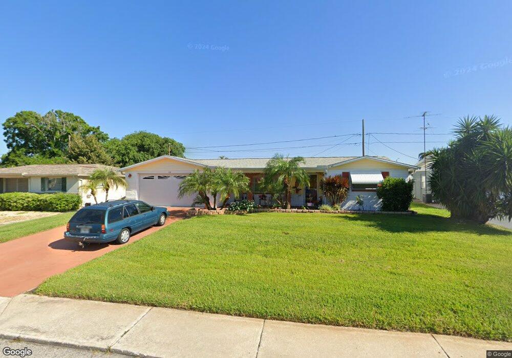
5137 Tilson Dr New Port Richey, FL 34652
Estimated Value: $199,218 - $261,000
3
Beds
2
Baths
1,372
Sq Ft
$165/Sq Ft
Est. Value
About This Home
This home is located at 5137 Tilson Dr, New Port Richey, FL 34652 and is currently estimated at $227,055, approximately $165 per square foot. 5137 Tilson Dr is a home located in Pasco County with nearby schools including Anclote Elementary School, Gulf Middle School, and Gulf High School.
Ownership History
Date
Name
Owned For
Owner Type
Purchase Details
Closed on
Jun 16, 2015
Sold by
Bogart Barbara
Bought by
Bogart Barbara and The Barbara Bogart Family Trust
Current Estimated Value
Purchase Details
Closed on
Sep 5, 1997
Sold by
Corrier Wilfred
Bought by
Bogart John W and Bogart Barbara
Home Financials for this Owner
Home Financials are based on the most recent Mortgage that was taken out on this home.
Original Mortgage
$61,697
Outstanding Balance
$9,528
Interest Rate
7.43%
Mortgage Type
FHA
Estimated Equity
$217,527
Create a Home Valuation Report for This Property
The Home Valuation Report is an in-depth analysis detailing your home's value as well as a comparison with similar homes in the area
Home Values in the Area
Average Home Value in this Area
Purchase History
| Date | Buyer | Sale Price | Title Company |
|---|---|---|---|
| Bogart Barbara | -- | Attorney | |
| Bogart John W | $59,900 | -- |
Source: Public Records
Mortgage History
| Date | Status | Borrower | Loan Amount |
|---|---|---|---|
| Open | Bogart John W | $61,697 |
Source: Public Records
Tax History Compared to Growth
Tax History
| Year | Tax Paid | Tax Assessment Tax Assessment Total Assessment is a certain percentage of the fair market value that is determined by local assessors to be the total taxable value of land and additions on the property. | Land | Improvement |
|---|---|---|---|---|
| 2025 | $647 | $64,210 | -- | -- |
| 2024 | $647 | $62,400 | -- | -- |
| 2023 | $629 | $60,590 | $0 | $0 |
| 2022 | $649 | $58,830 | $0 | $0 |
| 2021 | $641 | $57,120 | $19,404 | $37,716 |
| 2020 | $638 | $56,340 | $12,524 | $43,816 |
| 2019 | $628 | $55,080 | $0 | $0 |
| 2018 | $605 | $52,166 | $0 | $0 |
| 2017 | $617 | $53,739 | $0 | $0 |
| 2016 | $575 | $51,551 | $0 | $0 |
| 2015 | -- | $51,193 | $0 | $0 |
| 2014 | -- | $50,787 | $11,760 | $39,027 |
Source: Public Records
Map
Nearby Homes
- 5137 Manor Dr
- 5120 Cicero Dr
- 4161 Highland Loop
- 5253 Devries Dr
- 5200 Dove Dr
- 5122 Dove Dr
- 3645 Galway Dr
- 4906 Uranus Ave
- 5038 Galaxy Dr
- 3547 Morley Dr
- 4819 Beacon Hill Dr
- 0 Grand Blvd
- 5316 Drift Tide Dr
- 4201 Wiggins Dr
- 4037 Flamingo Dr
- 3522 Cambridge St
- 3420 Lanark Dr
- 3735 Mynabird Dr
- 4715 Manor Dr
- 4802 Drift Tide Dr