Estimated Value: $165,495
3
Beds
2
Baths
1,432
Sq Ft
$116/Sq Ft
Est. Value
About This Home
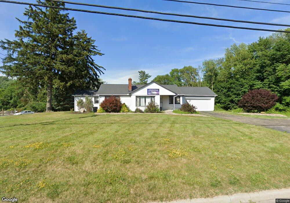
This home is located at 5138 State Route 43, Kent, OH 44240 and is currently estimated at $165,495, approximately $115 per square foot. 5138 State Route 43 is a home located in Portage County with nearby schools including Brimfield Elementary School, Field Middle School, and Field High School.
Ownership History
Date
Name
Owned For
Owner Type
Purchase Details
Closed on
Apr 18, 2015
Sold by
Urban David W
Bought by
Bell Renovations Llc
Current Estimated Value
Home Financials for this Owner
Home Financials are based on the most recent Mortgage that was taken out on this home.
Original Mortgage
$10,000
Outstanding Balance
$5,744
Interest Rate
3.85%
Mortgage Type
Future Advance Clause Open End Mortgage
Estimated Equity
$159,751
Purchase Details
Closed on
Mar 19, 2014
Sold by
Urban David W
Bought by
Bell Joshua
Purchase Details
Closed on
Jan 14, 2004
Sold by
Urban Daniel
Bought by
State Of Ohio
Create a Home Valuation Report for This Property
The Home Valuation Report is an in-depth analysis detailing your home's value as well as a comparison with similar homes in the area
Home Values in the Area
Average Home Value in this Area
Purchase History
| Date | Buyer | Sale Price | Title Company |
|---|---|---|---|
| Bell Renovations Llc | $85,000 | Knigdom Title | |
| Bell Joshua | $85,000 | None Available | |
| State Of Ohio | $12,344 | -- |
Source: Public Records
Mortgage History
| Date | Status | Borrower | Loan Amount |
|---|---|---|---|
| Open | Bell Renovations Llc | $10,000 | |
| Closed | Bell Joshua | $0 |
Source: Public Records
Tax History Compared to Growth
Tax History
| Year | Tax Paid | Tax Assessment Tax Assessment Total Assessment is a certain percentage of the fair market value that is determined by local assessors to be the total taxable value of land and additions on the property. | Land | Improvement |
|---|---|---|---|---|
| 2024 | $4,377 | $74,310 | $33,850 | $40,460 |
| 2023 | $3,456 | $48,310 | $31,330 | $16,980 |
| 2022 | $3,479 | $48,310 | $31,330 | $16,980 |
| 2021 | $3,482 | $48,310 | $31,330 | $16,980 |
| 2020 | $3,381 | $48,310 | $31,330 | $16,980 |
| 2019 | $3,387 | $48,310 | $31,330 | $16,980 |
| 2018 | $2,789 | $45,610 | $22,540 | $23,070 |
| 2017 | $2,789 | $45,610 | $22,540 | $23,070 |
| 2016 | $2,804 | $45,610 | $22,540 | $23,070 |
| 2015 | $2,531 | $46,170 | $25,380 | $20,790 |
| 2014 | $2,452 | $46,170 | $25,380 | $20,790 |
| 2013 | $2,282 | $46,170 | $25,380 | $20,790 |
Source: Public Records
Map
Nearby Homes
- 1224 Cedar Ridge Rd
- 1236 Cedar Ridge Rd
- V/L Sherman Rd
- Poplar Plan at Woodland Reserve
- Nassau Cove Plan at Woodland Reserve
- 0 Meloy Rd Unit 5162435
- 1625 S Lincoln St
- 720 Ivan Dr
- 1587 Chadwick Rd
- 703 Avondale St
- 708 Berkeley St
- 4682 State Route 43
- 238 Valleyview Dr
- 540 E School St
- 218 E School St
- 561 E School St
- 4837 King Meadow Trail
- 1426 Loop Rd Unit 1426
- 1204 Franklin Ave
- 218 E Oak St
- 1197 Meloy Rd
- 5090 State Route 43
- 5082 State Route 43
- 1257 Meloy Rd
- 5062 State Route 43
- 5060 Ohio 43
- 5054 State Route 43
- 5041 State Route 43
- 5023 State Route 43
- 5023 State Route 43
- 1201 Cedar Ridge Rd Unit 36852980
- 1209 Cedar Ridge Dr
- 1228 Cedar Ridge Dr
- 1236 Cedar Ridge Dr
- 1205 Cedar Ridge Dr
- 1295 Meloy Rd
- 5005 State Route 43
- 1335 Meloy Rd
- 0 Meloy Rd Unit 3750077
- 0 Meloy Rd Unit 4187628