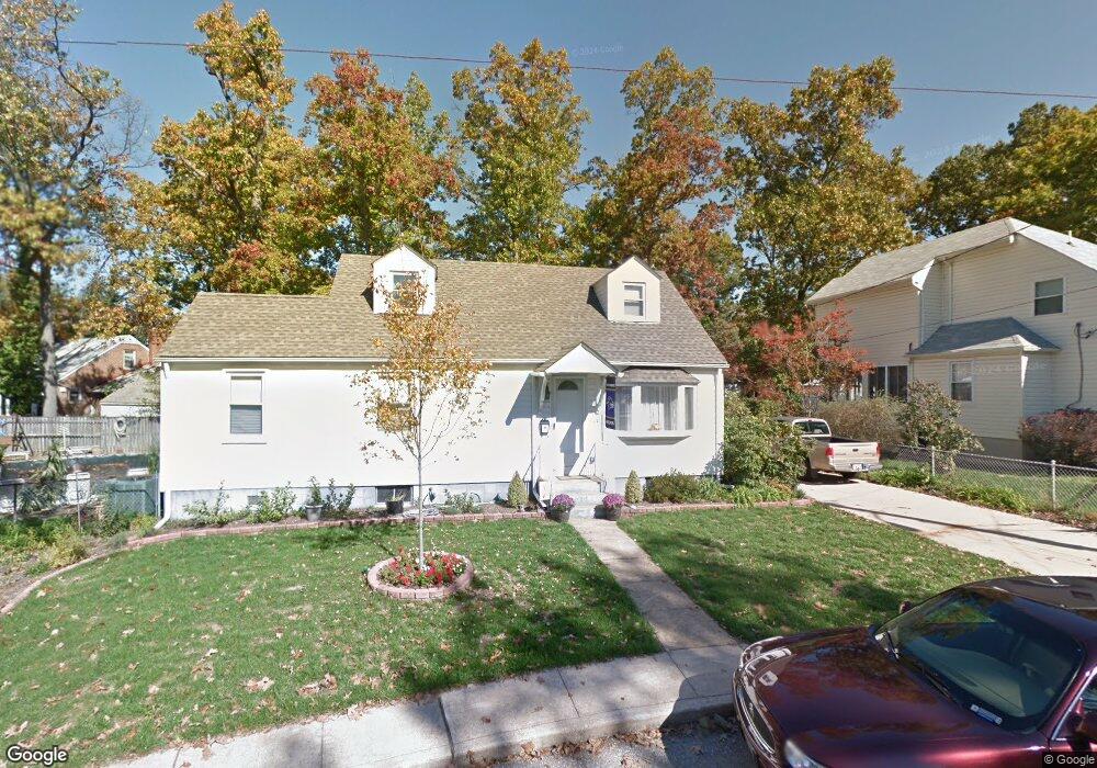
514 1st Ave SW Glen Burnie, MD 21061
Estimated Value: $383,000 - $443,000
--
Bed
2
Baths
1,800
Sq Ft
$223/Sq Ft
Est. Value
About This Home
This home is located at 514 1st Ave SW, Glen Burnie, MD 21061 and is currently estimated at $401,768, approximately $223 per square foot. 514 1st Ave SW is a home located in Anne Arundel County with nearby schools including Richard Henry Lee Elementary School, Corkran Middle School, and Glen Burnie High School.
Ownership History
Date
Name
Owned For
Owner Type
Purchase Details
Closed on
Apr 27, 2011
Sold by
Not Provided
Bought by
Phelan Patrick Michael and Phelan Karen Annette
Current Estimated Value
Home Financials for this Owner
Home Financials are based on the most recent Mortgage that was taken out on this home.
Original Mortgage
$146,000
Outstanding Balance
$8,931
Interest Rate
4.76%
Mortgage Type
New Conventional
Estimated Equity
$392,837
Purchase Details
Closed on
Apr 15, 2011
Sold by
Not Provided
Bought by
Phelan Patrick Michael and Phelan Karen Annette
Home Financials for this Owner
Home Financials are based on the most recent Mortgage that was taken out on this home.
Original Mortgage
$146,000
Outstanding Balance
$8,931
Interest Rate
4.76%
Mortgage Type
New Conventional
Estimated Equity
$392,837
Create a Home Valuation Report for This Property
The Home Valuation Report is an in-depth analysis detailing your home's value as well as a comparison with similar homes in the area
Home Values in the Area
Average Home Value in this Area
Purchase History
| Date | Buyer | Sale Price | Title Company |
|---|---|---|---|
| Phelan Patrick Michael | $182,500 | -- | |
| Phelan Patrick Michael | $182,500 | -- | |
| Phelan Patrick Michael | $182,500 | -- | |
| Phelan Patrick Michael | $182,500 | -- |
Source: Public Records
Mortgage History
| Date | Status | Borrower | Loan Amount |
|---|---|---|---|
| Open | Phelan Patrick Michael | $146,000 | |
| Closed | Phelan Patrick Michael | $146,000 | |
| Closed | Phelan Patrick Michael | $146,000 |
Source: Public Records
Tax History Compared to Growth
Tax History
| Year | Tax Paid | Tax Assessment Tax Assessment Total Assessment is a certain percentage of the fair market value that is determined by local assessors to be the total taxable value of land and additions on the property. | Land | Improvement |
|---|---|---|---|---|
| 2025 | $3,793 | $359,900 | $159,700 | $200,200 |
| 2024 | $3,793 | $340,367 | $0 | $0 |
| 2023 | $3,203 | $320,833 | $0 | $0 |
| 2022 | $3,421 | $301,300 | $127,600 | $173,700 |
| 2021 | $3,272 | $298,600 | $0 | $0 |
| 2020 | $3,272 | $295,900 | $0 | $0 |
| 2019 | $3,222 | $293,200 | $117,600 | $175,600 |
| 2018 | $3,076 | $288,633 | $0 | $0 |
| 2017 | $3,038 | $284,067 | $0 | $0 |
| 2016 | -- | $279,500 | $0 | $0 |
| 2015 | -- | $265,667 | $0 | $0 |
| 2014 | -- | $251,833 | $0 | $0 |
Source: Public Records
Map
Nearby Homes
- 611 Glenview Ave
- 201 Central Ave
- 301 Newfield Rd
- 305 Newfield Rd
- 108 1st Ave SW
- 420 Lincoln Ave SW
- 108 New Jersey Ave NW
- 625 Newfield Rd
- 209 Lincoln Ave SW
- 207 Lincoln Ave SW
- 618 Stewart Ave
- 100 3rd Ave SE
- 106 3rd Ave SE
- 911 Meadowbrook Rd
- 310 New Jersey Ave NE
- 107 Main Ave SW
- 19 Main Ave SW
- 330 New Jersey Ave NE
- 7517 Baltimore Annapolis Blvd
- 903 Jay Ct
- 512 1st Ave SW
- 9 Brownshade Dr
- 516 1st Ave SW
- 7 Brownshade Dr
- 510 1st Ave SW
- 11 Brownshade Dr
- 517 1st Ave SW
- 5 Brownshade Dr
- 515 1st Ave SW
- 513 1st Ave SW
- 508 1st Ave SW
- 511 1st Ave SW
- 8 Brownshade Dr
- 13 Brownshade Dr
- 509 1st Ave SW
- 3 Brownshade Dr
- 2 Brownshade Dr
- 408 Joyce Dr
- 412 Joyce Dr
- 15 Brownshade Dr