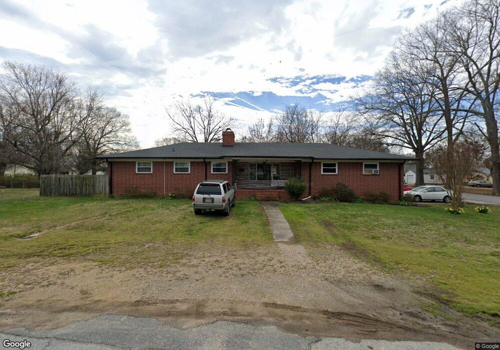
514 Charles St Kannapolis, NC 28083
Estimated Value: $359,980 - $394,000
5
Beds
3
Baths
2,326
Sq Ft
$161/Sq Ft
Est. Value
About This Home
This home is located at 514 Charles St, Kannapolis, NC 28083 and is currently estimated at $374,995, approximately $161 per square foot. 514 Charles St is a home located in Cabarrus County with nearby schools including Forest Park Elementary School, Kannapolis Middle, and A.L. Brown High School.
Ownership History
Date
Name
Owned For
Owner Type
Purchase Details
Closed on
Oct 6, 2008
Sold by
Koumlamith Paul and Koumlamith Penny
Bought by
Paino Kathy
Current Estimated Value
Purchase Details
Closed on
May 26, 1998
Sold by
Linker Cindy C and Linker Cindy C
Bought by
Kounlamith Bounleuth and Kounlamith Khamphony
Home Financials for this Owner
Home Financials are based on the most recent Mortgage that was taken out on this home.
Original Mortgage
$111,452
Interest Rate
7.04%
Mortgage Type
FHA
Purchase Details
Closed on
Aug 1, 1984
Create a Home Valuation Report for This Property
The Home Valuation Report is an in-depth analysis detailing your home's value as well as a comparison with similar homes in the area
Home Values in the Area
Average Home Value in this Area
Purchase History
| Date | Buyer | Sale Price | Title Company |
|---|---|---|---|
| Paino Kathy | -- | None Available | |
| Kounlamith Bounleuth | $115,000 | -- | |
| -- | $58,500 | -- |
Source: Public Records
Mortgage History
| Date | Status | Borrower | Loan Amount |
|---|---|---|---|
| Previous Owner | Kounlamith Bounleuth | $111,452 |
Source: Public Records
Tax History Compared to Growth
Tax History
| Year | Tax Paid | Tax Assessment Tax Assessment Total Assessment is a certain percentage of the fair market value that is determined by local assessors to be the total taxable value of land and additions on the property. | Land | Improvement |
|---|---|---|---|---|
| 2025 | $3,978 | $350,300 | $60,000 | $290,300 |
| 2024 | $3,978 | $350,300 | $60,000 | $290,300 |
| 2023 | $2,913 | $212,660 | $33,000 | $179,660 |
| 2022 | $2,913 | $212,660 | $33,000 | $179,660 |
| 2021 | $2,913 | $212,660 | $33,000 | $179,660 |
| 2020 | $2,913 | $212,660 | $33,000 | $179,660 |
| 2019 | $2,005 | $146,340 | $21,000 | $125,340 |
| 2018 | $1,976 | $146,340 | $21,000 | $125,340 |
| 2017 | $1,946 | $146,340 | $21,000 | $125,340 |
| 2016 | $1,946 | $135,720 | $22,500 | $113,220 |
| 2015 | $1,710 | $135,720 | $22,500 | $113,220 |
| 2014 | $1,710 | $135,720 | $22,500 | $113,220 |
Source: Public Records
Map
Nearby Homes
- 1008 Packard Ave
- 500 Plymouth St
- 608 Fairview St
- 505 Rogers Lake Rd E
- 506 Ford St
- 615 Fairview St
- 613 Hillside St
- 617 Fairview St
- 402 Ford St
- 803 Irene Ave
- 803 Desoto Ave
- 1004 S Ridge Ave
- 910 Fairview St
- 621 Norland Ave
- 209 James St
- 417 York Ave
- 111 Landmark Dr
- 210 Brook St
- 704 Gem St Unit 17
- 1050 Mclain Rd