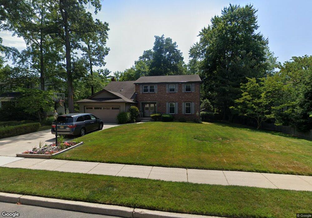
514 Queen Ann Rd Cherry Hill, NJ 08003
Estimated Value: $619,630 - $718,000
--
Bed
--
Bath
2,954
Sq Ft
$227/Sq Ft
Est. Value
About This Home
This home is located at 514 Queen Ann Rd, Cherry Hill, NJ 08003 and is currently estimated at $669,158, approximately $226 per square foot. 514 Queen Ann Rd is a home located in Camden County with nearby schools including Bret Harte Elementary School, Henry C. Beck Middle School, and Cherry Hill High-East High School.
Ownership History
Date
Name
Owned For
Owner Type
Purchase Details
Closed on
Nov 12, 2024
Sold by
Graff Mitchell A and Graff Stefani R
Bought by
Mitchell A Graff Revocable Trust and Stefani R Graff Revocable Trust
Current Estimated Value
Purchase Details
Closed on
Oct 1, 1998
Sold by
Hernberg Joseph
Bought by
Graff Mitchell A and Graff Stefani R
Home Financials for this Owner
Home Financials are based on the most recent Mortgage that was taken out on this home.
Original Mortgage
$125,000
Interest Rate
6.8%
Create a Home Valuation Report for This Property
The Home Valuation Report is an in-depth analysis detailing your home's value as well as a comparison with similar homes in the area
Home Values in the Area
Average Home Value in this Area
Purchase History
| Date | Buyer | Sale Price | Title Company |
|---|---|---|---|
| Mitchell A Graff Revocable Trust | -- | None Listed On Document | |
| Mitchell A Graff Revocable Trust | -- | None Listed On Document | |
| Mitchell A Graff Revocable Trust | -- | None Listed On Document | |
| Graff Mitchell A | $230,000 | -- |
Source: Public Records
Mortgage History
| Date | Status | Borrower | Loan Amount |
|---|---|---|---|
| Previous Owner | Graff Mitchell A | $125,000 |
Source: Public Records
Tax History Compared to Growth
Tax History
| Year | Tax Paid | Tax Assessment Tax Assessment Total Assessment is a certain percentage of the fair market value that is determined by local assessors to be the total taxable value of land and additions on the property. | Land | Improvement |
|---|---|---|---|---|
| 2025 | $14,541 | $326,100 | $78,300 | $247,800 |
| 2024 | $13,703 | $326,100 | $78,300 | $247,800 |
| 2023 | $13,703 | $326,100 | $78,300 | $247,800 |
| 2022 | $13,324 | $326,100 | $78,300 | $247,800 |
| 2021 | $13,367 | $326,100 | $78,300 | $247,800 |
| 2020 | $13,204 | $326,100 | $78,300 | $247,800 |
| 2019 | $13,197 | $326,100 | $78,300 | $247,800 |
| 2018 | $13,161 | $326,100 | $78,300 | $247,800 |
| 2017 | $12,982 | $326,100 | $78,300 | $247,800 |
| 2016 | $12,809 | $326,100 | $78,300 | $247,800 |
| 2015 | $12,607 | $326,100 | $78,300 | $247,800 |
| 2014 | $12,467 | $326,100 | $78,300 | $247,800 |
Source: Public Records
Map
Nearby Homes
- 503 Balsam Rd
- 1852 Lark Ln
- 1105 Heartwood Dr
- 1805 Country Club Dr
- 1004 Owl Place
- 506 Cranford Rd
- 1912 Cardinal Lake Dr
- 1738 Country Club Dr
- 414 Lavender Hill Dr
- 1217 Liberty Bell Dr
- 1869 W Point Dr
- 110 Rue du Boise
- 102 Rue Du Bois
- 104 Rue Du Bois
- 1224 Concord Ln
- 1333 Bunker Hill Dr
- 4 Southwood Dr
- 321 Iris Rd
- 324 Juniper Dr
- 1530 Hillside Dr
- 516 Queen Ann Rd
- 512 Queen Ann Rd
- 1803 Fireside Ln
- 1766 Tearose Ln
- 518 Queen Anne Rd
- 518 Queen Ann Rd
- 1811 E Fireside Ct
- 1765 Fireside Ln
- 1805 Fireside Ln
- 1800 Fireside Ln
- 1767 Tearose Ln
- 1764 Tearose Ln
- 1807 Fireside Ln
- 520 Queen Ann Rd
- 1802 Fireside Ln
- 1763 Fireside Ln
- 1764 Fireside Ln
- 1813 E Fireside Ct
- 1804 Fireside Ln
- 1765 Tearose Ln