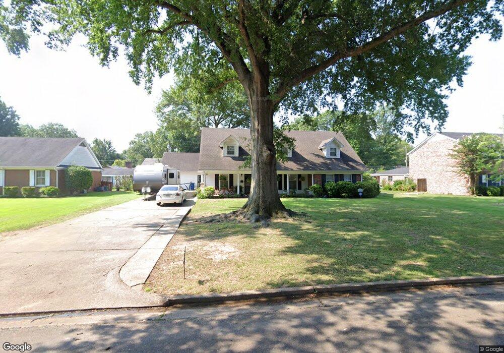
514 Roosevelt Ave West Memphis, AR 72301
Estimated Value: $253,000 - $357,000
5
Beds
3
Baths
3,304
Sq Ft
$95/Sq Ft
Est. Value
About This Home
This home is located at 514 Roosevelt Ave, West Memphis, AR 72301 and is currently estimated at $312,408, approximately $94 per square foot. 514 Roosevelt Ave is a home located in Crittenden County with nearby schools including Bragg Elementary School, West Junior High School, and The Academies of West Memphis Charter School.
Ownership History
Date
Name
Owned For
Owner Type
Purchase Details
Closed on
Feb 19, 2020
Sold by
James Paul J
Bought by
Sampley Willie Bob
Current Estimated Value
Home Financials for this Owner
Home Financials are based on the most recent Mortgage that was taken out on this home.
Original Mortgage
$196,377
Outstanding Balance
$173,878
Interest Rate
3.6%
Mortgage Type
FHA
Estimated Equity
$138,530
Purchase Details
Closed on
Sep 12, 2014
Bought by
James David Hamilton and James Ann Wrape
Create a Home Valuation Report for This Property
The Home Valuation Report is an in-depth analysis detailing your home's value as well as a comparison with similar homes in the area
Home Values in the Area
Average Home Value in this Area
Purchase History
| Date | Buyer | Sale Price | Title Company |
|---|---|---|---|
| Sampley Willie Bob | $200,000 | Stewart Title | |
| James David Hamilton | -- | -- |
Source: Public Records
Mortgage History
| Date | Status | Borrower | Loan Amount |
|---|---|---|---|
| Open | Sampley Willie Bob | $196,377 |
Source: Public Records
Tax History Compared to Growth
Tax History
| Year | Tax Paid | Tax Assessment Tax Assessment Total Assessment is a certain percentage of the fair market value that is determined by local assessors to be the total taxable value of land and additions on the property. | Land | Improvement |
|---|---|---|---|---|
| 2024 | $1,786 | $47,640 | $6,800 | $40,840 |
| 2023 | $1,861 | $47,640 | $6,800 | $40,840 |
| 2022 | $1,911 | $47,640 | $6,800 | $40,840 |
| 2021 | $1,911 | $47,640 | $6,800 | $40,840 |
| 2020 | $1,400 | $47,640 | $6,800 | $40,840 |
| 2019 | $1,167 | $39,020 | $6,250 | $32,770 |
| 2018 | $902 | $39,020 | $6,250 | $32,770 |
| 2017 | $902 | $39,020 | $6,250 | $32,770 |
| 2016 | $902 | $39,020 | $6,250 | $32,770 |
| 2015 | $915 | $39,020 | $6,250 | $32,770 |
| 2014 | $915 | $30,860 | $6,250 | $24,610 |
Source: Public Records
Map
Nearby Homes
- 501 W Cooper Ave
- 607 W Barton Ave
- 503 W Oliver Ave
- 413 Gibson Ave
- 323 W Oliver Ave
- 307 W Cooper Ave
- 1009 Spears St
- 235 W Barton Ave
- 807 W Barton Ave
- 221 W Barton Ave
- 216 Roosevelt Ave
- 223 W Oliver Ave
- 232 Ross Ave
- 451 S Roselawn Dr
- 215 W Oliver Ave
- 321 S Worthington Dr
- 823 S Roselawn Dr
- 1113 Spears St
- 1105 Cherry Ln
- 512 Lois Marie Cove
- 516 Roosevelt Ave
- 510 Roosevelt Ave
- 515 W Cooper Ave
- 509 Roosevelt Ave
- 518 Roosevelt Ave
- 519 W Cooper Ave
- 511 W Cooper Ave
- 507 Roosevelt Ave
- 506 Roosevelt Ave
- 523 W Cooper Ave
- 513 Roosevelt Ave
- 505 W Cooper Ave
- 505 Roosevelt Ave
- 510 W Cooper Ave
- 500 Roosevelt Ave
- 601 Roosevelt Ave
- 503 Roosevelt Ave
- 506 W Barton Ave
- 516 W Cooper Ave
- 508 W Barton Ave