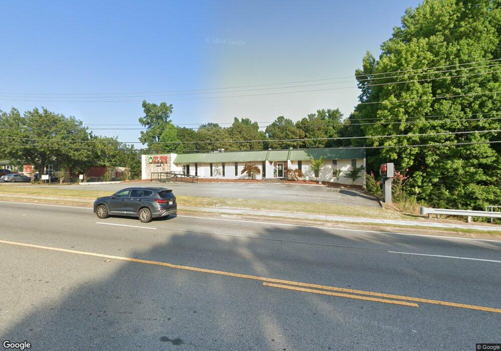
5140 Buford Hwy Norcross, GA 30071
Estimated Value: $1,543,265
--
Bed
--
Bath
4,846
Sq Ft
$318/Sq Ft
Est. Value
About This Home
This home is located at 5140 Buford Hwy, Norcross, GA 30071 and is currently estimated at $1,543,265, approximately $318 per square foot. 5140 Buford Hwy is a home located in Gwinnett County with nearby schools including Norcross Elementary School, Summerour Middle School, and Norcross High School.
Ownership History
Date
Name
Owned For
Owner Type
Purchase Details
Closed on
Jul 28, 2025
Sold by
Jls Top Signs Inc
Bought by
Koong Linni Lee and Koong Fang Hwa
Current Estimated Value
Purchase Details
Closed on
Oct 29, 2015
Sold by
Jenmar Properties Llc
Bought by
Jls Top Signs Inc
Home Financials for this Owner
Home Financials are based on the most recent Mortgage that was taken out on this home.
Original Mortgage
$573,000
Interest Rate
3.89%
Mortgage Type
Commercial
Purchase Details
Closed on
Jun 15, 2000
Sold by
Fritsch William A
Bought by
Jenmar Prop Llc
Home Financials for this Owner
Home Financials are based on the most recent Mortgage that was taken out on this home.
Original Mortgage
$47,200
Interest Rate
8.27%
Mortgage Type
Commercial
Create a Home Valuation Report for This Property
The Home Valuation Report is an in-depth analysis detailing your home's value as well as a comparison with similar homes in the area
Home Values in the Area
Average Home Value in this Area
Purchase History
| Date | Buyer | Sale Price | Title Company |
|---|---|---|---|
| Koong Linni Lee | -- | -- | |
| Jls Top Signs Inc | $578,750 | -- | |
| Jenmar Prop Llc | -- | -- |
Source: Public Records
Mortgage History
| Date | Status | Borrower | Loan Amount |
|---|---|---|---|
| Previous Owner | Jls Top Signs Inc | $573,000 | |
| Previous Owner | Jenmar Prop Llc | $47,200 |
Source: Public Records
Tax History Compared to Growth
Tax History
| Year | Tax Paid | Tax Assessment Tax Assessment Total Assessment is a certain percentage of the fair market value that is determined by local assessors to be the total taxable value of land and additions on the property. | Land | Improvement |
|---|---|---|---|---|
| 2025 | $15,624 | $431,040 | $112,400 | $318,640 |
| 2024 | $18,211 | $498,840 | $112,400 | $386,440 |
| 2023 | $18,211 | $388,880 | $100,800 | $288,080 |
| 2022 | $15,852 | $431,200 | $102,440 | $328,760 |
| 2021 | $9,300 | $241,120 | $89,600 | $151,520 |
| 2020 | $9,360 | $241,120 | $89,600 | $151,520 |
| 2019 | $9,025 | $241,120 | $89,600 | $151,520 |
| 2018 | $9,061 | $241,120 | $89,600 | $151,520 |
| 2016 | $7,242 | $189,480 | $89,600 | $99,880 |
| 2015 | $7,308 | $189,480 | $89,600 | $99,880 |
| 2014 | $7,359 | $189,480 | $89,600 | $99,880 |
Source: Public Records
Map
Nearby Homes
- 3360 Smith Ridge Trace NW
- 5167 Conductor Ct
- 2468 Whistle Stop Dr
- 5143 Micaela Way
- 4969 Old Norcross Rd
- 5063 Micaela Way
- 2688 Shetland Ln
- 4945 Clara Mae Walk
- 2605 Silver Cliff Dr Unit I
- 2824 Langford Commons Dr
- 4838 Chaucery Ln
- 4849 Chaucery Ln
- 5257 Westhill Dr
- 2472 Westhill Ct
- 2472 Westhill Ct NW
- 5534 Wynhall Dr
- 2621 Bailey Dr
- 3118 Stanstead Ct
- 2928 Stanstead Cir
- 5206 Westhill Dr NW
- 5129 Cambridge Way
- 5139 Cambridge Way Unit 2
- 3370 Smith Ridge Trace
- 3360 Smith Ridge
- 5149 Cambridge Way
- 3380 Smith Ridge Trace
- 3350 Smith Ridge Trace NW
- 5109 Cambridge Way
- 3340 Smith Ridge Trace
- 5159 Cambridge Way
- 3320 Smith Ridge Trace NW Unit A
- 3330 Smith Ridge Trace Unit na
- 3330 Smith Ridge Trace
- 0 Cambridge Way NW Unit 8002070
- 5169 Cambridge Way
- 3310 Smith Ridge Trace
- 2780 Smith Ridge Trace
- 3327 Smith Ridge Trace
- 3337 Smith Ridge Trace NW Unit 3337
- 3337 Smith Ridge Trace NW