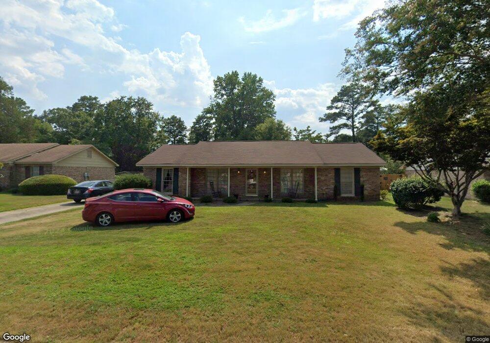
5140 Stonegate Dr Columbus, GA 31909
North Columbus NeighborhoodEstimated Value: $197,181 - $245,000
3
Beds
3
Baths
1,675
Sq Ft
$131/Sq Ft
Est. Value
About This Home
This home is located at 5140 Stonegate Dr, Columbus, GA 31909 and is currently estimated at $220,045, approximately $131 per square foot. 5140 Stonegate Dr is a home located in Muscogee County with nearby schools including Waddell Elementary School, Midland Middle School, and Shaw High School.
Ownership History
Date
Name
Owned For
Owner Type
Purchase Details
Closed on
Apr 21, 2011
Sold by
Foreman Joel Martin
Bought by
Sherriff Janice M
Current Estimated Value
Home Financials for this Owner
Home Financials are based on the most recent Mortgage that was taken out on this home.
Original Mortgage
$111,920
Outstanding Balance
$77,251
Interest Rate
4.81%
Mortgage Type
New Conventional
Estimated Equity
$142,794
Purchase Details
Closed on
Jan 6, 2011
Sold by
Foreman Hazel J
Bought by
Foreman Joel Martin and Foreman William Lee
Create a Home Valuation Report for This Property
The Home Valuation Report is an in-depth analysis detailing your home's value as well as a comparison with similar homes in the area
Home Values in the Area
Average Home Value in this Area
Purchase History
| Date | Buyer | Sale Price | Title Company |
|---|---|---|---|
| Sherriff Janice M | $139,900 | -- | |
| Foreman Joel Martin | -- | None Available |
Source: Public Records
Mortgage History
| Date | Status | Borrower | Loan Amount |
|---|---|---|---|
| Open | Sherriff Janice M | $111,920 |
Source: Public Records
Tax History
| Year | Tax Paid | Tax Assessment Tax Assessment Total Assessment is a certain percentage of the fair market value that is determined by local assessors to be the total taxable value of land and additions on the property. | Land | Improvement |
|---|---|---|---|---|
| 2025 | $1,349 | $65,184 | $9,988 | $55,196 |
| 2024 | $1,349 | $65,184 | $9,988 | $55,196 |
| 2023 | $663 | $65,184 | $9,988 | $55,196 |
| 2022 | $1,407 | $52,756 | $9,988 | $42,768 |
| 2021 | $1,407 | $44,420 | $9,988 | $34,432 |
| 2020 | $1,407 | $44,420 | $9,988 | $34,432 |
| 2019 | $1,412 | $44,420 | $9,988 | $34,432 |
| 2018 | $1,412 | $44,420 | $9,988 | $34,432 |
| 2017 | $1,416 | $44,420 | $9,988 | $34,432 |
| 2016 | $1,421 | $55,960 | $4,963 | $50,997 |
| 2015 | $1,421 | $55,960 | $4,963 | $50,997 |
| 2014 | $1,766 | $55,960 | $4,963 | $50,997 |
| 2013 | -- | $55,960 | $4,963 | $50,997 |
Source: Public Records
Map
Nearby Homes
- 5824 Bishop Dr
- 4017 Shade Valley Dr
- 6236 Olde Towne Dr
- 6100 Stony Creek Dr
- 5258 Cunningham Dr
- 6215 Parker Dr
- 5434 Rockhurst Dr
- 6502 Tidewater Ct
- 5422 Brookview Dr
- 5621 Hodges Dr
- 7101 Cross Tie Dr
- 5623 Hodges Dr
- 6016 Warm Springs Ct
- 6068 Bear Creek Ct
- 6528 Yellow Stone Ct
- 5741 Eastside Dr
- 4847 Warm Springs Rd
- 5045 Old Post Rd
- 4628 Sears Rd
- 5912 Big Oak Dr
- 5206 Stonegate Dr
- 5134 Stonegate Dr
- 5828 Dearborn Ave
- 5126 Stonegate Dr
- 5212 Stonegate Dr
- 5820 Dearborn Ave
- 5836 Dearborn Ave
- 5139 Stonegate Dr
- 5205 Stonegate Dr
- 5133 Stonegate Dr
- 5812 Dearborn Ave
- 5120 Stonegate Dr
- 5220 Stonegate Dr
- 5211 Stonegate Dr
- 5844 Dearborn Ave
- 5125 Stonegate Dr
- 5219 Stonegate Dr
- 5116 Stonegate Dr
- 5228 Stonegate Dr
- 5119 Stonegate Dr
Your Personal Tour Guide
Ask me questions while you tour the home.