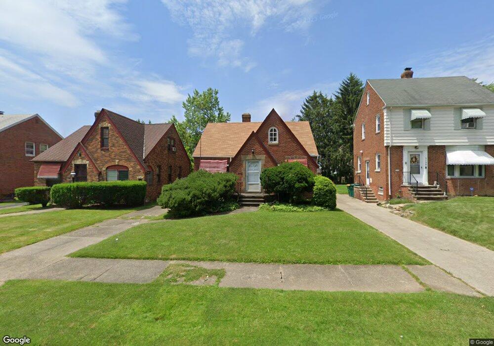
5142 Philip Ave Maple Heights, OH 44137
Estimated Value: $111,329 - $139,000
3
Beds
2
Baths
1,305
Sq Ft
$96/Sq Ft
Est. Value
About This Home
This home is located at 5142 Philip Ave, Maple Heights, OH 44137 and is currently estimated at $124,832, approximately $95 per square foot. 5142 Philip Ave is a home located in Cuyahoga County with nearby schools including Abraham Lincoln Elementary School, Rockside/ J.F. Kennedy School, and Barack Obama School.
Ownership History
Date
Name
Owned For
Owner Type
Purchase Details
Closed on
Nov 3, 2025
Sold by
Tinio Christopher P and Tinio Jeannette A
Bought by
Grove View Group Llc
Current Estimated Value
Home Financials for this Owner
Home Financials are based on the most recent Mortgage that was taken out on this home.
Original Mortgage
$307,500
Outstanding Balance
$307,500
Interest Rate
6.3%
Mortgage Type
New Conventional
Estimated Equity
-$182,668
Purchase Details
Closed on
Dec 15, 2022
Sold by
Dittrich Robert J and Dittrich Marilyn A
Bought by
Tinio Christopher P and Tinio Jeannette A
Purchase Details
Closed on
Mar 26, 1980
Sold by
Dittrich Robert J
Bought by
Dittrich Raymond
Purchase Details
Closed on
Mar 10, 1980
Sold by
Dittrich Mary
Bought by
Dittrich Robert J
Purchase Details
Closed on
Jan 1, 1975
Bought by
Dittrich Mary
Create a Home Valuation Report for This Property
The Home Valuation Report is an in-depth analysis detailing your home's value as well as a comparison with similar homes in the area
Home Values in the Area
Average Home Value in this Area
Purchase History
| Date | Buyer | Sale Price | Title Company |
|---|---|---|---|
| Grove View Group Llc | -- | Revere Title | |
| Tinio Christopher P | $48,000 | Rever Title | |
| Dittrich Raymond | $24,600 | -- | |
| Dittrich Robert J | -- | -- | |
| Dittrich Mary | -- | -- |
Source: Public Records
Mortgage History
| Date | Status | Borrower | Loan Amount |
|---|---|---|---|
| Open | Grove View Group Llc | $307,500 |
Source: Public Records
Tax History Compared to Growth
Tax History
| Year | Tax Paid | Tax Assessment Tax Assessment Total Assessment is a certain percentage of the fair market value that is determined by local assessors to be the total taxable value of land and additions on the property. | Land | Improvement |
|---|---|---|---|---|
| 2024 | $3,364 | $36,575 | $7,140 | $29,435 |
| 2023 | $2,314 | $22,260 | $4,340 | $17,920 |
| 2022 | $1,468 | $22,260 | $4,340 | $17,920 |
| 2021 | $1,562 | $22,260 | $4,340 | $17,920 |
| 2020 | $1,115 | $16,870 | $3,290 | $13,580 |
| 2019 | $1,104 | $48,200 | $9,400 | $38,800 |
| 2018 | $1,096 | $16,870 | $3,290 | $13,580 |
| 2017 | $948 | $15,330 | $3,010 | $12,320 |
| 2016 | $913 | $15,330 | $3,010 | $12,320 |
| 2015 | $1,079 | $15,330 | $3,010 | $12,320 |
| 2014 | $1,079 | $16,840 | $3,330 | $13,510 |
Source: Public Records
Map
Nearby Homes
- 5110 Philip Ave
- 5082 Philip Ave
- 5061 Philip Ave
- 5185 Clement Ave
- 5208 Clement Ave
- 5231 Philip Ave
- 5031 Cato St
- 5212 Catherine St
- 5257 Philip Ave
- 5199 Arch St
- 5210 Theodore St
- 5239 Arch St
- 5320 Clement Ave
- 16712 Kollin Ave
- 5234 Erwin St
- 17916 North Blvd
- 17204 Maple Heights Blvd
- 17912 North Blvd
- 16241 Glenburn Ave
- 5247 Henry St
- 5138 Philip Ave
- 5146 Philip Ave
- 5136 Philip Ave
- 5150 Philip Ave
- 5130 Philip Ave
- 5154 Philip Ave
- 5133 Catherine St
- 5129 Catherine St
- 5137 Catherine St
- 5126 Philip Ave
- 5158 Philip Ave
- 5125 Catherine St
- 5141 Catherine St
- 5143 Philip Ave
- 5139 Philip Ave
- 5147 Philip Ave
- 5121 Catherine St
- 5122 Philip Ave
- 5135 Philip Ave
- 5162 Philip Ave