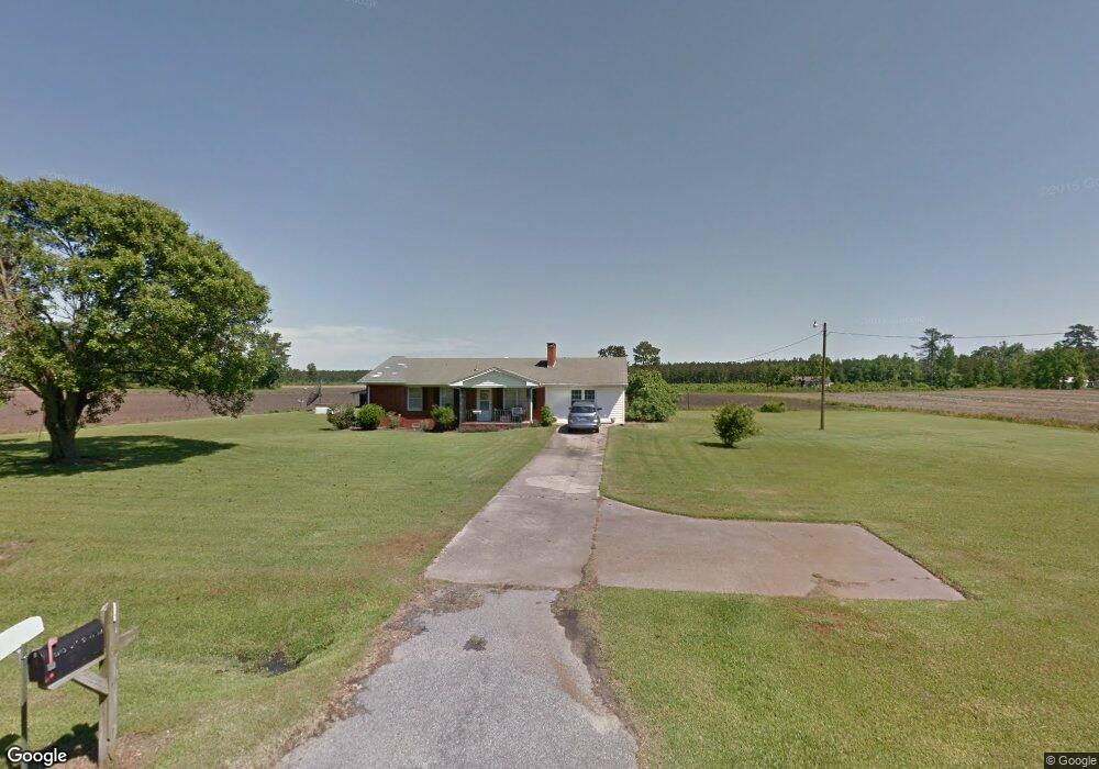
5143 Wp Hardy Rd La Grange, NC 28551
Estimated Value: $229,000 - $290,000
3
Beds
2
Baths
1,804
Sq Ft
$144/Sq Ft
Est. Value
About This Home
This home is located at 5143 Wp Hardy Rd, La Grange, NC 28551 and is currently estimated at $258,938, approximately $143 per square foot. 5143 Wp Hardy Rd is a home located in Lenoir County with nearby schools including La Grange Elementary School, E.B. Frink Middle School, and North Lenoir High School.
Ownership History
Date
Name
Owned For
Owner Type
Purchase Details
Closed on
Nov 12, 2024
Sold by
Jbl Empires Inc
Bought by
Skipper Phillip R and Skipper Emily E
Current Estimated Value
Home Financials for this Owner
Home Financials are based on the most recent Mortgage that was taken out on this home.
Original Mortgage
$258,000
Outstanding Balance
$255,167
Interest Rate
6.12%
Mortgage Type
VA
Estimated Equity
$3,771
Purchase Details
Closed on
Oct 10, 2023
Sold by
Rouse Herbert E
Bought by
Jbl Empires Inc
Purchase Details
Closed on
Aug 23, 2005
Sold by
Rouse Betty Carolyn
Bought by
Rouse Cynthia Louise and Rouse Herbert E
Create a Home Valuation Report for This Property
The Home Valuation Report is an in-depth analysis detailing your home's value as well as a comparison with similar homes in the area
Home Values in the Area
Average Home Value in this Area
Purchase History
| Date | Buyer | Sale Price | Title Company |
|---|---|---|---|
| Skipper Phillip R | $258,000 | None Listed On Document | |
| Jbl Empires Inc | $26,000 | None Listed On Document | |
| Jbl Empires Inc | $26,000 | None Listed On Document | |
| Rouse Cynthia Louise | -- | None Available |
Source: Public Records
Mortgage History
| Date | Status | Borrower | Loan Amount |
|---|---|---|---|
| Open | Skipper Phillip R | $258,000 |
Source: Public Records
Tax History Compared to Growth
Tax History
| Year | Tax Paid | Tax Assessment Tax Assessment Total Assessment is a certain percentage of the fair market value that is determined by local assessors to be the total taxable value of land and additions on the property. | Land | Improvement |
|---|---|---|---|---|
| 2025 | $1,904 | $259,662 | $28,913 | $230,749 |
| 2024 | $476 | $41,751 | $15,640 | $26,111 |
| 2023 | $460 | $41,751 | $15,640 | $26,111 |
| 2022 | $460 | $41,751 | $15,640 | $26,111 |
| 2021 | $460 | $41,751 | $15,640 | $26,111 |
| 2020 | $460 | $41,751 | $15,640 | $26,111 |
| 2019 | $460 | $41,751 | $15,640 | $26,111 |
| 2018 | $453 | $41,751 | $15,640 | $26,111 |
| 2017 | $449 | $41,751 | $15,640 | $26,111 |
| 2014 | $1,110 | $117,215 | $15,640 | $101,575 |
| 2013 | -- | $117,215 | $15,640 | $101,575 |
| 2011 | -- | $117,215 | $15,640 | $101,575 |
Source: Public Records
Map
Nearby Homes
- 5130 Aldridge Store Rd
- 4310 Colie Rd
- 5024 Gladys Owens St
- 3796 Pecan Grove Cir
- 7428 N Carolina 903
- 3821 Lindsey Ln
- 3777 Waters Mill Rd
- 113 Institute
- 109 Institute
- 603 N Caswell St
- 107 Institute
- 606 N Caswell St
- Monroe Plan at Walnut Hills - Liberty Series
- Adams Plan at Walnut Hills - Liberty Series
- 3803 Huntcliff Dr
- 3766 Huntcliff Dr
- 3740 Huntcliff Dr
- 3730 Huntcliff Dr
- 3725 Huntcliff Dr
- 5004 Wp Hardy Rd
- 5115 Wp Hardy Rd
- 5741 Pauls Path Rd
- 5746 Pauls Path Rd
- 5520 Pauls Path Rd
- 5758 Pauls Path Rd
- 5463 Pauls Path Rd
- 4929 Wp Hardy Rd
- 5415 Pauls Path Rd
- 0 W P Hardy Rd
- 4106 Brothers Rd
- 4084 Brothers Rd
- 4834 Wp Hardy Rd
- 4070 Brothers Rd
- 4824 Wp Hardy Rd
- 3998 Brothers Rd
- 4123 Brothers Rd
- 4105 Brothers Rd
- 4190 Brothers Rd
- 4055 Brothers Rd