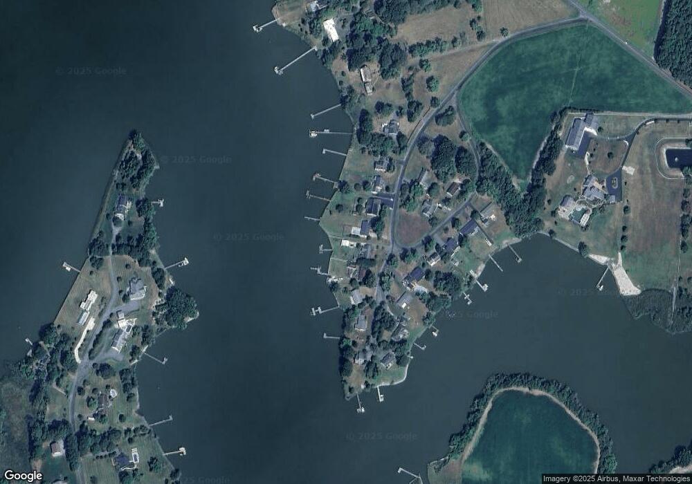
5144 Paw Paw Rd Cambridge, MD 21613
Estimated Value: $524,000 - $588,000
3
Beds
2
Baths
1,711
Sq Ft
$334/Sq Ft
Est. Value
About This Home
This home is located at 5144 Paw Paw Rd, Cambridge, MD 21613 and is currently estimated at $571,318, approximately $333 per square foot. 5144 Paw Paw Rd is a home located in Dorchester County with nearby schools including Maple Elementary School, Mace's Lane Middle School, and Cambridge-South Dorchester High School.
Ownership History
Date
Name
Owned For
Owner Type
Purchase Details
Closed on
May 13, 2009
Sold by
Garvin Rodney Kimberly Garvin
Bought by
Garvin Rodney Carrie Garvin
Current Estimated Value
Purchase Details
Closed on
Sep 18, 2008
Sold by
Siwarski Thomas M
Bought by
Garvin Rodney Kimberly Garvin
Home Financials for this Owner
Home Financials are based on the most recent Mortgage that was taken out on this home.
Original Mortgage
$300,000
Interest Rate
6.54%
Mortgage Type
Purchase Money Mortgage
Purchase Details
Closed on
Sep 16, 2008
Sold by
Siwarski Thomas M
Bought by
Garvin Rodney Kimberly Garvin
Home Financials for this Owner
Home Financials are based on the most recent Mortgage that was taken out on this home.
Original Mortgage
$300,000
Interest Rate
6.54%
Mortgage Type
Purchase Money Mortgage
Purchase Details
Closed on
Mar 29, 1993
Sold by
Combs George W
Bought by
Siwarski Thomas M
Create a Home Valuation Report for This Property
The Home Valuation Report is an in-depth analysis detailing your home's value as well as a comparison with similar homes in the area
Home Values in the Area
Average Home Value in this Area
Purchase History
| Date | Buyer | Sale Price | Title Company |
|---|---|---|---|
| Garvin Rodney Carrie Garvin | -- | -- | |
| Garvin Rodney Kimberly Garvin | $375,000 | -- | |
| Garvin Rodney Kimberly Garvin | $375,000 | -- | |
| Siwarski Thomas M | $155,000 | -- |
Source: Public Records
Mortgage History
| Date | Status | Borrower | Loan Amount |
|---|---|---|---|
| Previous Owner | Garvin Rodney Kimberly Garvin | $300,000 | |
| Previous Owner | Garvin Rodney Kimberly Garvin | $300,000 |
Source: Public Records
Tax History Compared to Growth
Tax History
| Year | Tax Paid | Tax Assessment Tax Assessment Total Assessment is a certain percentage of the fair market value that is determined by local assessors to be the total taxable value of land and additions on the property. | Land | Improvement |
|---|---|---|---|---|
| 2025 | $4,993 | $432,000 | $244,300 | $187,700 |
| 2024 | $4,475 | $414,533 | $0 | $0 |
| 2023 | $4,475 | $397,067 | $0 | $0 |
| 2022 | $8,562 | $379,600 | $244,300 | $135,300 |
| 2021 | $4,281 | $379,600 | $244,300 | $135,300 |
| 2020 | $4,281 | $379,600 | $244,300 | $135,300 |
| 2019 | $4,297 | $381,000 | $244,300 | $136,700 |
| 2018 | $4,226 | $374,600 | $0 | $0 |
| 2017 | $4,059 | $368,200 | $0 | $0 |
| 2016 | -- | $361,800 | $0 | $0 |
| 2015 | $4,367 | $361,800 | $0 | $0 |
| 2014 | $4,367 | $361,800 | $0 | $0 |
Source: Public Records
Map
Nearby Homes
- 5210 Wilson Rd
- 0 Silver Goose Rd Unit Lot WP001
- 2040 Dailsville Rd
- 4910 Gregory Rd
- 2191 Winterberry Ln
- 2189 Winterberry Ln
- 2212 Winterberry Ln
- 1622 Town Point Rd
- 1701 Perseus Rd
- 0 N S Dailsville Rd
- 5219 Heron Rd
- 5223 Heron Rd
- 5214 Heron Rd
- 2365 Church Creek Rd
- 5216 Heron Rd
- 5229 Heron Rd
- 5226 Heron Rd
- 1529 Deep Water Rd
- 1609 Heliport Rd
- 2420 Cambridge Beltway
- 5144 Paw Paw Rd
- 5146 Paw Paw Rd
- 5142 Paw Paw Rd
- 5146 Paw Paw Rd
- 5148 Paw Paw Rd
- 5140 Paw Paw Rd
- 5148 Paw Rd
- 5128 Paw Paw Rd
- 5128 Paw Acres
- 5130 Paw Rd
- 5130 Paw Paw Rd
- 5126 Paw Paw Rd
- 5150 Paw Paw Rd
- 5150 Paw Paw Rd
- 5128 Paw Rd
- 5138 Paw Paw Rd
- 5149 Paw Paw Rd
- 5149 Paw Rd
- 5132 Paw Paw Rd
- 5152 Paw Paw Rd
