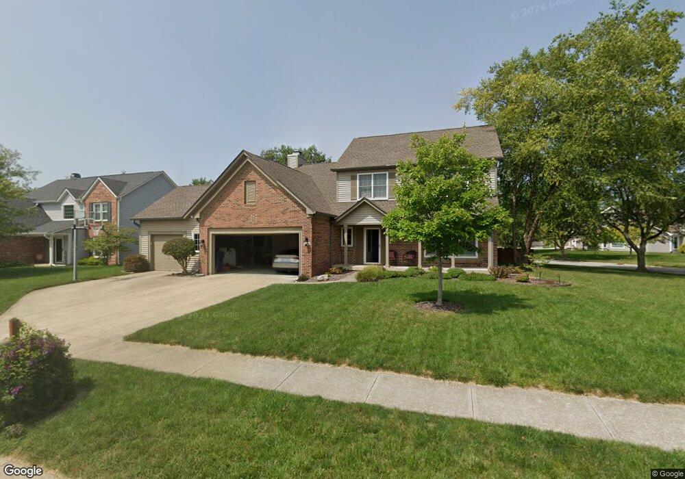
5144 Trull Brook Dr Noblesville, IN 46062
West Noblesville NeighborhoodEstimated Value: $411,000 - $452,989
4
Beds
3
Baths
3,089
Sq Ft
$139/Sq Ft
Est. Value
About This Home
This home is located at 5144 Trull Brook Dr, Noblesville, IN 46062 and is currently estimated at $429,247, approximately $138 per square foot. 5144 Trull Brook Dr is a home located in Hamilton County with nearby schools including Hazel Dell Elementary School, Noblesville West Middle School, and Noblesville High School.
Ownership History
Date
Name
Owned For
Owner Type
Purchase Details
Closed on
May 31, 2005
Sold by
Hoffman Michael T and Hoffman Linda K
Bought by
Ralston Jeffrey and Ralston Angela
Current Estimated Value
Home Financials for this Owner
Home Financials are based on the most recent Mortgage that was taken out on this home.
Original Mortgage
$155,200
Outstanding Balance
$79,664
Interest Rate
5.5%
Mortgage Type
Fannie Mae Freddie Mac
Estimated Equity
$349,583
Purchase Details
Closed on
Apr 27, 2001
Sold by
Neiman David M and Neiman Heidi L
Bought by
Hoffman Michael T and Hoffman Linda K
Home Financials for this Owner
Home Financials are based on the most recent Mortgage that was taken out on this home.
Original Mortgage
$162,000
Interest Rate
7.03%
Create a Home Valuation Report for This Property
The Home Valuation Report is an in-depth analysis detailing your home's value as well as a comparison with similar homes in the area
Home Values in the Area
Average Home Value in this Area
Purchase History
| Date | Buyer | Sale Price | Title Company |
|---|---|---|---|
| Ralston Jeffrey | -- | -- | |
| Hoffman Michael T | -- | Stewart Title Services |
Source: Public Records
Mortgage History
| Date | Status | Borrower | Loan Amount |
|---|---|---|---|
| Open | Ralston Jeffrey | $155,200 | |
| Previous Owner | Hoffman Michael T | $162,000 |
Source: Public Records
Tax History Compared to Growth
Tax History
| Year | Tax Paid | Tax Assessment Tax Assessment Total Assessment is a certain percentage of the fair market value that is determined by local assessors to be the total taxable value of land and additions on the property. | Land | Improvement |
|---|---|---|---|---|
| 2024 | $4,593 | $361,800 | $82,900 | $278,900 |
| 2023 | $4,658 | $369,400 | $82,900 | $286,500 |
| 2022 | $4,013 | $306,700 | $82,900 | $223,800 |
| 2021 | $3,734 | $286,200 | $82,900 | $203,300 |
| 2020 | $3,508 | $261,800 | $82,900 | $178,900 |
| 2019 | $3,313 | $259,300 | $39,700 | $219,600 |
| 2018 | $2,985 | $230,000 | $39,700 | $190,300 |
| 2017 | $2,828 | $227,100 | $39,700 | $187,400 |
| 2016 | $2,568 | $209,000 | $39,700 | $169,300 |
| 2014 | $2,422 | $201,700 | $39,200 | $162,500 |
| 2013 | $2,422 | $197,500 | $39,200 | $158,300 |
Source: Public Records
Map
Nearby Homes
- 5050 Trull Brook Dr
- 5287 Ashbrook Dr
- 17712 Crown Pointe Ct
- 4882 Gilet Dr
- 17717 Remy Rd
- 4883 Gilet Dr
- Meridian III Plan at Cranbrook Towns
- Talbott II Plan at Cranbrook Towns
- Lockerbie V Plan at Cranbrook Towns
- 4887 Gilet Dr
- 5237 Tulip Tree Dr
- 17902 Cristin Way
- 18229 Moontown Rd
- 4846 E Amesbury Place
- 350 Sandbrook Dr
- 4601 Amesbury Place
- 17506 Ebling Trail
- 17490 Ebling Trail
- 17451 Ebling Trail
- 17459 Ebling Trail
- 5134 Trull Brook Dr
- 5121 Ashbrook Dr
- 17890 Tallgrass Ct
- 5124 Trull Brook Dr
- 5153 Trull Brook Dr
- 5143 Trull Brook Dr
- 5163 Trull Brook Dr
- 17900 Tallgrass Ct
- 5114 Trull Brook Dr
- 5089 Ashbrook Dr
- 17911 Albany Ct
- 17883 Tallgrass Ct
- 17898 Albany Ct
- 5123 Trull Brook Dr
- 17910 Tallgrass Ct
- 5073 Ashbrook Dr
- 5104 Trull Brook Dr
- 17893 Tallgrass Ct
- 5113 Trull Brook Dr
- 17908 Albany Ct