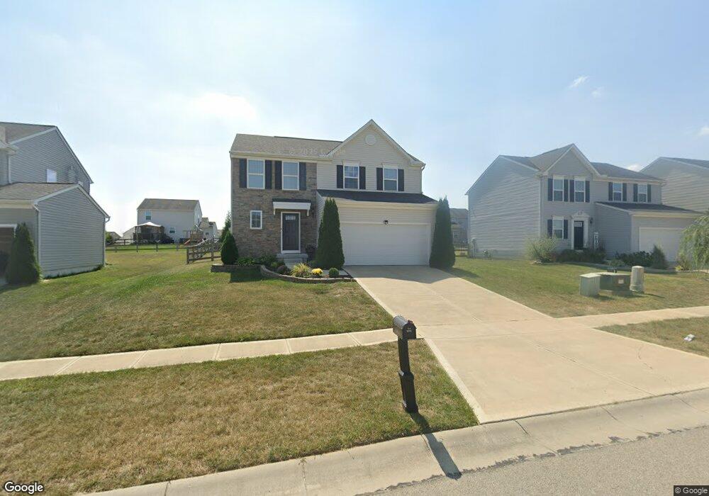
5148 Englewood Dr Unit 175 Liberty Township, OH 45011
Estimated Value: $379,993 - $415,000
3
Beds
3
Baths
1,800
Sq Ft
$223/Sq Ft
Est. Value
About This Home
This home is located at 5148 Englewood Dr Unit 175, Liberty Township, OH 45011 and is currently estimated at $401,498, approximately $223 per square foot. 5148 Englewood Dr Unit 175 is a home located in Butler County with nearby schools including Cherokee Elementary School, Heritage Early Childhood School, and Lakota Plains Junior School.
Ownership History
Date
Name
Owned For
Owner Type
Purchase Details
Closed on
Nov 25, 2014
Sold by
Nvr Inc
Bought by
Moya Carlos A
Current Estimated Value
Home Financials for this Owner
Home Financials are based on the most recent Mortgage that was taken out on this home.
Original Mortgage
$205,102
Outstanding Balance
$157,049
Interest Rate
3.91%
Mortgage Type
New Conventional
Estimated Equity
$244,449
Purchase Details
Closed on
Sep 5, 2014
Sold by
Skyscraper Ltd
Bought by
Nvr Inc
Create a Home Valuation Report for This Property
The Home Valuation Report is an in-depth analysis detailing your home's value as well as a comparison with similar homes in the area
Home Values in the Area
Average Home Value in this Area
Purchase History
| Date | Buyer | Sale Price | Title Company |
|---|---|---|---|
| Moya Carlos A | $201,125 | None Available | |
| Nvr Inc | $37,500 | None Available |
Source: Public Records
Mortgage History
| Date | Status | Borrower | Loan Amount |
|---|---|---|---|
| Open | Moya Carlos A | $205,102 |
Source: Public Records
Tax History Compared to Growth
Tax History
| Year | Tax Paid | Tax Assessment Tax Assessment Total Assessment is a certain percentage of the fair market value that is determined by local assessors to be the total taxable value of land and additions on the property. | Land | Improvement |
|---|---|---|---|---|
| 2024 | $4,105 | $104,720 | $12,250 | $92,470 |
| 2023 | $4,053 | $109,640 | $12,250 | $97,390 |
| 2022 | $3,714 | $75,160 | $12,250 | $62,910 |
| 2021 | $3,694 | $75,160 | $12,250 | $62,910 |
| 2020 | $3,796 | $75,160 | $12,250 | $62,910 |
| 2019 | $6,304 | $65,440 | $13,520 | $51,920 |
| 2018 | $3,697 | $65,440 | $13,520 | $51,920 |
| 2017 | $3,762 | $65,440 | $13,520 | $51,920 |
| 2016 | $3,365 | $58,120 | $13,520 | $44,600 |
| 2015 | $3,340 | $58,120 | $13,520 | $44,600 |
Source: Public Records
Map
Nearby Homes
- 4943 Silver Creek Ct
- 5008 N Star Ct
- 4998 Long Dr
- 5114 Princeton Glendale Rd
- 5014 Rockdale Rd
- 5140 Elk Run Dr
- 4588 Fairway Eleven Ct
- 21 Kelly St Unit 21
- 4830 Cobblestone Ln
- 4902 Harrier Ln
- 4957 Streamside Ct
- 33 E Kelly St Unit 33
- 5565 Eagle Ct
- 5567 Eagle Ct
- 4946 Pebble Ct
- 4938 Pebble Ct
- 4934 Pebble Ct
- 4821 Osprey Pointe Dr
- 4930 Pebble Ct
- 4926 Pebble Ct
- 5148 Englewood Dr
- 5158 Englewood Dr
- 5138 Englewood Dr
- 4640 Englewood Dr
- 5155 Englewood Dr
- 5128 Englewood Dr
- 4838 Redstone Dr
- 4818 Redstone Dr
- 5168 Englewood Dr
- 4828 Redstone Dr
- 5118 Englewood Dr
- 5145 Englewood Dr
- 5135 Englewood Dr
- 5215 Englewood Dr
- 4848 Redstone Dr
- 4808 Redstone Dr
- 5125 Englewood Dr
- 5165 Englewood Dr
- 5115 Englewood Dr
- 4858 Redstone Dr