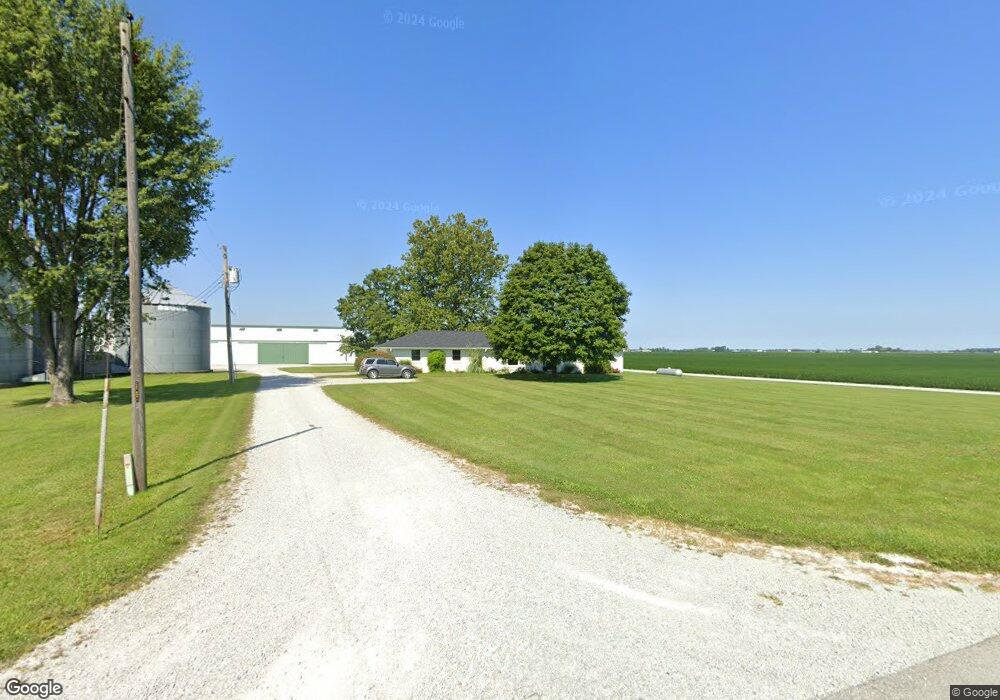
5149 S 700 W Pendleton, IN 46064
Estimated Value: $333,000 - $546,012
Studio
2
Baths
1,552
Sq Ft
$270/Sq Ft
Est. Value
About This Home
This home is located at 5149 S 700 W, Pendleton, IN 46064 and is currently estimated at $419,671, approximately $270 per square foot. 5149 S 700 W is a home located in Madison County with nearby schools including Pendleton Elementary School and Pendleton Heights Middle School.
Ownership History
Date
Name
Owned For
Owner Type
Purchase Details
Closed on
Jun 17, 2025
Sold by
Purdue Jeffrey T
Bought by
Purdue Sunset Farms Llc
Current Estimated Value
Purchase Details
Closed on
Jul 29, 2021
Sold by
Purdue Supplemental Care Trust
Bought by
Purdue Jeffrey T
Purchase Details
Closed on
Mar 4, 2021
Sold by
Purdue Trust
Bought by
Purdue Supplemental Care Trust
Create a Home Valuation Report for This Property
The Home Valuation Report is an in-depth analysis detailing your home's value as well as a comparison with similar homes in the area
Home Values in the Area
Average Home Value in this Area
Purchase History
| Date | Buyer | Sale Price | Title Company |
|---|---|---|---|
| Purdue Sunset Farms Llc | -- | None Listed On Document | |
| Purdue Jeffrey T | -- | None Available | |
| Purdue Supplemental Care Trust | -- | None Available |
Source: Public Records
Tax History
| Year | Tax Paid | Tax Assessment Tax Assessment Total Assessment is a certain percentage of the fair market value that is determined by local assessors to be the total taxable value of land and additions on the property. | Land | Improvement |
|---|---|---|---|---|
| 2025 | $6,064 | $348,200 | $198,200 | $150,000 |
| 2024 | $6,064 | $325,400 | $211,600 | $113,800 |
| 2023 | $5,646 | $282,300 | $178,900 | $103,400 |
| 2022 | $5,026 | $247,800 | $144,400 | $103,400 |
| 2021 | $2,825 | $221,700 | $126,800 | $94,900 |
| 2020 | $3,589 | $223,000 | $125,100 | $97,900 |
| 2019 | $3,924 | $243,600 | $148,600 | $95,000 |
| 2018 | $3,919 | $239,200 | $152,800 | $86,400 |
| 2017 | $3,927 | $258,100 | $172,900 | $85,200 |
| 2016 | $4,564 | $267,200 | $182,000 | $85,200 |
| 2014 | $4,147 | $268,100 | $183,200 | $84,900 |
| 2013 | $4,147 | $244,700 | $159,800 | $84,900 |
Source: Public Records
Map
Nearby Homes
- 5717 - 5721 W Sr 132
- 7113 Theo Baker Blvd
- 5758 Bancroft Dr
- 5752 Bancroft Dr
- 5746 Bancroft Dr
- 5757 Bancroft Dr
- 5740 Bancroft Dr
- 5734 Bancroft Dr
- 7145 Theo Baker Blvd
- 7153 Theo Baker Blvd
- 6049 W Foster Branch Dr
- 7129 Theo Baker Blvd
- 1592.5 S State Road 13
- 7121 Theo Baker Blvd
- 7105 Theo Baker Blvd
- 0 W 300 S Unit MBR22051203
- IN Hwy 13 & 38
- 9007 S Indiana 13 & Indiana 38 Hwy
- 7200 Murph Way
- 7170 Murph Way
- 5776 S 700 W
- 5776 S 700 W
- 5776 S 700 W
- 6367 W State Road 132
- 6560 Old Indiana 132
- 6560 W State Road 132
- 6474 W State Road 132
- 5311 S 625 W
- 6370 W State Road 132
- 6933 Lapel Rd
- 6985 W State Road 132
- 7019 W State Road 132
- 5409 S 625 W
- 5981 S 700 W
- 5750 S 800 W
- 5750 S 800 W
- 5750 S 800 W
- 7088 Old Indiana 132
- 6114 W State Road 132
- 6114 Old State Road 132
Your Personal Tour Guide
Ask me questions while you tour the home.