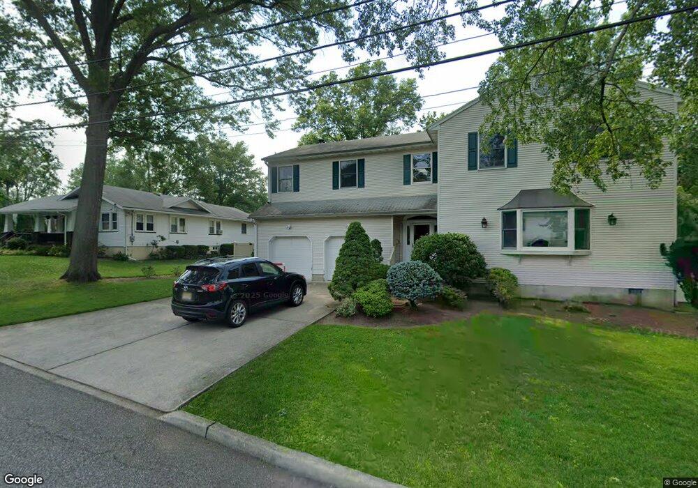
515 Albradt St Paramus, NJ 07652
Estimated Value: $1,148,397 - $1,392,000
--
Bed
--
Bath
3,024
Sq Ft
$416/Sq Ft
Est. Value
About This Home
This home is located at 515 Albradt St, Paramus, NJ 07652 and is currently estimated at $1,258,099, approximately $416 per square foot. 515 Albradt St is a home located in Bergen County with nearby schools including Paramus High School, Alpine Learning Group, and Paramus Catholic High School.
Ownership History
Date
Name
Owned For
Owner Type
Purchase Details
Closed on
Jul 7, 2025
Sold by
Wang Lei and Zhang Guoqin
Bought by
Plaza Iii Llc
Current Estimated Value
Purchase Details
Closed on
Aug 31, 1993
Sold by
Sullivan Cornelius and Sullivan Jane
Bought by
Wang Lei and Zhang Gouqin
Home Financials for this Owner
Home Financials are based on the most recent Mortgage that was taken out on this home.
Original Mortgage
$270,000
Interest Rate
7.21%
Create a Home Valuation Report for This Property
The Home Valuation Report is an in-depth analysis detailing your home's value as well as a comparison with similar homes in the area
Home Values in the Area
Average Home Value in this Area
Purchase History
| Date | Buyer | Sale Price | Title Company |
|---|---|---|---|
| Plaza Iii Llc | -- | None Listed On Document | |
| Plaza Iii Llc | -- | None Listed On Document | |
| Wang Lei | $385,000 | -- |
Source: Public Records
Mortgage History
| Date | Status | Borrower | Loan Amount |
|---|---|---|---|
| Previous Owner | Wang Lei | $270,000 |
Source: Public Records
Tax History Compared to Growth
Tax History
| Year | Tax Paid | Tax Assessment Tax Assessment Total Assessment is a certain percentage of the fair market value that is determined by local assessors to be the total taxable value of land and additions on the property. | Land | Improvement |
|---|---|---|---|---|
| 2025 | $13,017 | $879,600 | $383,000 | $496,600 |
| 2024 | $12,649 | $859,800 | $349,300 | $510,500 |
| 2023 | $11,995 | $824,600 | $332,500 | $492,100 |
| 2022 | $11,995 | $772,900 | $309,800 | $463,100 |
| 2021 | $11,697 | $707,200 | $281,200 | $426,000 |
| 2020 | $11,104 | $696,200 | $276,200 | $420,000 |
| 2019 | $11,218 | $604,400 | $246,400 | $358,000 |
| 2018 | $11,079 | $604,400 | $246,400 | $358,000 |
| 2017 | $10,885 | $604,400 | $246,400 | $358,000 |
| 2016 | $10,589 | $604,400 | $246,400 | $358,000 |
| 2015 | $10,480 | $604,400 | $246,400 | $358,000 |
| 2014 | $10,390 | $604,400 | $246,400 | $358,000 |
Source: Public Records
Map
Nearby Homes
- 232 W Midland Ave
- 265 Purdue Ct
- 495 Paramus Rd
- 83 Birchwood Rd
- 605 Craig Ave
- 11 Gabriel Ct
- 12 Gabriel Ct
- 16 Gabriel Ct
- 648 Falmouth Ave
- 602 Mill Run
- 660 Arcadia Rd
- 16 Columbine Rd
- 133 Morristown Place
- 479 S Pleasant Ave
- 101 Glen Ave
- 522 Grove St
- 33 Beekman Place
- 780 Hilton Place
- 12 Pershing Ave
- 338 S van Dien Ave
- 517 Albradt St
- 511 Albradt St
- 522 Otto Place
- 519 Albradt St
- 516 Otto Place
- 524 Otto Place
- 514 Albradt St
- 516 Albradt St
- 521 Albradt St
- 512 Albradt St
- 207 W Midland Ave
- 518 Albradt St
- 526 Otto Place
- 205 W Midland Ave
- 523 Albradt St
- 199 W Midland Ave
- 520 Albradt St
- 546 Westbrook Ct
- 197 W Midland Ave
- 521 Otto Place