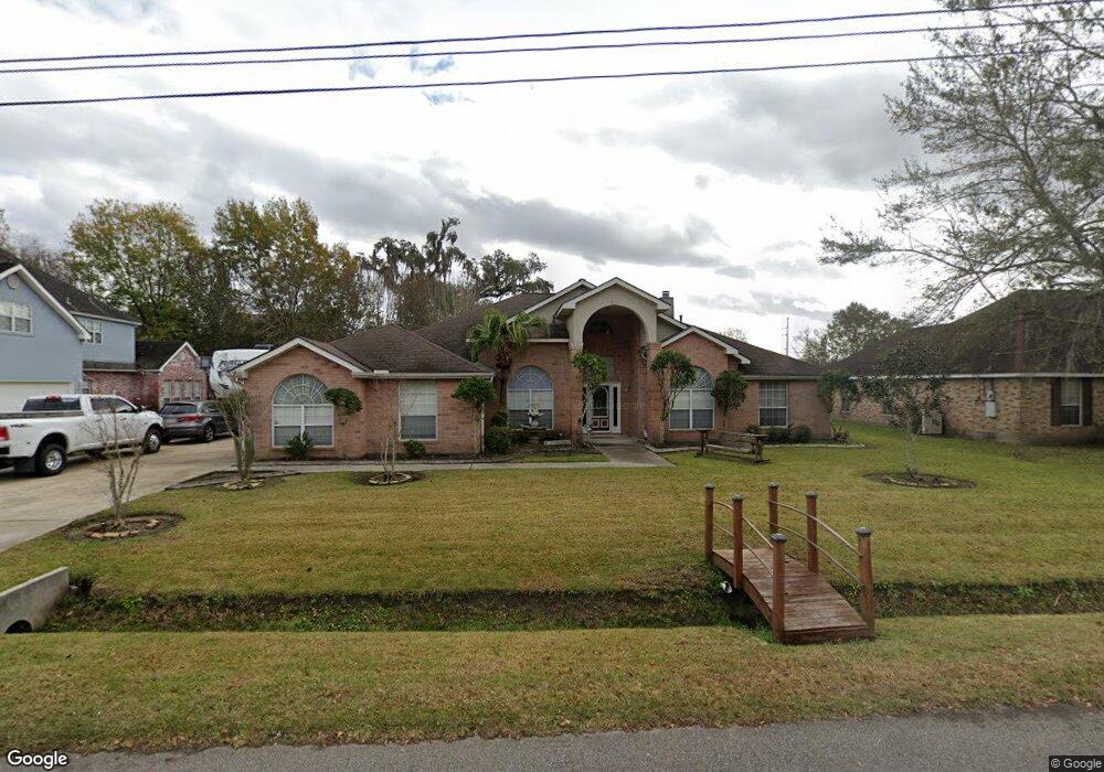
515 Diane Dr Luling, LA 70070
Estimated Value: $330,000 - $457,963
5
Beds
4
Baths
3,200
Sq Ft
$124/Sq Ft
Est. Value
About This Home
This home is located at 515 Diane Dr, Luling, LA 70070 and is currently estimated at $397,491, approximately $124 per square foot. 515 Diane Dr is a home located in St. Charles Parish with nearby schools including Mimosa Park Elementary School, Lakewood Elementary School, and J.B. Martin Middle School.
Ownership History
Date
Name
Owned For
Owner Type
Purchase Details
Closed on
Dec 28, 2015
Sold by
Gomez Levi G
Bought by
Leblanc Aleta G and Francis Patricia G
Current Estimated Value
Purchase Details
Closed on
Dec 14, 2015
Sold by
Bridges Trudy C
Bought by
Leblanc Aleta G and Lfrancis Patricia G
Purchase Details
Closed on
Jul 29, 2005
Sold by
Alexander Twyla Scott and Alexander Tracy J
Bought by
Stuckey Paulina and Cassidy Dyne Kevin
Home Financials for this Owner
Home Financials are based on the most recent Mortgage that was taken out on this home.
Original Mortgage
$216,000
Interest Rate
5.51%
Mortgage Type
New Conventional
Create a Home Valuation Report for This Property
The Home Valuation Report is an in-depth analysis detailing your home's value as well as a comparison with similar homes in the area
Home Values in the Area
Average Home Value in this Area
Purchase History
| Date | Buyer | Sale Price | Title Company |
|---|---|---|---|
| Leblanc Aleta G | -- | None Available | |
| Leblanc Aleta G | -- | None Available | |
| Stuckey Paulina | $270,000 | First Financial Title Agency |
Source: Public Records
Mortgage History
| Date | Status | Borrower | Loan Amount |
|---|---|---|---|
| Previous Owner | Stuckey Paulina | $216,000 |
Source: Public Records
Tax History
| Year | Tax Paid | Tax Assessment Tax Assessment Total Assessment is a certain percentage of the fair market value that is determined by local assessors to be the total taxable value of land and additions on the property. | Land | Improvement |
|---|---|---|---|---|
| 2025 | $3,093 | $38,100 | $7,540 | $30,560 |
| 2024 | $3,093 | $38,100 | $7,540 | $30,560 |
| 2023 | $3,141 | $28,680 | $5,560 | $23,120 |
| 2022 | $3,354 | $28,680 | $5,560 | $23,120 |
| 2021 | $3,044 | $25,812 | $5,004 | $20,808 |
| 2020 | $3,389 | $28,680 | $5,560 | $23,120 |
| 2019 | $3,171 | $26,740 | $4,300 | $22,440 |
| 2018 | $3,146 | $26,740 | $4,300 | $22,440 |
| 2017 | $3,143 | $26,740 | $4,300 | $22,440 |
| 2016 | $3,156 | $26,740 | $4,300 | $22,440 |
| 2015 | $2,063 | $25,046 | $2,915 | $22,131 |
| 2014 | $1,988 | $25,046 | $2,915 | $22,131 |
| 2013 | $1,995 | $25,046 | $2,915 | $22,131 |
Source: Public Records
Map
Nearby Homes
Your Personal Tour Guide
Ask me questions while you tour the home.