Estimated Value: $491,073 - $601,000
Studio
--
Bath
1,565
Sq Ft
$349/Sq Ft
Est. Value
About This Home
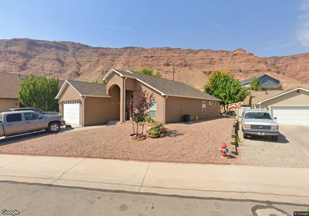
This home is located at 515 Doc Allen Dr, Moab, UT 84532 and is currently estimated at $545,518, approximately $348 per square foot. 515 Doc Allen Dr is a home with nearby schools including Helen M. Knight School, Grand County Middle School, and Grand County High School.
Ownership History
Date
Name
Owned For
Owner Type
Purchase Details
Closed on
Apr 7, 2015
Sold by
Steven M Steven M
Bought by
Erlandson Steve
Current Estimated Value
Purchase Details
Closed on
May 24, 2010
Sold by
Mcelhaney Douglas C and Mcelhaney Carma J
Bought by
Erlandson Steven M
Home Financials for this Owner
Home Financials are based on the most recent Mortgage that was taken out on this home.
Original Mortgage
$207,200
Outstanding Balance
$137,807
Interest Rate
5.05%
Mortgage Type
New Conventional
Estimated Equity
$407,711
Create a Home Valuation Report for This Property
The Home Valuation Report is an in-depth analysis detailing your home's value as well as a comparison with similar homes in the area
Home Values in the Area
Average Home Value in this Area
Purchase History
| Date | Buyer | Sale Price | Title Company |
|---|---|---|---|
| Erlandson Steve | -- | Anderson Oliver Title Ins | |
| Erlandson Steven M | -- | -- |
Source: Public Records
Mortgage History
| Date | Status | Borrower | Loan Amount |
|---|---|---|---|
| Open | Erlandson Steven M | $207,200 |
Source: Public Records
Tax History
| Year | Tax Paid | Tax Assessment Tax Assessment Total Assessment is a certain percentage of the fair market value that is determined by local assessors to be the total taxable value of land and additions on the property. | Land | Improvement |
|---|---|---|---|---|
| 2025 | $2,688 | $463,697 | $75,000 | $388,697 |
| 2024 | $2,688 | $463,697 | $75,000 | $388,697 |
| 2023 | $2,774 | $463,697 | $75,000 | $388,697 |
| 2022 | $2,334 | $452,376 | $75,000 | $377,376 |
| 2021 | $1,708 | $286,180 | $85,000 | $201,180 |
| 2020 | $1,772 | $286,180 | $85,000 | $201,180 |
| 2019 | $1,673 | $286,180 | $85,000 | $201,180 |
| 2018 | $1,484 | $256,180 | $55,000 | $201,180 |
| 2017 | $1,537 | $0 | $0 | $0 |
| 2016 | $1,521 | $0 | $0 | $0 |
| 2015 | $1,338 | $0 | $0 | $0 |
| 2014 | $2,344 | $0 | $0 | $0 |
| 2013 | -- | $124,709 | $0 | $0 |
Source: Public Records
Map
Nearby Homes
- 836 S Main St
- 855 David Ct Unit 34
- 766 Huntridge Dr
- 545 Kane Creek Blvd
- 661 S 400 E
- 424 E Secret Cove Ct
- 494 E Kachina Way
- 318 E Pueblo Ct
- 1260 Madison Way
- 214 S 200 E Unit 6
- 214 S 200 E Unit 7
- 214 S 200 E Unit 9
- 214 S 200 E Unit 4
- 214 S 200 E Unit 8
- 214 S 200 E Unit 1
- 214 S 200 E Unit 2
- 443 Kane Creek Blvd Unit 211
- 443 Kane Creek Blvd Unit 111
- 443 Kane Creek Blvd Unit 210
- 443 Kane Creek Blvd Unit 301
- 82 Dogwood Ave
- 515 Doc Allen Dr
- 800 S Main St
- 812 S Main St
- 921 David Ct
- 859 Mountain View Dr
- 840 S Main St
- 856 Mountain View Dr
- 702 S Main St
- 702 S Main St Unit 3
- 853 Mountain View Dr
- 879 David Ct
- 881 David Ct
- 881 David Ct Unit 37
- 850 Mountain View Dr
- 909 David Ct
- 811 S Main St
- 845 Mountain View Dr
- 867 David Ct
- 844 Mountain View Dr
Your Personal Tour Guide
Ask me questions while you tour the home.