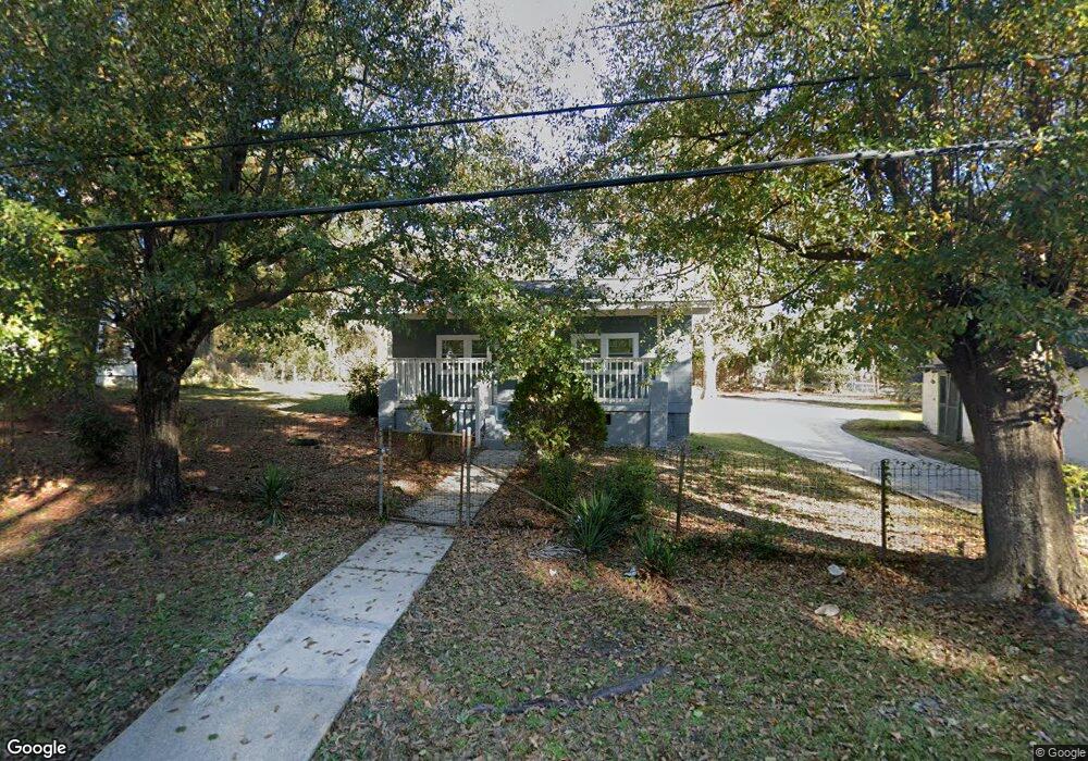
515 Glenn Robertson Dr Lagrange, GA 30241
Estimated Value: $93,000 - $121,000
2
Beds
1
Bath
1,030
Sq Ft
$108/Sq Ft
Est. Value
About This Home
This home is located at 515 Glenn Robertson Dr, Lagrange, GA 30241 and is currently estimated at $111,539, approximately $108 per square foot. 515 Glenn Robertson Dr is a home located in Troup County with nearby schools including Hollis Hand Elementary School, Franklin Forest Elementary School, and Ethel W. Kight Elementary School.
Ownership History
Date
Name
Owned For
Owner Type
Purchase Details
Closed on
Jul 24, 2020
Sold by
Newsome Charlie Will
Bought by
Community Residential Inc
Current Estimated Value
Purchase Details
Closed on
Jul 23, 1999
Sold by
Estate Of Mary Alice Phillips
Bought by
Newsome Charlie Will and Newsome Louise
Purchase Details
Closed on
Jan 1, 1973
Sold by
Glenn Robertson
Bought by
Estate Of Mary Alice Phillips
Purchase Details
Closed on
Jan 1, 1968
Sold by
Tom Cummings
Bought by
Glenn Robertson
Create a Home Valuation Report for This Property
The Home Valuation Report is an in-depth analysis detailing your home's value as well as a comparison with similar homes in the area
Home Values in the Area
Average Home Value in this Area
Purchase History
| Date | Buyer | Sale Price | Title Company |
|---|---|---|---|
| Community Residential Inc | -- | -- | |
| Newsome Charlie Will | $35,000 | -- | |
| Estate Of Mary Alice Phillips | -- | -- | |
| Glenn Robertson | -- | -- |
Source: Public Records
Tax History Compared to Growth
Tax History
| Year | Tax Paid | Tax Assessment Tax Assessment Total Assessment is a certain percentage of the fair market value that is determined by local assessors to be the total taxable value of land and additions on the property. | Land | Improvement |
|---|---|---|---|---|
| 2024 | $714 | $26,196 | $2,360 | $23,836 |
| 2023 | $687 | $25,196 | $2,360 | $22,836 |
| 2022 | $664 | $23,796 | $2,360 | $21,436 |
| 2021 | $417 | $13,832 | $2,360 | $11,472 |
| 2020 | $417 | $13,832 | $2,360 | $11,472 |
| 2019 | $388 | $12,864 | $2,360 | $10,504 |
| 2018 | $388 | $12,864 | $2,360 | $10,504 |
| 2017 | $1 | $8,828 | $1,164 | $7,664 |
| 2016 | $1 | $8,804 | $1,164 | $7,640 |
| 2015 | $2 | $8,804 | $1,164 | $7,640 |
| 2014 | $1 | $8,402 | $1,164 | $7,238 |
| 2013 | -- | $10,896 | $1,164 | $9,732 |
Source: Public Records
Map
Nearby Homes
- LOT 4 Borton St
- LOT 3 Borton St
- LOT 5 Borton St
- LOT 6 Borton St
- 0 Kelley St Unit 10550311
- 957 Kelley St
- 1017 Mason St
- 626 Smoot St
- 510 Smoot St
- 0 Brown St Unit 10550761
- 0 Brown St Unit 10550754
- 203 Revis St
- 205 Revis St
- 0 Burr St
- 306 Burr St
- 200 Mccall St
- 311 Colquitt St
- 105 Dix St
- 0 Locust St
- 0 E Fendig St
- 905 Mason St
- 509 Glenn Robertson Dr
- 601 Glenn Robertson Dr
- 507 Glenn Robertson Dr
- 510 Glenn Robertson Dr
- 508 Glenn Robertson Dr
- 904 Mason St
- 908 Mason St
- 504 Glenn Robertson Dr
- 607 Glenn Robertson Dr
- 503 Glenn Robertson Dr
- 608 Glenn Robertson Dr
- 912 Mason St
- 917 Mason St
- 609 Glenn Robertson Dr
- 906 Borton St
- 501 Glenn Robertson Dr
- 903 Kelley St
- 0 Glenn Robertson Dr Unit 7476498
- 0 Glenn Robertson Dr Unit 8664189