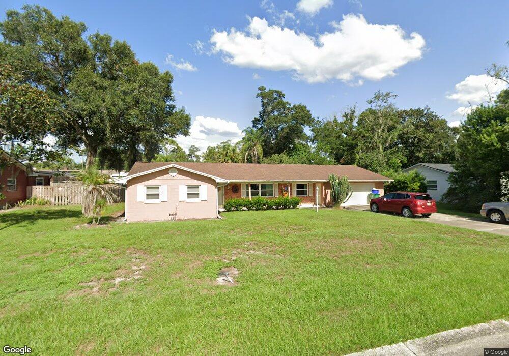
515 Holly Ln Deland, FL 32724
Estimated Value: $292,287 - $369,000
4
Beds
2
Baths
1,932
Sq Ft
$166/Sq Ft
Est. Value
About This Home
This home is located at 515 Holly Ln, Deland, FL 32724 and is currently estimated at $319,822, approximately $165 per square foot. 515 Holly Ln is a home located in Volusia County with nearby schools including Deland High School, Blue Lake Elementary School, and Deland Middle School.
Ownership History
Date
Name
Owned For
Owner Type
Purchase Details
Closed on
Jun 30, 2008
Sold by
Wehrfritz Mary Jane
Bought by
Enders Marta R and Enders Wayne R
Current Estimated Value
Home Financials for this Owner
Home Financials are based on the most recent Mortgage that was taken out on this home.
Original Mortgage
$50,000
Outstanding Balance
$32,092
Interest Rate
5.97%
Mortgage Type
Purchase Money Mortgage
Estimated Equity
$287,730
Purchase Details
Closed on
Apr 24, 2006
Sold by
Wehrfritz Mary J
Bought by
Wehrfritz Mary Jane and Mary Jane Wehrfritz Trust
Create a Home Valuation Report for This Property
The Home Valuation Report is an in-depth analysis detailing your home's value as well as a comparison with similar homes in the area
Home Values in the Area
Average Home Value in this Area
Purchase History
| Date | Buyer | Sale Price | Title Company |
|---|---|---|---|
| Enders Marta R | $170,000 | Westside Title Services Inc | |
| Wehrfritz Mary Jane | -- | Attorney |
Source: Public Records
Mortgage History
| Date | Status | Borrower | Loan Amount |
|---|---|---|---|
| Open | Enders Marta R | $50,000 |
Source: Public Records
Tax History Compared to Growth
Tax History
| Year | Tax Paid | Tax Assessment Tax Assessment Total Assessment is a certain percentage of the fair market value that is determined by local assessors to be the total taxable value of land and additions on the property. | Land | Improvement |
|---|---|---|---|---|
| 2025 | $1,082 | $106,495 | -- | -- |
| 2024 | $1,082 | $103,494 | -- | -- |
| 2023 | $1,082 | $100,480 | $0 | $0 |
| 2022 | $1,045 | $97,553 | $0 | $0 |
| 2021 | $1,064 | $94,712 | $0 | $0 |
| 2020 | $1,042 | $93,404 | $0 | $0 |
| 2019 | $1,044 | $91,304 | $0 | $0 |
| 2018 | $1,048 | $89,602 | $0 | $0 |
| 2017 | $1,044 | $87,759 | $0 | $0 |
| 2016 | $997 | $85,954 | $0 | $0 |
| 2015 | $1,019 | $85,357 | $0 | $0 |
| 2014 | $1,025 | $84,680 | $0 | $0 |
Source: Public Records
Map
Nearby Homes
- 1100 E University Ave
- 1007 Crescent Pkwy
- 1005 Crescent Pkwy
- 1235 E Minnesota Ave
- 405 N McDonald Ave
- 401 N McDonald Ave
- 418 Berwick Cir
- 527 Land O Lakes Ct
- 851 E Pennsylvania Ave
- 714 Astoria Dr
- 753 Mystic Oaks Ln
- 241 N Hill Ave
- 183 N Hill Ave Unit 90
- 239 N Hill Ave Unit 110
- 151 N Hill Ave Unit 100
- 217 N Hill Ave Unit 20
- 201 N Hill Ave Unit 150
- 733 E Ohio Ave
- 706 E Minnesota Ave Unit C
- 0 E Wisconsin Ave Unit MFRO6190518