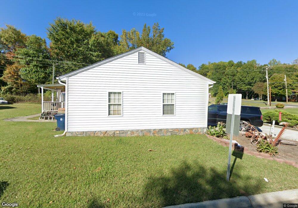
515 Moore Dr Lexington, NC 27292
Estimated Value: $171,000 - $252,000
2
Beds
1
Bath
2,780
Sq Ft
$74/Sq Ft
Est. Value
About This Home
This home is located at 515 Moore Dr, Lexington, NC 27292 and is currently estimated at $204,811, approximately $73 per square foot. 515 Moore Dr is a home located in Davidson County with nearby schools including South Lexington School, Lexington Middle School, and Lexington Senior High School.
Ownership History
Date
Name
Owned For
Owner Type
Purchase Details
Closed on
Jan 6, 2020
Sold by
Crump Rhonda L and Hargrave Rhonda
Bought by
Hargrave Rhonda
Current Estimated Value
Home Financials for this Owner
Home Financials are based on the most recent Mortgage that was taken out on this home.
Original Mortgage
$101,750
Outstanding Balance
$92,340
Interest Rate
5.12%
Mortgage Type
FHA
Estimated Equity
$112,471
Purchase Details
Closed on
Aug 1, 1999
Purchase Details
Closed on
Apr 1, 1985
Create a Home Valuation Report for This Property
The Home Valuation Report is an in-depth analysis detailing your home's value as well as a comparison with similar homes in the area
Home Values in the Area
Average Home Value in this Area
Purchase History
| Date | Buyer | Sale Price | Title Company |
|---|---|---|---|
| Hargrave Rhonda | -- | First Source Title Agcy Inc | |
| -- | $49,500 | -- | |
| -- | $17,000 | -- |
Source: Public Records
Mortgage History
| Date | Status | Borrower | Loan Amount |
|---|---|---|---|
| Open | Hargrave Rhonda | $101,750 |
Source: Public Records
Tax History
| Year | Tax Paid | Tax Assessment Tax Assessment Total Assessment is a certain percentage of the fair market value that is determined by local assessors to be the total taxable value of land and additions on the property. | Land | Improvement |
|---|---|---|---|---|
| 2025 | $1,679 | $129,110 | $0 | $0 |
| 2024 | $1,679 | $129,110 | $0 | $0 |
| 2023 | $1,679 | $129,110 | $0 | $0 |
| 2022 | $1,679 | $129,110 | $0 | $0 |
| 2021 | $1,679 | $129,110 | $0 | $0 |
| 2020 | $1,502 | $116,410 | $0 | $0 |
| 2019 | $1,525 | $116,410 | $0 | $0 |
| 2018 | $1,525 | $116,410 | $0 | $0 |
| 2017 | $1,525 | $116,410 | $0 | $0 |
| 2016 | $1,525 | $116,410 | $0 | $0 |
| 2015 | $1,467 | $116,410 | $0 | $0 |
| 2014 | $1,530 | $121,420 | $0 | $0 |
Source: Public Records
Map
Nearby Homes
- 307 Washburn St
- 326 Washburn St
- 203 Reich St
- 0000 S Main St
- 865 Old Linwood Rd
- 345 Harper Mill Cir
- 10 E 12th Ave
- 313 Owens Ridge Way
- 153 Gurney Kerns Rd
- 1301 Cotton Grove Rd
- 366 Harper Mill Cir
- 373 Harper Mill Cir
- 333 Owens Ridge Way
- 370 Harper Mill Cir
- 374 Harper Mill Cir
- 644 Brown St
- 401 Owens Ridge Way
- 405 Owens Ridge Way
- 613 Beckner St
- 440 Owens Ridge Way
- 513 Moore Dr
- 104 Covenant Ln
- 101-123 Bay Meadow Ct
- 517 Moore Dr
- 106 Covenant Ln
- 512 Moore Dr
- 105 Bay Meadow Ct Unit 105
- 519 Moore Dr
- 509 Moore Dr
- 108 Covenant Ln
- 110 Covenant Ln
- 508 Moore Dr
- 111 Covenant Ln
- 507 Moore Dr
- 112 Covenant Ln
- 506 Moore Dr
- 114 Covenant Ln
- 505 Moore Dr
- 505 Moore Dr
- 116 Covenant Ln
Your Personal Tour Guide
Ask me questions while you tour the home.