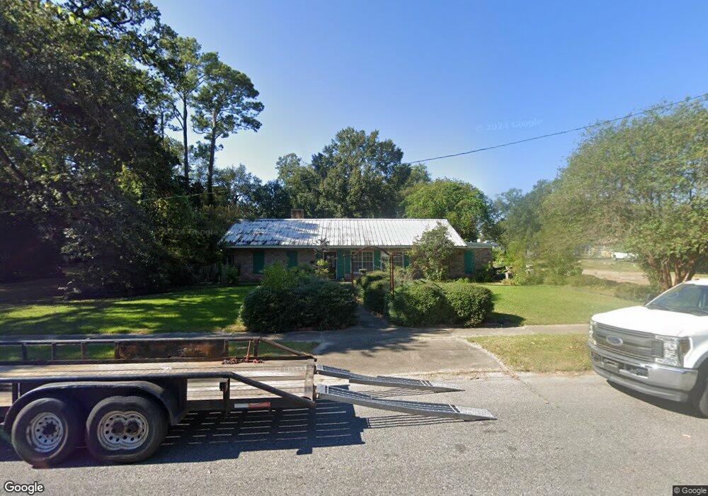
515 N Main St Breaux Bridge, LA 70517
Estimated Value: $130,000 - $161,150
--
Bed
--
Bath
1,390
Sq Ft
$110/Sq Ft
Est. Value
About This Home
This home is located at 515 N Main St, Breaux Bridge, LA 70517 and is currently estimated at $152,788, approximately $109 per square foot. 515 N Main St is a home located in St. Martin Parish with nearby schools including Breaux Bridge Primary School, Breaux Bridge Junior High School, and Breaux Bridge High School.
Ownership History
Date
Name
Owned For
Owner Type
Purchase Details
Closed on
Jan 9, 2025
Sold by
Dupuy Andre Francis
Bought by
Dupuy Edmund Michael and Anne Leblanc Dupuy Corinne
Current Estimated Value
Purchase Details
Closed on
Jul 31, 2024
Sold by
Santangelo Dupuy Caroline
Bought by
Dupuy Andre Francis
Home Financials for this Owner
Home Financials are based on the most recent Mortgage that was taken out on this home.
Original Mortgage
$120,280
Interest Rate
6.87%
Mortgage Type
New Conventional
Create a Home Valuation Report for This Property
The Home Valuation Report is an in-depth analysis detailing your home's value as well as a comparison with similar homes in the area
Home Values in the Area
Average Home Value in this Area
Purchase History
| Date | Buyer | Sale Price | Title Company |
|---|---|---|---|
| Dupuy Edmund Michael | $4,150 | None Listed On Document | |
| Dupuy Edmund Michael | $4,150 | None Listed On Document | |
| Dupuy Andre Francis | $124,000 | None Listed On Document |
Source: Public Records
Mortgage History
| Date | Status | Borrower | Loan Amount |
|---|---|---|---|
| Previous Owner | Dupuy Andre Francis | $120,280 |
Source: Public Records
Tax History Compared to Growth
Tax History
| Year | Tax Paid | Tax Assessment Tax Assessment Total Assessment is a certain percentage of the fair market value that is determined by local assessors to be the total taxable value of land and additions on the property. | Land | Improvement |
|---|---|---|---|---|
| 2024 | $1,528 | $15,170 | $3,180 | $11,990 |
| 2023 | $476 | $11,780 | $3,180 | $8,600 |
| 2022 | $476 | $11,780 | $3,180 | $8,600 |
| 2021 | $1,222 | $11,780 | $3,180 | $8,600 |
| 2020 | $1,219 | $11,780 | $3,180 | $8,600 |
| 2019 | $550 | $12,430 | $3,180 | $9,250 |
| 2018 | $543 | $12,430 | $3,180 | $9,250 |
| 2017 | $1,178 | $12,430 | $3,180 | $9,250 |
| 2016 | $1,123 | $12,430 | $3,180 | $9,250 |
| 2015 | $1,207 | $12,610 | $3,180 | $9,430 |
| 2014 | $1,207 | $12,610 | $3,180 | $9,430 |
| 2013 | $1,207 | $12,610 | $3,180 | $9,430 |
Source: Public Records
Map
Nearby Homes
- 421 N Main St
- 274 Blanchard St
- 624 N Railroad St
- 480 Nona St
- 237 Aline Dr
- 1104 Susan St
- 813 Solomon St
- Tbd Agnes Dr
- Tbd Agnes Dr Unit 1i-1j
- Tbd Agnes Dr Unit 1k-1l
- 5 Main Hwy
- 3 Main Hwy
- 2 Main Hwy
- 4 Main Hwy
- 1017 Solomon St
- 704 Cecile Blvd
- 105 Washington St
- 817 Cecile Blvd
- 306 Lakewood
- 729 N Belle Cir