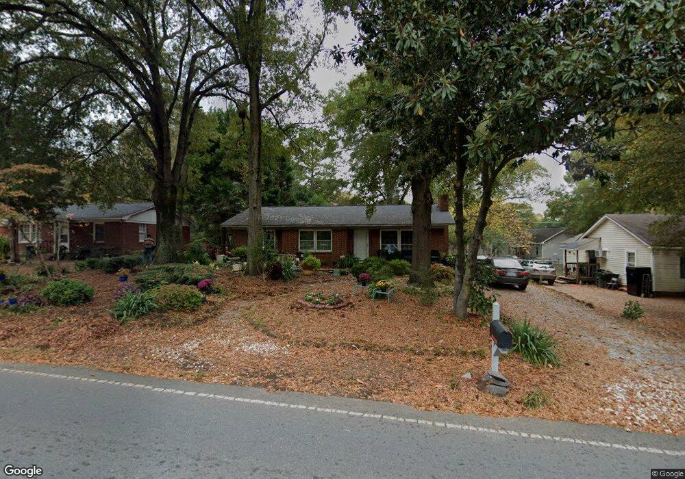
515 N Secrest Ave Monroe, NC 28110
Estimated Value: $217,000 - $276,000
3
Beds
1
Bath
1,252
Sq Ft
$194/Sq Ft
Est. Value
About This Home
This home is located at 515 N Secrest Ave, Monroe, NC 28110 and is currently estimated at $243,103, approximately $194 per square foot. 515 N Secrest Ave is a home located in Union County with nearby schools including Rock Rest Elementary School, East Union Middle School, and Forest Hills High School.
Ownership History
Date
Name
Owned For
Owner Type
Purchase Details
Closed on
Aug 12, 1998
Sold by
Brownie Irving Annie Yvonne and Brownie Irving
Bought by
Craig Harris Temest M
Current Estimated Value
Home Financials for this Owner
Home Financials are based on the most recent Mortgage that was taken out on this home.
Original Mortgage
$51,500
Outstanding Balance
$11,525
Interest Rate
7.75%
Estimated Equity
$231,578
Create a Home Valuation Report for This Property
The Home Valuation Report is an in-depth analysis detailing your home's value as well as a comparison with similar homes in the area
Home Values in the Area
Average Home Value in this Area
Purchase History
| Date | Buyer | Sale Price | Title Company |
|---|---|---|---|
| Craig Harris Temest M | $50,000 | -- |
Source: Public Records
Mortgage History
| Date | Status | Borrower | Loan Amount |
|---|---|---|---|
| Open | Craig Harris Temest M | $51,500 |
Source: Public Records
Tax History Compared to Growth
Tax History
| Year | Tax Paid | Tax Assessment Tax Assessment Total Assessment is a certain percentage of the fair market value that is determined by local assessors to be the total taxable value of land and additions on the property. | Land | Improvement |
|---|---|---|---|---|
| 2024 | $1,144 | $104,900 | $13,400 | $91,500 |
| 2023 | $1,144 | $104,900 | $13,400 | $91,500 |
| 2022 | $1,144 | $104,900 | $13,400 | $91,500 |
| 2021 | $1,144 | $104,900 | $13,400 | $91,500 |
| 2020 | $748 | $55,520 | $13,420 | $42,100 |
| 2019 | $748 | $55,520 | $13,420 | $42,100 |
| 2018 | $342 | $55,520 | $13,420 | $42,100 |
| 2017 | $759 | $55,500 | $13,400 | $42,100 |
| 2016 | $751 | $55,520 | $13,420 | $42,100 |
| 2015 | $431 | $55,520 | $13,420 | $42,100 |
| 2014 | $992 | $81,290 | $18,140 | $63,150 |
Source: Public Records
Map
Nearby Homes
- 2707 Mason St
- 1115 Unionville Indian Trail St Unit 1
- 104 Florence Dr
- 2109 Confederate St
- 0 Old Pageland Monroe Rd Unit CAR4224859
- Findlay II Plan at Willoughby Park
- Crawford Plan at Willoughby Park
- 416 Willoughby Park Dr
- 508 Willoughby Park Dr
- Savoy II Plan at Willoughby Park
- Draper II Plan at Willoughby Park
- 1801 Augustine St
- 500 Willoughby Park Dr
- Graham II Plan at Willoughby Park
- Bexley II Plan at Willoughby Park
- Dearborn II Plan at Willoughby Park
- 408 Willoughby Park Dr
- 504 Willoughby Park Dr
- Erie II Plan at Willoughby Park
- 622 Creekridge Dr
- 2710 Walkup Ave
- 511 N Secrest Ave
- 518 N Secrest Ave Unit A
- 509 N Secrest Ave
- 516 N Secrest Ave
- 507 N Secrest Ave
- 2704 Walkup Ave
- 2804 Walkup Ave
- 512 N Secrest Ave
- 505 N Secrest Ave
- 510 N Secrest Ave
- 503 N Secrest Ave
- 2702 Walkup Ave
- 2707 Union St
- 2709 Walkup Ave
- 2806 Walkup Ave
- 508 Redwine St
- 2705 Union St
- 506 Redwine St
- 508 N Secrest Ave