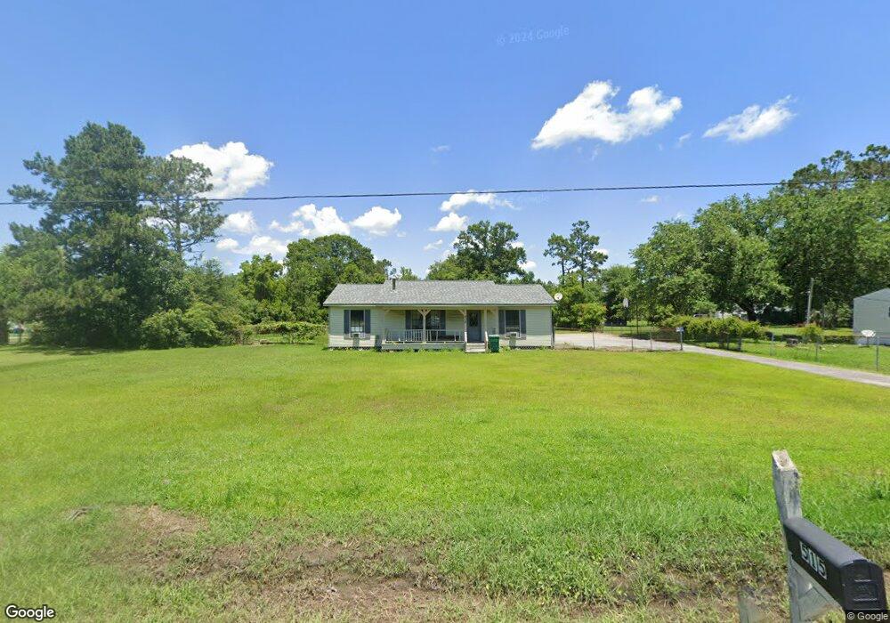
515 Oleander Ln Westlake, LA 70669
Estimated Value: $173,122 - $210,000
3
Beds
3
Baths
1,664
Sq Ft
$117/Sq Ft
Est. Value
About This Home
This home is located at 515 Oleander Ln, Westlake, LA 70669 and is currently estimated at $195,031, approximately $117 per square foot. 515 Oleander Ln is a home located in Calcasieu Parish with nearby schools including Westwood Elementary School, Western Heights Elementary School, and S.P. Arnett Middle School.
Ownership History
Date
Name
Owned For
Owner Type
Purchase Details
Closed on
Jul 23, 2008
Sold by
Briley Randolph Andrew and Briley Connie Joyce
Bought by
Barton Kevin Wayne
Current Estimated Value
Home Financials for this Owner
Home Financials are based on the most recent Mortgage that was taken out on this home.
Original Mortgage
$88,900
Outstanding Balance
$58,189
Interest Rate
6.36%
Mortgage Type
Purchase Money Mortgage
Estimated Equity
$136,842
Create a Home Valuation Report for This Property
The Home Valuation Report is an in-depth analysis detailing your home's value as well as a comparison with similar homes in the area
Home Values in the Area
Average Home Value in this Area
Purchase History
| Date | Buyer | Sale Price | Title Company |
|---|---|---|---|
| Barton Kevin Wayne | $127,000 | None Available |
Source: Public Records
Mortgage History
| Date | Status | Borrower | Loan Amount |
|---|---|---|---|
| Open | Barton Kevin Wayne | $88,900 |
Source: Public Records
Tax History Compared to Growth
Tax History
| Year | Tax Paid | Tax Assessment Tax Assessment Total Assessment is a certain percentage of the fair market value that is determined by local assessors to be the total taxable value of land and additions on the property. | Land | Improvement |
|---|---|---|---|---|
| 2024 | $753 | $7,020 | $1,170 | $5,850 |
| 2023 | $768 | $7,020 | $1,170 | $5,850 |
| 2022 | $771 | $7,020 | $1,170 | $5,850 |
| 2021 | $0 | $7,020 | $1,170 | $5,850 |
| 2020 | $698 | $6,390 | $1,120 | $5,270 |
| 2019 | $783 | $6,930 | $1,080 | $5,850 |
| 2018 | $757 | $6,930 | $1,080 | $5,850 |
| 2017 | $747 | $6,930 | $1,080 | $5,850 |
| 2016 | $757 | $6,930 | $1,080 | $5,850 |
| 2015 | $757 | $6,930 | $1,080 | $5,850 |
Source: Public Records
Map
Nearby Homes
- 369 Ann Terrace Ave
- 0 Charlotte Ave Unit SWL25001918
- 141 Cureton Rd
- 570 Ann Terrace Ave
- 0 Fletcher Rd
- 3425 Davis Rd
- 3124 Davis Rd
- 202 Phillips Rd
- 0 Davis Rd
- 0 Niel Rd Unit SWL23002840
- 3701 Davis Rd
- 320 Mcguire Rd
- 700 S Perkins Ferry Rd
- 112 Villa Dr
- 2725 Smith Ferry Rd
- 1545 S Perkins Ferry Rd
- 0 W Wayside Dr Unit SWL25001592
- 109 W Wayside Dr
- 1567 S Perkins Ferry Rd
- 1258 S Perkins Ferry Rd
- 519 Oleander Ln
- 511 Oleander Ln
- 510 Poinciana Ln
- 505 Oleander Ln
- 518 Poinciana Ln
- 521 Oleander Ln
- 512 Oleander Ln
- 510 Oleander Ln
- 518 Oleander Ln
- 504 Poinciana Ln
- 522 Poinciana Ln
- 520 Oleander Ln
- 504 Oleander Ln
- 401 Dalton Rd
- 426 Honeysuckle Ln
- 511 Poinciana Ln
- 515 Poinciana Ln
- 3329 Western Meadows Dr
- 3323 Western Meadows Dr
- 427 Honeysuckle Ln