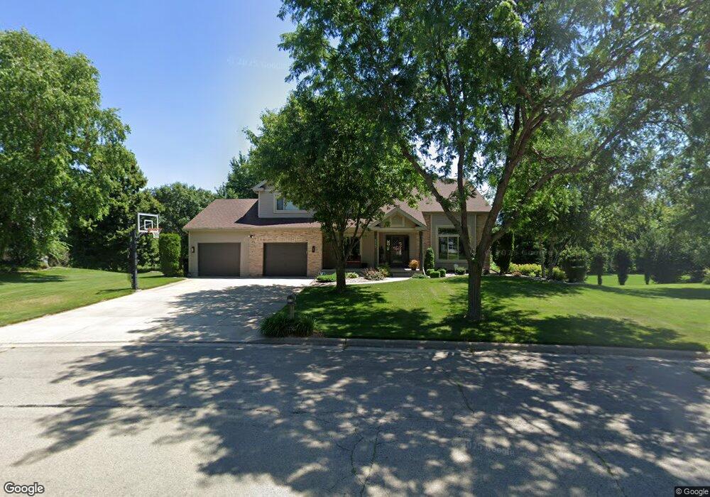
515 Riverside Dr de Forest, WI 53532
Estimated Value: $643,987 - $728,000
Studio
--
Bath
--
Sq Ft
25,962
Sq Ft Lot
About This Home
This home is located at 515 Riverside Dr, de Forest, WI 53532 and is currently estimated at $685,997. 515 Riverside Dr is a home located in Dane County with nearby schools including Yahara Elementary School, DeForest Middle School, and DeForest High School.
Ownership History
Date
Name
Owned For
Owner Type
Purchase Details
Closed on
Jun 7, 2007
Sold by
Markquart Paul E and Markquart Melissa J
Bought by
Hottmann Daniel L and Hottmann Nicole L
Current Estimated Value
Home Financials for this Owner
Home Financials are based on the most recent Mortgage that was taken out on this home.
Original Mortgage
$375,250
Outstanding Balance
$222,983
Interest Rate
6.2%
Mortgage Type
Purchase Money Mortgage
Estimated Equity
$463,014
Create a Home Valuation Report for This Property
The Home Valuation Report is an in-depth analysis detailing your home's value as well as a comparison with similar homes in the area
Home Values in the Area
Average Home Value in this Area
Purchase History
| Date | Buyer | Sale Price | Title Company |
|---|---|---|---|
| Hottmann Daniel L | $395,000 | None Available |
Source: Public Records
Mortgage History
| Date | Status | Borrower | Loan Amount |
|---|---|---|---|
| Open | Hottmann Daniel L | $375,250 |
Source: Public Records
Tax History
| Year | Tax Paid | Tax Assessment Tax Assessment Total Assessment is a certain percentage of the fair market value that is determined by local assessors to be the total taxable value of land and additions on the property. | Land | Improvement |
|---|---|---|---|---|
| 2025 | $10,557 | $616,000 | $110,100 | $505,900 |
| 2024 | $9,932 | $616,100 | $110,200 | $505,900 |
| 2023 | $9,427 | $555,700 | $104,300 | $451,400 |
| 2022 | $8,992 | $512,300 | $95,000 | $417,300 |
| 2021 | $8,416 | $426,900 | $92,000 | $334,900 |
| 2020 | $8,546 | $411,800 | $81,300 | $330,500 |
| 2019 | $8,187 | $399,400 | $81,300 | $318,100 |
| 2018 | $7,979 | $392,100 | $81,300 | $310,800 |
| 2017 | $7,666 | $392,100 | $81,300 | $310,800 |
| 2016 | $7,727 | $392,100 | $81,300 | $310,800 |
| 2015 | $7,536 | $356,600 | $68,000 | $288,600 |
| 2014 | $7,400 | $356,600 | $68,000 | $288,600 |
| 2013 | $8,348 | $356,600 | $68,000 | $288,600 |
Source: Public Records
Map
Nearby Homes
- 516 Woodvale Dr
- 4070 Great Bridge Dr
- 620 Acker Pkwy
- 392 Campbell Hill Ct
- 7786 Bluestem Trail
- 7782 Bluestem Trail
- 117 Crooked Tree Cir
- 7687 Stonecrop Way
- 7711 Stonecrop Way
- 7694 Stonecrop Way
- 7698 Stonecrop Way
- 7684 Stonecrop Way
- 185 N Lexington Pkwy
- 993 Clover Ln
- Unit 8 Deer Hollow Ct
- 216 Reigstad St
- L208 Stonecrop Way
- Unit 3 Deer Hollow Ct
- 849 Deer Hollow Ct
- Unit 1 Deer Hollow Ct
- 513 Riverside Dr
- 517 Riverside Dr
- 510 Riverside Dr
- 519 Riverside Dr
- 511 Riverside Dr
- 508 Riverside Dr
- 512 Riverside Dr
- 506 Riverside Dr
- 509 Riverside Dr
- 514 Riverside Dr
- 504 Riverside Dr
- 512 Riverview Ct
- 605 Sunnybrook Dr
- 507 Riverside Dr
- 514 Riverview Ct
- 607 Sunnybrook Dr
- 629 Hanks Hollow Trail
- 516 Riverside Dr
- 603 Sunnybrook Dr
- 510 Riverview Ct
Your Personal Tour Guide
Ask me questions while you tour the home.