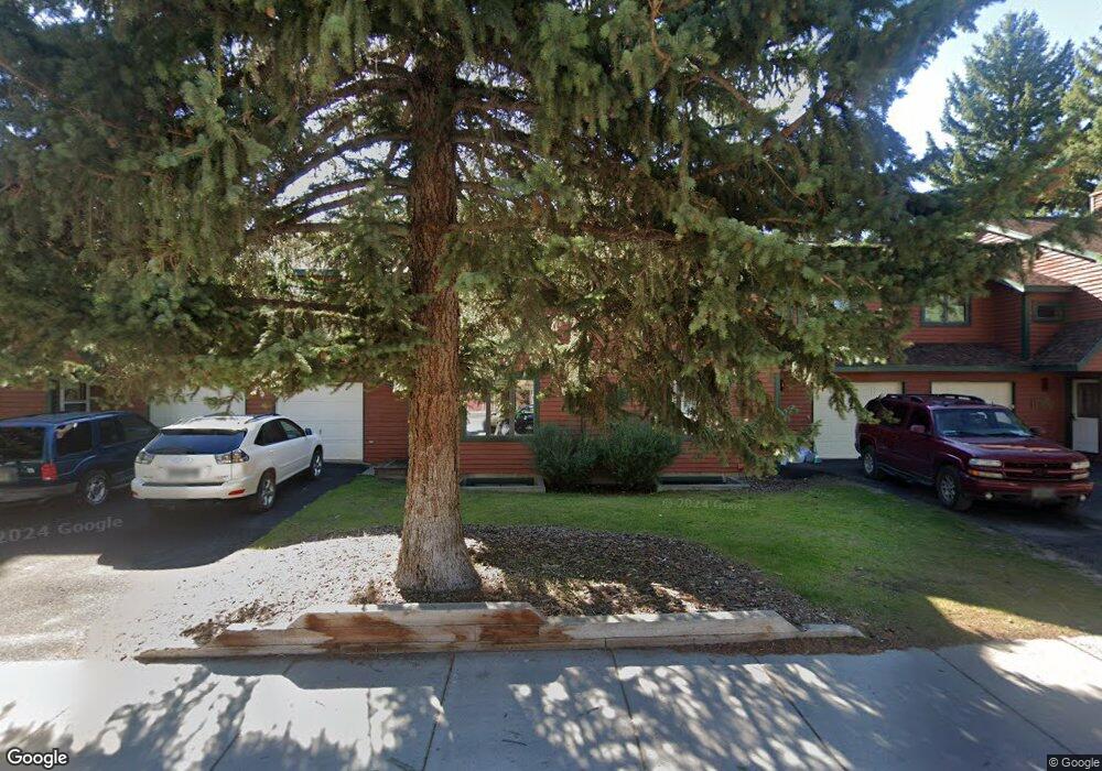
515 S Cache St Jackson, WY 83001
Estimated Value: $1,719,000 - $1,944,022
4
Beds
4
Baths
2,015
Sq Ft
$914/Sq Ft
Est. Value
About This Home
This home is located at 515 S Cache St, Jackson, WY 83001 and is currently estimated at $1,842,256, approximately $914 per square foot. 515 S Cache St is a home located in Teton County with nearby schools including Jackson Elementary School, Jackson Hole Middle School, and Jackson Hole High School.
Ownership History
Date
Name
Owned For
Owner Type
Purchase Details
Closed on
Jul 9, 2019
Sold by
James Nena R
Bought by
James Nena R and Nena R James Living Trust
Current Estimated Value
Purchase Details
Closed on
Dec 19, 2016
Sold by
Henton David Eugene and Henton Barbara Ann
Bought by
James Nena R
Purchase Details
Closed on
Sep 22, 2008
Sold by
Henton David E and Henton Barbara A
Bought by
The David Eugene Henton Trust and The Barbara Ann Henton Trust
Create a Home Valuation Report for This Property
The Home Valuation Report is an in-depth analysis detailing your home's value as well as a comparison with similar homes in the area
Purchase History
| Date | Buyer | Sale Price | Title Company |
|---|---|---|---|
| James Nena R | -- | None Available | |
| James Nena R | -- | First American Title Insuran | |
| The David Eugene Henton Trust | -- | None Available |
Source: Public Records
Tax History
| Year | Tax Paid | Tax Assessment Tax Assessment Total Assessment is a certain percentage of the fair market value that is determined by local assessors to be the total taxable value of land and additions on the property. | Land | Improvement |
|---|---|---|---|---|
| 2025 | $10,399 | $156,537 | $3,629 | $152,908 |
| 2024 | $10,399 | $185,371 | $4,180 | $181,191 |
| 2023 | $10,454 | $185,923 | $4,180 | $181,743 |
| 2022 | $5,648 | $100,899 | $4,180 | $96,719 |
| 2021 | $5,344 | $93,795 | $4,180 | $89,615 |
| 2020 | $4,817 | $86,055 | $4,180 | $81,875 |
| 2019 | $5,113 | $89,615 | $4,180 | $85,435 |
| 2018 | $4,148 | $73,092 | $4,180 | $68,912 |
| 2017 | $3,556 | $61,363 | $4,180 | $57,183 |
| 2016 | $3,210 | $58,389 | $4,180 | $54,209 |
| 2015 | $1,808 | $54,524 | $4,180 | $50,344 |
| 2014 | $1,808 | $34,257 | $4,180 | $30,077 |
| 2013 | $1,808 | $34,257 | $4,180 | $30,077 |
Source: Public Records
Map
Nearby Homes
- 20 W Karns Ave
- 100 W Snow King Ave
- 645 S Glenwood St
- 165 S Millward St
- 125 W Kelly Ave
- 110 & 120 W Hansen Ave
- 150 W Simpson Ave Unit 404
- 355 W Karns Ave
- 750 S Millward St
- 175 S Glenwood St Unit 305
- 210 Spruce Dr
- 315 Pine Dr
- 110 S Willow St
- 475 W Kelly Ave
- 515 Pine Dr
- 360 E Pearl Ave
- 531 Snow King Loop Unit 3130
- 165 N Glenwood St Unit 28
- 165 N Glenwood St Unit 22
- 165 N Glenwood St Unit 31
- 517 S Cache St
- 22 W Karns Ave Unit 22
- 24 W Karns Ave
- 525 S Cache St
- 555 S Cache St
- 50 W Karns Ave
- 25 W Karns Ave
- 565 S Cache St
- 55 W Karns Ave
- 480 S Cache St Unit 2-1
- 480 S Cache St
- 480 S Cache St Unit 2
- 480 S Cache St Unit 1
- 80 W Karns Ave
- 465 S Cache St
- 30 E Karns Ave
- 460 S Cache St
- 85 W Karns Ave
- 87 W Karns Ave
- 462 S Glenwood St
Your Personal Tour Guide
Ask me questions while you tour the home.