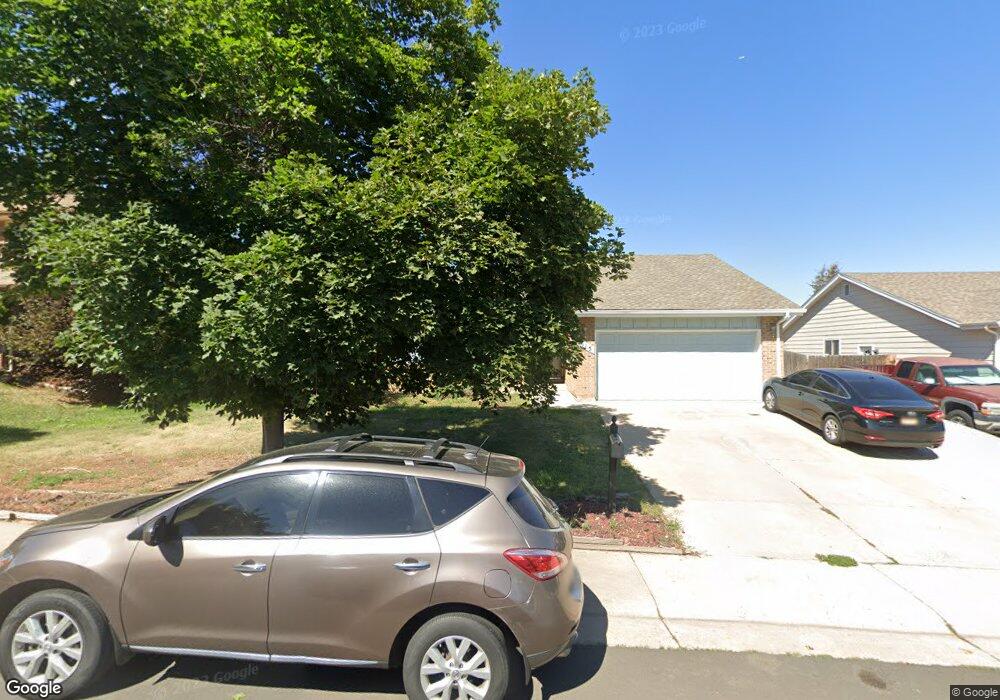
515 S Memphis Way Aurora, CO 80017
Centre Pointe NeighborhoodEstimated Value: $504,000 - $510,768
4
Beds
3
Baths
2,940
Sq Ft
$172/Sq Ft
Est. Value
About This Home
This home is located at 515 S Memphis Way, Aurora, CO 80017 and is currently estimated at $506,942, approximately $172 per square foot. 515 S Memphis Way is a home located in Arapahoe County with nearby schools including Tollgate Elementary School of Expeditionary Learning, Mrachek Middle School, and Gateway High School.
Ownership History
Date
Name
Owned For
Owner Type
Purchase Details
Closed on
Jun 22, 2016
Sold by
Smith Ronald and Smith Beverly
Bought by
Tetteh Edward and Affare Stella
Current Estimated Value
Home Financials for this Owner
Home Financials are based on the most recent Mortgage that was taken out on this home.
Original Mortgage
$304,000
Outstanding Balance
$241,950
Interest Rate
3.57%
Mortgage Type
New Conventional
Estimated Equity
$264,992
Purchase Details
Closed on
Mar 5, 2013
Sold by
Smith Ronald and Smith Beverly R
Bought by
Smith Ronald and Smith Beverly
Home Financials for this Owner
Home Financials are based on the most recent Mortgage that was taken out on this home.
Original Mortgage
$168,300
Interest Rate
3.57%
Mortgage Type
New Conventional
Purchase Details
Closed on
Apr 15, 1996
Sold by
Young David L and Hauser Michele R
Bought by
Young David L and Young Michele R
Purchase Details
Closed on
Dec 15, 1995
Sold by
Maloney George F and Maloney Amy L
Bought by
Smith Ronald and Smith Beverly R
Home Financials for this Owner
Home Financials are based on the most recent Mortgage that was taken out on this home.
Original Mortgage
$118,750
Interest Rate
7.33%
Purchase Details
Closed on
Mar 28, 1995
Sold by
Young David L and Hauser Michele R
Bought by
Maloney George F and Maloney Amy L
Home Financials for this Owner
Home Financials are based on the most recent Mortgage that was taken out on this home.
Original Mortgage
$84,000
Interest Rate
8.72%
Purchase Details
Closed on
Oct 25, 1991
Sold by
Conversion Arapco
Bought by
Young David L and Hauser Michele R
Purchase Details
Closed on
May 1, 1980
Sold by
Conversion Arapco
Bought by
Conversion Arapco
Purchase Details
Closed on
Jul 4, 1776
Bought by
Conversion Arapco
Create a Home Valuation Report for This Property
The Home Valuation Report is an in-depth analysis detailing your home's value as well as a comparison with similar homes in the area
Home Values in the Area
Average Home Value in this Area
Purchase History
| Date | Buyer | Sale Price | Title Company |
|---|---|---|---|
| Tetteh Edward | $320,000 | Homestead Title & Escrow | |
| Smith Ronald | -- | Land Title Guarantee Company | |
| Young David L | -- | -- | |
| Smith Ronald | $125,000 | -- | |
| Smith Ronald | $125,000 | Land Title | |
| Maloney George F | $105,000 | First American Heritage Titl | |
| Young David L | -- | -- | |
| Conversion Arapco | -- | -- | |
| Conversion Arapco | -- | -- |
Source: Public Records
Mortgage History
| Date | Status | Borrower | Loan Amount |
|---|---|---|---|
| Open | Tetteh Edward | $304,000 | |
| Previous Owner | Smith Ronald | $168,300 | |
| Previous Owner | Smith Ronald | $118,750 | |
| Previous Owner | Maloney George F | $84,000 |
Source: Public Records
Tax History Compared to Growth
Tax History
| Year | Tax Paid | Tax Assessment Tax Assessment Total Assessment is a certain percentage of the fair market value that is determined by local assessors to be the total taxable value of land and additions on the property. | Land | Improvement |
|---|---|---|---|---|
| 2024 | $3,107 | $33,433 | -- | -- |
| 2023 | $3,107 | $33,433 | $0 | $0 |
| 2022 | $2,724 | $27,126 | $0 | $0 |
| 2021 | $2,812 | $27,126 | $0 | $0 |
| 2020 | $2,768 | $26,584 | $0 | $0 |
| 2019 | $2,753 | $26,584 | $0 | $0 |
| 2018 | $2,438 | $23,054 | $0 | $0 |
| 2017 | $2,121 | $23,054 | $0 | $0 |
| 2016 | $1,656 | $17,623 | $0 | $0 |
| 2015 | $1,598 | $17,623 | $0 | $0 |
| 2014 | $1,270 | $13,484 | $0 | $0 |
| 2013 | -- | $14,240 | $0 | $0 |
Source: Public Records
Map
Nearby Homes
- 16135 E Exposition Dr
- 16136 E Exposition Dr
- 497 S Memphis Way Unit 17
- 611 S Laredo Cir
- 16094 E Exposition Dr
- 477 S Memphis Way Unit 11
- 467 S Memphis Way Unit 17
- 15875 E Custer Dr
- 16001 E Alaska Place Unit 7
- 16001 E Alaska Place Unit 1
- 491 S Kalispell Way Unit 207
- 491 S Kalispell Way Unit 305
- 444 S Kittredge St Unit 205
- 481 S Kalispell Way Unit 306
- 431 S Kalispell Way Unit 308
- 401 S Kalispell Way Unit 104
- 401 S Kalispell Way Unit 206
- 16405 E Kentucky Ave
- 1024 S Mobile St
- 17055 E Alameda Pkwy
- 535 S Memphis Way
- 505 S Memphis Way
- 560 S Laredo Cir
- 550 S Laredo Cir
- 555 S Memphis Way
- 516 S Memphis Way
- 570 S Laredo Cir
- 536 S Memphis Way
- 506 S Memphis Way
- 546 S Memphis Way
- 540 S Laredo Cir
- 575 S Memphis Way
- 556 S Memphis Way
- 580 S Laredo Cir
- 576 S Memphis Way
- 551 S Mobile Place
- 553 S Mobile Place
- 559 S Laredo Cir
- 579 S Laredo Cir
- 557 S Mobile Place