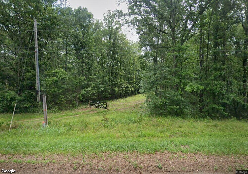
515 Sanders Rd Macon, GA 31210
Estimated Value: $114,674 - $321,000
Studio
2
Baths
1,152
Sq Ft
$204/Sq Ft
Est. Value
About This Home
This home is located at 515 Sanders Rd, Macon, GA 31210 and is currently estimated at $235,558, approximately $204 per square foot. 515 Sanders Rd is a home located in Monroe County with nearby schools including T.G. Scott Elementary School, Mary Persons High School, and St Andrews Montessori School.
Ownership History
Date
Name
Owned For
Owner Type
Purchase Details
Closed on
Mar 15, 2007
Sold by
Not Provided
Bought by
Padgett Edna A
Current Estimated Value
Purchase Details
Closed on
Dec 5, 2006
Purchase Details
Closed on
Dec 15, 2003
Purchase Details
Closed on
Aug 27, 1998
Purchase Details
Closed on
Jan 8, 1996
Purchase Details
Closed on
Apr 6, 1990
Create a Home Valuation Report for This Property
The Home Valuation Report is an in-depth analysis detailing your home's value as well as a comparison with similar homes in the area
Purchase History
| Date | Buyer | Sale Price | Title Company |
|---|---|---|---|
| Padgett Edna A | $80,000 | -- | |
| -- | -- | -- | |
| -- | $100,000 | -- | |
| -- | $72,000 | -- | |
| -- | -- | -- | |
| -- | $5,000 | -- |
Source: Public Records
Tax History
| Year | Tax Paid | Tax Assessment Tax Assessment Total Assessment is a certain percentage of the fair market value that is determined by local assessors to be the total taxable value of land and additions on the property. | Land | Improvement |
|---|---|---|---|---|
| 2025 | $2 | $32,068 | $13,800 | $18,268 |
| 2024 | $2 | $32,068 | $13,800 | $18,268 |
| 2023 | $2 | $29,028 | $13,800 | $15,228 |
| 2022 | $814 | $29,028 | $13,800 | $15,228 |
| 2021 | $814 | $29,028 | $13,800 | $15,228 |
| 2020 | $655 | $22,788 | $7,560 | $15,228 |
| 2019 | $149 | $22,788 | $7,560 | $15,228 |
| 2018 | $0 | $22,788 | $7,560 | $15,228 |
| 2017 | $662 | $22,788 | $7,560 | $15,228 |
| 2016 | $630 | $22,788 | $7,560 | $15,228 |
| 2015 | -- | $22,788 | $7,560 | $15,228 |
| 2014 | -- | $22,788 | $7,560 | $15,228 |
Source: Public Records
Map
Nearby Homes
- 158 Caroline Ct
- 140 Caroline Ct
- 202 Hilltop Cir
- 198 Jennings Ln
- 311 N Rivoli Farms Dr
- 0 Zebulon Rd Unit 26279583
- 66 Quail Trail
- 129 Burchwood Dr
- 37 Fawn Dr
- 749 Lamar Rd
- 405 Laurel Place
- 6368 Old Forsyth Rd
- 112 Irongate
- 124 Boulder Cove
- 119 Stoney Creek Dr
- 120 Hampton Way Unit LOT 6
- 116 Hampton Way Unit LOT 5
- 110 Aston Hall
- 109 Camden Trace
- 122 High Ridge Dr
- 533 Sanders Rd
- 541 Sanders Rd
- 557 Sanders Rd
- 603 Sanders Rd
- 597 Sanders Rd
- 8349 Whittle Rd
- 8345 Whittle Rd
- 625 Sanders Rd
- 8329 Whittle Rd
- 729 Sanders Rd
- 95 N Whittle Farms Rd
- 95 N Whittle Farms Rd Unit 6 A&B
- 661 Sanders Rd
- 8433 Whittle Rd
- 683 Sanders Rd
- 234 Sanders Rd
- 8 Spelman Rd
- 8301 Whittle Rd
- 262 Sanders Rd
- 72 N Whittle Farms Rd
Your Personal Tour Guide
Ask me questions while you tour the home.
