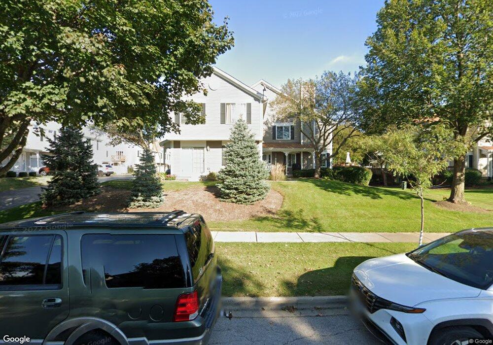
515 Sandhurst Ln Unit 30L South Elgin, IL 60177
Estimated Value: $260,000 - $265,000
2
Beds
2
Baths
1,220
Sq Ft
$214/Sq Ft
Est. Value
About This Home
This home is located at 515 Sandhurst Ln Unit 30L, South Elgin, IL 60177 and is currently estimated at $261,428, approximately $214 per square foot. 515 Sandhurst Ln Unit 30L is a home located in Kane County with nearby schools including Fox Meadow Elementary School, Kenyon Woods Middle School, and South Elgin High School.
Ownership History
Date
Name
Owned For
Owner Type
Purchase Details
Closed on
Mar 29, 2004
Sold by
Letsinger Michael L and Letsinger Danielle D
Bought by
Roty Patricia J
Current Estimated Value
Home Financials for this Owner
Home Financials are based on the most recent Mortgage that was taken out on this home.
Original Mortgage
$134,000
Outstanding Balance
$54,001
Interest Rate
3.62%
Mortgage Type
Purchase Money Mortgage
Estimated Equity
$207,427
Purchase Details
Closed on
Sep 15, 1999
Sold by
Galla Sean A
Bought by
Letsinger Michael L and Letsinger Danielle D
Home Financials for this Owner
Home Financials are based on the most recent Mortgage that was taken out on this home.
Original Mortgage
$117,176
Interest Rate
7.87%
Mortgage Type
FHA
Purchase Details
Closed on
Jul 8, 1994
Sold by
Windsor Development Corp
Bought by
Galla Sean A
Home Financials for this Owner
Home Financials are based on the most recent Mortgage that was taken out on this home.
Original Mortgage
$83,400
Interest Rate
8.6%
Create a Home Valuation Report for This Property
The Home Valuation Report is an in-depth analysis detailing your home's value as well as a comparison with similar homes in the area
Home Values in the Area
Average Home Value in this Area
Purchase History
| Date | Buyer | Sale Price | Title Company |
|---|---|---|---|
| Roty Patricia J | $167,500 | -- | |
| Letsinger Michael L | $121,000 | -- | |
| Galla Sean A | $111,500 | Chicago Title Insurance Co |
Source: Public Records
Mortgage History
| Date | Status | Borrower | Loan Amount |
|---|---|---|---|
| Open | Roty Patricia J | $134,000 | |
| Previous Owner | Letsinger Michael L | $117,176 | |
| Previous Owner | Galla Sean A | $83,400 |
Source: Public Records
Tax History Compared to Growth
Tax History
| Year | Tax Paid | Tax Assessment Tax Assessment Total Assessment is a certain percentage of the fair market value that is determined by local assessors to be the total taxable value of land and additions on the property. | Land | Improvement |
|---|---|---|---|---|
| 2024 | $4,764 | $68,374 | $17,175 | $51,199 |
| 2023 | $4,511 | $61,770 | $15,516 | $46,254 |
| 2022 | $4,331 | $56,324 | $14,148 | $42,176 |
| 2021 | $4,063 | $52,659 | $13,227 | $39,432 |
| 2020 | $3,771 | $48,478 | $12,627 | $35,851 |
| 2019 | $3,620 | $46,178 | $12,028 | $34,150 |
| 2018 | $3,535 | $43,502 | $11,331 | $32,171 |
| 2017 | $3,345 | $41,125 | $10,712 | $30,413 |
| 2016 | $3,165 | $38,153 | $9,938 | $28,215 |
| 2015 | -- | $34,971 | $9,109 | $25,862 |
| 2014 | -- | $32,431 | $8,997 | $23,434 |
| 2013 | -- | $33,286 | $9,234 | $24,052 |
Source: Public Records
Map
Nearby Homes
- 435 Sandhurst Ln Unit 3
- 1458 Woodland Dr
- 1370 Marleigh Ln
- 8N594 S Mclean Blvd
- 1063 Manchester Ct Unit 1
- 1419 S Pembroke Dr
- 590 Fenwick Ln
- 387 S Pointe Ave
- 671 Fieldcrest Dr
- 126 Kingsport Dr
- 291 Kingsport Dr
- 289 Kingsport Dr
- 287 Kingsport Dr
- 285 Kingsport Dr
- 283 Kingsport Dr
- 281 Kingsport Dr
- 280 Kingsport Dr
- 282 Kingsport Dr
- 286 Kingsport Dr
- 309 Kingsport Dr
- 513 Sandhurst Ln Unit 2
- 517 Sandhurst Ln Unit 4
- 442 Lowell Dr Unit 2
- 413 Sandhurst Ln Unit 2
- 426 Lowell Dr Unit 4
- 402 Lowell Dr Unit 2
- 404 Lowell Dr Unit 3
- 422 Lowell Dr Unit 2
- 526 Lowell Dr Unit 4
- 433 Sandhurst Ln Unit 2
- 523 Sandhurst Ln Unit 2
- 417 Sandhurst Ln Unit D
- 482 Lowell Dr Unit 2
- 522 Lowell Dr Unit 2
- 525 Sandhurst Ln Unit 3
- 527 Sandhurst Ln Unit 4
- 463 Sandhurst Ln Unit 2
- 512 Lowell Dr Unit 2
- 424 Lowell Dr Unit 3
- 514 Lowell Dr Unit 3