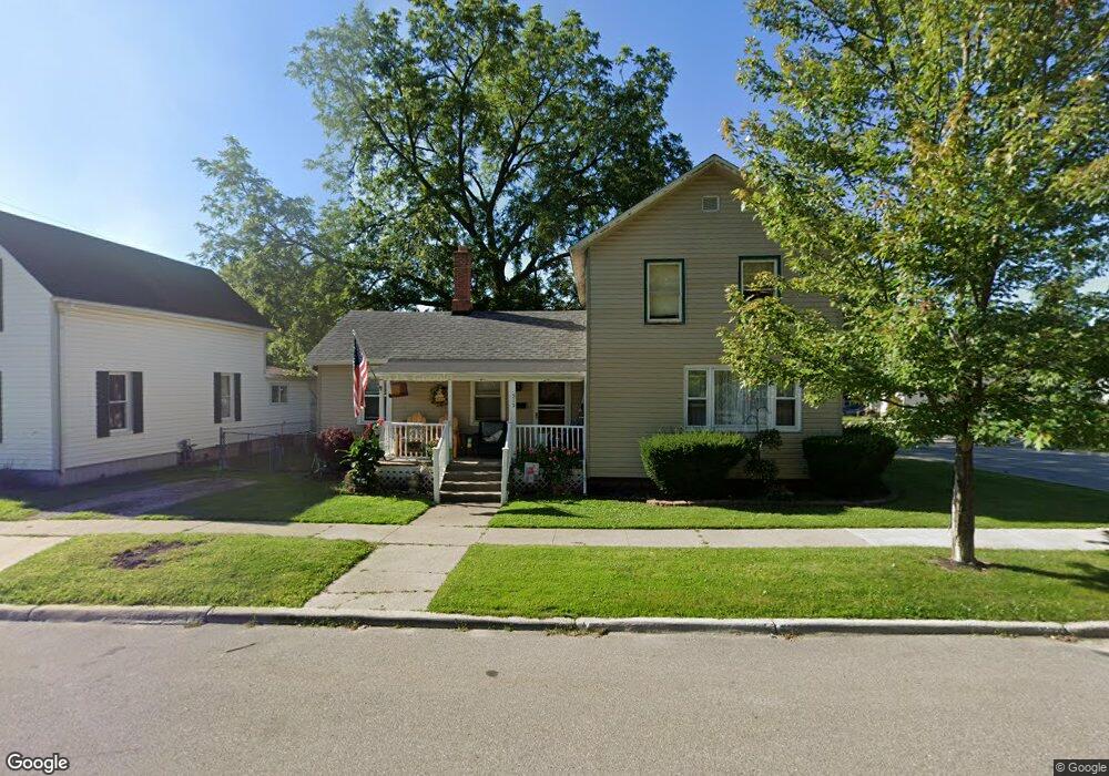
515 Trumbull St Saint Clair, MI 48079
Estimated Value: $167,718 - $265,000
2
Beds
2
Baths
1,444
Sq Ft
$147/Sq Ft
Est. Value
About This Home
This home is located at 515 Trumbull St, Saint Clair, MI 48079 and is currently estimated at $211,680, approximately $146 per square foot. 515 Trumbull St is a home located in St. Clair County with nearby schools including Pine River Elementary School, St. Clair Middle School, and St. Clair High School.
Ownership History
Date
Name
Owned For
Owner Type
Purchase Details
Closed on
Aug 25, 2009
Sold by
Vankehrberg Varn E and Vankehrberg Van Kehrberg
Bought by
Dziubinski Edward A and Dziubinski Barbara J
Current Estimated Value
Purchase Details
Closed on
Jun 30, 2006
Sold by
Dziubinski Edward A and Dziubinski Barbara J
Bought by
Vankehrberg Vern E and Vankehrberg Van Kehrberg
Home Financials for this Owner
Home Financials are based on the most recent Mortgage that was taken out on this home.
Original Mortgage
$95,000
Interest Rate
7%
Mortgage Type
Seller Take Back
Create a Home Valuation Report for This Property
The Home Valuation Report is an in-depth analysis detailing your home's value as well as a comparison with similar homes in the area
Home Values in the Area
Average Home Value in this Area
Purchase History
| Date | Buyer | Sale Price | Title Company |
|---|---|---|---|
| Dziubinski Edward A | -- | None Available | |
| Vankehrberg Vern E | $100,000 | Multiple |
Source: Public Records
Mortgage History
| Date | Status | Borrower | Loan Amount |
|---|---|---|---|
| Previous Owner | Vankehrberg Vern E | $95,000 |
Source: Public Records
Tax History
| Year | Tax Paid | Tax Assessment Tax Assessment Total Assessment is a certain percentage of the fair market value that is determined by local assessors to be the total taxable value of land and additions on the property. | Land | Improvement |
|---|---|---|---|---|
| 2025 | $2,384 | $80,600 | $0 | $0 |
| 2024 | $2,317 | $77,000 | $0 | $0 |
| 2023 | $2,185 | $66,600 | $0 | $0 |
| 2022 | $2,294 | $58,200 | $0 | $0 |
| 2020 | $2,175 | $47,900 | $47,900 | $0 |
| 2019 | $2,079 | $45,000 | $0 | $0 |
| 2018 | $2,073 | $38,600 | $0 | $0 |
| 2017 | $2,031 | $36,200 | $0 | $0 |
| 2016 | $1,920 | $36,200 | $0 | $0 |
| 2015 | -- | $35,000 | $35,000 | $0 |
| 2014 | -- | $34,100 | $34,100 | $0 |
| 2013 | -- | $34,800 | $0 | $0 |
Source: Public Records
Map
Nearby Homes
- 402 S 5th St
- 206 S 4th St
- 715 Thornapple St
- 920 Clinton Ave
- TBD Range
- 412 Orchard St
- 409 N 5th St
- 606 N 6th St
- 1207 Clinton Ave
- 1007 Henry St
- 592 Snowbird Cir E
- 2 S Carney Dr Unit Lot TBD
- 3 S Carney Dr
- 1423 S Riverside Ave
- 211 N Carney Dr
- 231 S Carney Dr
- 1 S Carney Dr
- 2 Riley
- 3 Riley Rd
- 1826 Riley Rd
- 509 Trumbull St
- 507 Trumbull St
- 512 Cass St
- 308 S 5th St
- 503 Trumbull St Unit Bldg-Unit
- 503 Trumbull St
- 514 Trumbull St
- 302 S 6th St Unit Bldg-Unit
- 302 S 6th St
- 302 S 6th St Unit 302
- S S Sixth St
- 302 S Sixth St
- 502 Cass St
- 508 Trumbull St
- 213 S 6th St
- 210 S 5th St Unit 212
- 316 S 6th St
- 602 Trumbull St
- 206 S 5th St
- 309 S 7th St
Your Personal Tour Guide
Ask me questions while you tour the home.