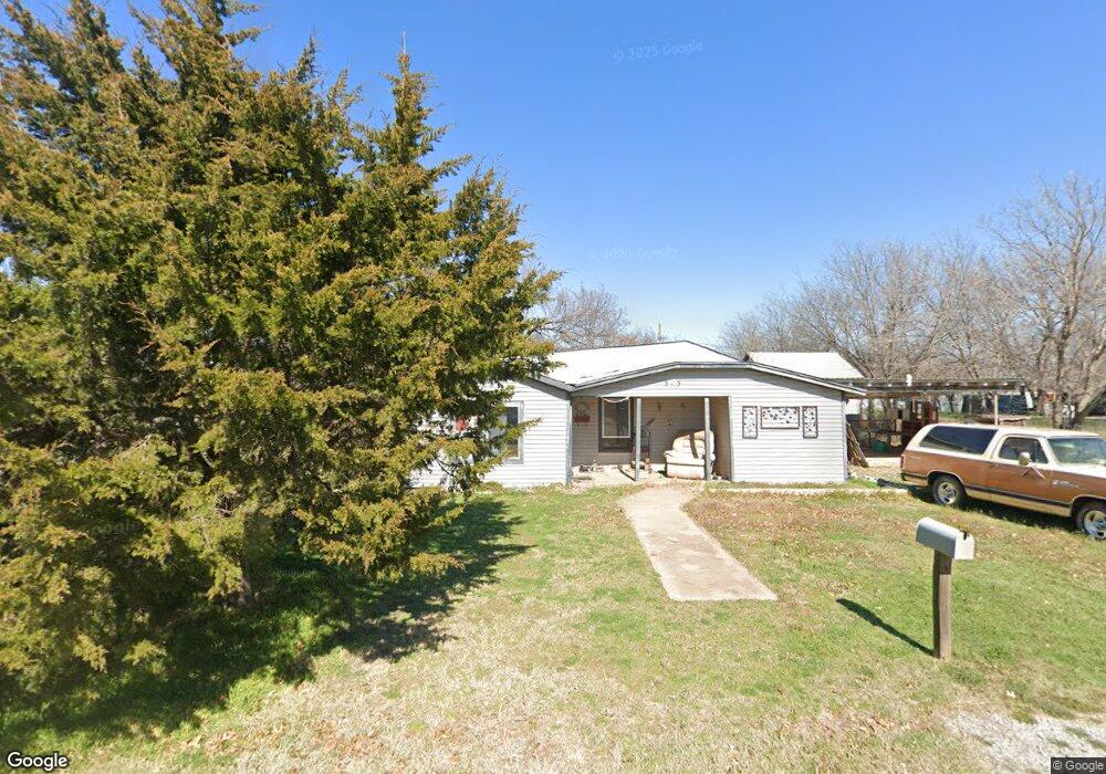
515 W Nebraska St Walters, OK 73572
Estimated Value: $55,000 - $105,000
3
Beds
1
Bath
1,156
Sq Ft
$62/Sq Ft
Est. Value
About This Home
This home is located at 515 W Nebraska St, Walters, OK 73572 and is currently estimated at $71,748, approximately $62 per square foot. 515 W Nebraska St is a home located in Cotton County with nearby schools including Walters Elementary School, Walters Middle School, and Walters High School.
Ownership History
Date
Name
Owned For
Owner Type
Purchase Details
Closed on
Jun 23, 2025
Sold by
Rahmani Rahmatollah
Bought by
Hardy Ryan
Current Estimated Value
Purchase Details
Closed on
Nov 20, 2024
Sold by
Teakell Sadie
Bought by
Rahmani Tahmatollah
Purchase Details
Closed on
Aug 31, 2015
Sold by
Davis Margaret Ann and Davis Steven S
Bought by
Teakell Sadie
Purchase Details
Closed on
Oct 1, 2000
Sold by
Charles J Wal
Bought by
Margaret Walters
Purchase Details
Closed on
Oct 10, 1989
Sold by
Jesse Wampler
Bought by
Charles Walters
Create a Home Valuation Report for This Property
The Home Valuation Report is an in-depth analysis detailing your home's value as well as a comparison with similar homes in the area
Home Values in the Area
Average Home Value in this Area
Purchase History
| Date | Buyer | Sale Price | Title Company |
|---|---|---|---|
| Hardy Ryan | -- | First American Title | |
| Hardy Ryan | -- | First American Title | |
| Rahmani Tahmatollah | -- | First American Title | |
| Rahmani Tahmatollah | -- | First American Title | |
| Teakell Sadie | $13,000 | First American Title Ins Co | |
| Margaret Walters | -- | -- | |
| Charles Walters | $3,500 | -- |
Source: Public Records
Tax History Compared to Growth
Tax History
| Year | Tax Paid | Tax Assessment Tax Assessment Total Assessment is a certain percentage of the fair market value that is determined by local assessors to be the total taxable value of land and additions on the property. | Land | Improvement |
|---|---|---|---|---|
| 2025 | $235 | $4,081 | $242 | $3,839 |
| 2024 | $235 | $2,701 | $242 | $2,459 |
| 2023 | $224 | $2,572 | $242 | $2,330 |
| 2022 | $212 | $2,450 | $242 | $2,208 |
| 2021 | $108 | $2,450 | $242 | $2,208 |
| 2020 | $108 | $2,450 | $242 | $2,208 |
| 2019 | $127 | $2,532 | $242 | $2,290 |
| 2018 | $131 | $2,580 | $242 | $2,338 |
| 2017 | $138 | $2,661 | $242 | $2,419 |
| 2016 | $226 | $2,710 | $242 | $2,468 |
| 2015 | $324 | $3,861 | $242 | $3,619 |
| 2014 | $316 | $3,736 | $242 | $3,494 |
Source: Public Records
Map
Nearby Homes
- 411 W Nebraska Ave
- 230 W Colorado St
- 103 Thurman Dr
- 221 W Kansas St
- 309 W Ohio St
- 401 Virginia Ave
- 121 E Texas St
- 206 E Nebraska Ave
- 227 E California St
- 321 N 3rd St
- 602 Tramel Cir
- 303 E Oklahoma St
- 227 E Ohio St
- 505 E Kansas Ave
- 500 E Iowa St
- 308 Willow Creek Dr
- 619 E South Boundary St
- 000 N 2620 Rd
- 130 Stardust Cir
- 180000 N 2600 Rd
- 507 W Nebraska St
- 517 W Nebraska St
- 505 W Nebraska St
- 510 W California St
- 211 S 9th St
- 501 W Nebraska St
- 514 W Nebraska St
- 512 W Nebraska St
- 601 W Nebraska St
- 602 W Nebraska St
- 505 W California St
- 411 W Nebraska St
- 517 W Nevada St
- 515 W Nevada St
- 521 W Nevada St
- 119 S 9th St
- 209 S 8th St
- 124 S 9th St
- 501 W Nevada St
- 428 W Nebraska St