Estimated Value: $216,735 - $268,000
3
Beds
2
Baths
1,410
Sq Ft
$174/Sq Ft
Est. Value
About This Home
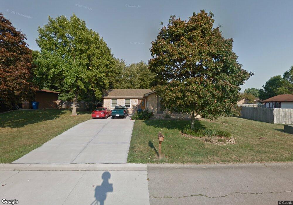
This home is located at 515 Whip Poor Will St, Troy, IL 62294 and is currently estimated at $244,934, approximately $173 per square foot. 515 Whip Poor Will St is a home located in Madison County with nearby schools including Silver Creek Elementary School, Triad Middle School, and Triad High School.
Ownership History
Date
Name
Owned For
Owner Type
Purchase Details
Closed on
Apr 16, 2007
Sold by
Boland Sherri L
Bought by
Cason Michael E and Cason Denise R
Current Estimated Value
Home Financials for this Owner
Home Financials are based on the most recent Mortgage that was taken out on this home.
Original Mortgage
$29,000
Interest Rate
5.9%
Mortgage Type
Balloon
Purchase Details
Closed on
Apr 14, 2004
Sold by
Boland Lloyd J and Boland Sherri I
Bought by
Boland Sherri L
Home Financials for this Owner
Home Financials are based on the most recent Mortgage that was taken out on this home.
Original Mortgage
$100,000
Interest Rate
4.37%
Mortgage Type
Purchase Money Mortgage
Create a Home Valuation Report for This Property
The Home Valuation Report is an in-depth analysis detailing your home's value as well as a comparison with similar homes in the area
Home Values in the Area
Average Home Value in this Area
Purchase History
| Date | Buyer | Sale Price | Title Company |
|---|---|---|---|
| Cason Michael E | $145,000 | Abstracts & Titles Inc | |
| Boland Sherri L | -- | Freedom Title |
Source: Public Records
Mortgage History
| Date | Status | Borrower | Loan Amount |
|---|---|---|---|
| Closed | Cason Michael E | $29,000 | |
| Open | Cason Michael E | $116,000 | |
| Previous Owner | Boland Sherri L | $100,000 |
Source: Public Records
Tax History
| Year | Tax Paid | Tax Assessment Tax Assessment Total Assessment is a certain percentage of the fair market value that is determined by local assessors to be the total taxable value of land and additions on the property. | Land | Improvement |
|---|---|---|---|---|
| 2024 | $4,222 | $68,430 | $10,770 | $57,660 |
| 2023 | $4,222 | $62,130 | $9,780 | $52,350 |
| 2022 | $3,886 | $57,210 | $9,010 | $48,200 |
| 2021 | $3,563 | $54,370 | $8,560 | $45,810 |
| 2020 | $3,556 | $52,970 | $8,340 | $44,630 |
| 2019 | $3,489 | $51,880 | $8,170 | $43,710 |
| 2018 | $3,386 | $48,070 | $7,570 | $40,500 |
| 2017 | $3,421 | $47,070 | $7,410 | $39,660 |
| 2016 | $3,225 | $47,070 | $7,410 | $39,660 |
| 2015 | $2,883 | $45,510 | $7,170 | $38,340 |
| 2014 | $2,883 | $45,510 | $7,170 | $38,340 |
| 2013 | $2,883 | $45,510 | $7,170 | $38,340 |
Source: Public Records
Map
Nearby Homes
- 2281 Staunton Rd
- 2261 Staunton Rd
- 2265 Staunton Rd
- 2289 Staunton Rd
- 2273 Staunton Rd
- 2285 Staunton Rd
- 2277 Staunton Rd
- 618 Meadowlark St
- 313 Old Homestead Dr
- 402 N Powell St
- 2335 Staunton Rd
- 332 N Kimberlin St
- 511 Zenk Rd
- 516 Nottingham Dr
- 502 Lindenwood Dr
- 500 Lindenwood Dr
- 306 Hazel St
- 124 Taylor Lake Dr
- 406 Lindenwood Dr
- 208 E Throp St
- 517 Whip Poor Will St
- 209 Red Bird St
- 516 Meadowlark St
- 518 Meadowlark St
- 207 Red Bird St
- 519 Whip Poor Will St
- 301 Red Bird St
- 520 Meadowlark St
- 520 Whip Poor Will St
- 210 Red Bird St
- 208 Red Bird St
- 522 Meadowlark St
- 515 Mockingbird St
- 517 Meadowlark St
- 515 Meadowlark St
- 513 Mockingbird St
- 517 Mockingbird St
- 206 Red Bird St
- 522 Whip Poor Will St
- 203 Red Bird St
Your Personal Tour Guide
Ask me questions while you tour the home.