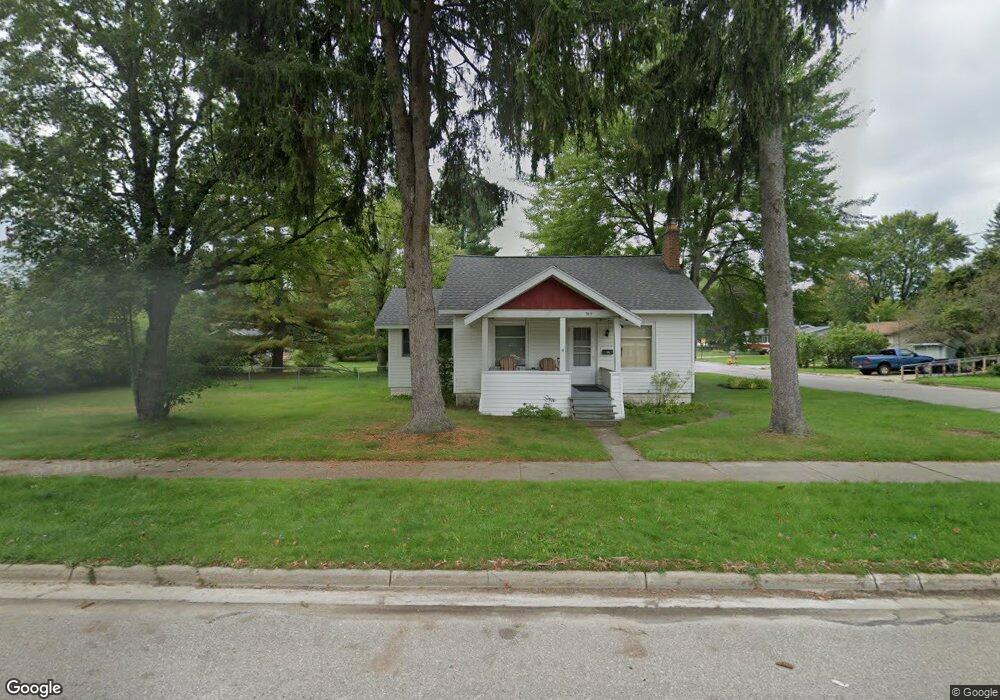
515 Woodward Ave Big Rapids, MI 49307
Estimated Value: $142,000 - $220,000
2
Beds
1
Bath
1,071
Sq Ft
$175/Sq Ft
Est. Value
About This Home
This home is located at 515 Woodward Ave, Big Rapids, MI 49307 and is currently estimated at $186,905, approximately $174 per square foot. 515 Woodward Ave is a home located in Mecosta County with nearby schools including Big Rapids High School, Crossroads Charter Academy Elementary School, and Crossroads Charter Academy Middle/High School.
Ownership History
Date
Name
Owned For
Owner Type
Purchase Details
Closed on
May 16, 2025
Sold by
Assaley Kenneth Philip
Bought by
Llm Holdings Llc
Current Estimated Value
Create a Home Valuation Report for This Property
The Home Valuation Report is an in-depth analysis detailing your home's value as well as a comparison with similar homes in the area
Home Values in the Area
Average Home Value in this Area
Purchase History
| Date | Buyer | Sale Price | Title Company |
|---|---|---|---|
| Llm Holdings Llc | $50,000 | None Listed On Document |
Source: Public Records
Tax History Compared to Growth
Tax History
| Year | Tax Paid | Tax Assessment Tax Assessment Total Assessment is a certain percentage of the fair market value that is determined by local assessors to be the total taxable value of land and additions on the property. | Land | Improvement |
|---|---|---|---|---|
| 2025 | $1,937 | $80,400 | $0 | $0 |
| 2024 | -- | $73,500 | $0 | $0 |
| 2023 | -- | $64,500 | $0 | $0 |
| 2022 | $1,905 | $56,100 | $0 | $0 |
| 2021 | $1,905 | $51,400 | $0 | $0 |
| 2020 | -- | -- | $0 | $0 |
| 2019 | -- | -- | $0 | $0 |
| 2018 | -- | -- | $0 | $0 |
| 2017 | -- | -- | $0 | $0 |
| 2016 | -- | -- | $0 | $0 |
| 2014 | -- | -- | $0 | $0 |
| 2013 | -- | -- | $0 | $0 |
Source: Public Records
Map
Nearby Homes
- 408 Woodward Ave
- 417 Sanborn Ave
- 628 Hutchinson St
- 106 Rust Ave
- 407 S Michigan Ave
- V/L Northland Dr
- 117 S Warren Ave
- 409 Marion Ave
- 420 Linden St
- 414 Maple St
- 326 Ives Ave
- 417 Maple St
- 513 Rose Ave
- 508 Finley Ave
- 114 N Warren Ave
- 615 Linden St
- 619 Rose Ave
- 612 Marion Ave
- 610 Birch St
- Elements 2200 Plan at Hills of Mitchell Creek - Elements
- 421 Escott St
- 415 Escott St
- 425 Escott St
- 426 Hutchinson St
- 420 Hutchinson St
- 503 Woodward Ave
- 404 Escott St
- 418 Escott St
- 414 Escott St
- 408 Escott St
- TBD Woodward Ave
- V/L 00 Woodward Ave
- 00 Woodward Ave
- 0 Woodward Ave
- 415 Hutchinson St
- 504 Woodward Ave
- 421 Hutchinson St
- 503 Sanborn Ave
- 514 Escott St
- 516 Escott St