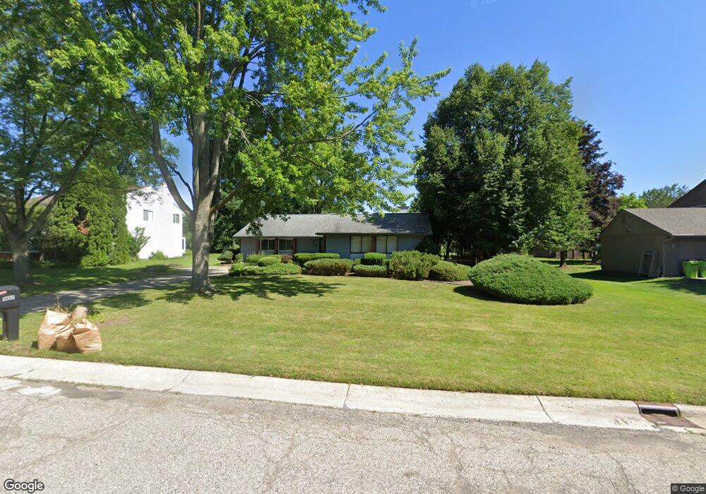
5150 Patrick Rd West Bloomfield, MI 48322
West Bloomfield Township NeighborhoodEstimated Value: $376,192 - $417,000
3
Beds
3
Baths
1,888
Sq Ft
$213/Sq Ft
Est. Value
About This Home
This home is located at 5150 Patrick Rd, West Bloomfield, MI 48322 and is currently estimated at $401,798, approximately $212 per square foot. 5150 Patrick Rd is a home located in Oakland County with nearby schools including Sheiko Elementary School, Brookfield Academy - West Bloomfield, and The Susan And Rabbi Harold Loss Ecc.
Ownership History
Date
Name
Owned For
Owner Type
Purchase Details
Closed on
Apr 8, 2003
Sold by
Schnipper Irving and Schnipper Barbara
Bought by
Schnipper A Irving and Schnipper Barbara
Current Estimated Value
Purchase Details
Closed on
Mar 17, 1997
Sold by
Schnipper Rabbi A
Bought by
Barbara Schnipper Tr
Purchase Details
Closed on
Feb 29, 1996
Sold by
Swaim Trust
Bought by
Schnipper Rabbi A
Home Financials for this Owner
Home Financials are based on the most recent Mortgage that was taken out on this home.
Original Mortgage
$127,500
Interest Rate
7.06%
Create a Home Valuation Report for This Property
The Home Valuation Report is an in-depth analysis detailing your home's value as well as a comparison with similar homes in the area
Home Values in the Area
Average Home Value in this Area
Purchase History
| Date | Buyer | Sale Price | Title Company |
|---|---|---|---|
| Schnipper A Irving | -- | -- | |
| Schnipper Irving | -- | -- | |
| Barbara Schnipper Tr | -- | -- | |
| Schnipper Rabbi A | $177,500 | -- |
Source: Public Records
Mortgage History
| Date | Status | Borrower | Loan Amount |
|---|---|---|---|
| Previous Owner | Schnipper Rabbi A | $127,500 |
Source: Public Records
Tax History
| Year | Tax Paid | Tax Assessment Tax Assessment Total Assessment is a certain percentage of the fair market value that is determined by local assessors to be the total taxable value of land and additions on the property. | Land | Improvement |
|---|---|---|---|---|
| 2025 | $3,862 | $176,980 | $60,750 | $116,230 |
| 2024 | $2,406 | $164,120 | $0 | $0 |
| 2022 | $2,304 | $144,610 | $45,000 | $99,610 |
| 2021 | $3,501 | $133,830 | $0 | $0 |
| 2020 | $2,258 | $131,310 | $40,550 | $90,760 |
| 2018 | $3,376 | $115,190 | $28,700 | $86,490 |
| 2015 | -- | $96,720 | $0 | $0 |
| 2014 | -- | $87,960 | $0 | $0 |
| 2011 | -- | $77,630 | $0 | $0 |
Source: Public Records
Map
Nearby Homes
- 5634 Stratford Dr
- 5585 Culpepper Dr
- 5549 Perrytown Dr
- 4819 Thorntree Dr
- 4817 Faircourt Dr
- 5731 Farmington Rd
- 4623 Patrick Rd
- 6323 Potomac Cir Unit 22
- 5256 Wright Way E Unit 64
- 5353 Wright Way W
- 5865 Dunmore Ct
- 6076 Dunmore Dr
- 5226 Brett Ct
- 5292 Pond Bluff Dr
- 5590 Bayswater Rd
- 5956 Pinecroft Dr
- 6121 Westbrooke Dr Unit 7
- 6129 Westbrooke Dr Unit 10
- 6323 Drakeshire Ln
- 4205 Pinehurst Dr
- 5132 Patrick Rd
- 5166 Patrick Rd
- 5099 Bantry Dr
- 5114 Patrick Rd
- 5151 Patrick Rd
- 5135 Bantry Dr
- 5133 Patrick Rd
- 5083 Bantry Dr Unit Bldg-Unit
- 5083 Bantry Dr
- 5167 Patrick Rd
- 5182 Patrick Rd
- 5115 Patrick Rd
- 5155 Bantry Dr
- 5183 Patrick Rd
- 5120 Chestershire Ct
- 5132 Chestershire Ct
- 5110 Bantry Dr
- 5200 Patrick Rd
- 5144 Chestershire Ct
Your Personal Tour Guide
Ask me questions while you tour the home.