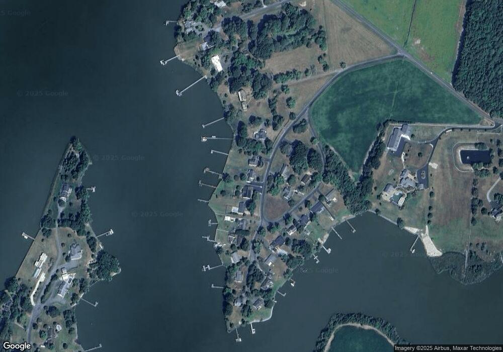
5150 Paw Paw Rd Cambridge, MD 21613
Estimated Value: $506,000 - $841,000
4
Beds
2
Baths
2,014
Sq Ft
$311/Sq Ft
Est. Value
About This Home
This home is located at 5150 Paw Paw Rd, Cambridge, MD 21613 and is currently estimated at $626,134, approximately $310 per square foot. 5150 Paw Paw Rd is a home located in Dorchester County with nearby schools including Maple Elementary School, Mace's Lane Middle School, and Cambridge-South Dorchester High School.
Ownership History
Date
Name
Owned For
Owner Type
Purchase Details
Closed on
Aug 1, 2014
Sold by
Jones Donald K and Jones Sybil A
Bought by
Gost Peter and Gost Elizabeth Humphrey
Current Estimated Value
Home Financials for this Owner
Home Financials are based on the most recent Mortgage that was taken out on this home.
Original Mortgage
$336,000
Outstanding Balance
$256,008
Interest Rate
4.09%
Mortgage Type
New Conventional
Estimated Equity
$370,127
Purchase Details
Closed on
Jun 30, 2006
Sold by
Jones Donald K and Jones Sybil A L
Bought by
Jones Donald K and Jones Sybil A
Purchase Details
Closed on
Jun 22, 2006
Sold by
Jones Donald K and Jones Sybil A L
Bought by
Jones Donald K and Jones Sybil A
Purchase Details
Closed on
Jan 11, 2005
Sold by
Jones Donald K and Jones Carolyn
Bought by
Jones Donald K and Jones Sybil A
Create a Home Valuation Report for This Property
The Home Valuation Report is an in-depth analysis detailing your home's value as well as a comparison with similar homes in the area
Home Values in the Area
Average Home Value in this Area
Purchase History
| Date | Buyer | Sale Price | Title Company |
|---|---|---|---|
| Gost Peter | $420,000 | Cambridge Title Company Llc | |
| Jones Donald K | -- | -- | |
| Jones Donald K | -- | -- | |
| Jones Donald K | -- | -- |
Source: Public Records
Mortgage History
| Date | Status | Borrower | Loan Amount |
|---|---|---|---|
| Open | Gost Peter | $336,000 |
Source: Public Records
Tax History Compared to Growth
Tax History
| Year | Tax Paid | Tax Assessment Tax Assessment Total Assessment is a certain percentage of the fair market value that is determined by local assessors to be the total taxable value of land and additions on the property. | Land | Improvement |
|---|---|---|---|---|
| 2025 | $4,876 | $421,700 | $244,700 | $177,000 |
| 2024 | $4,376 | $404,933 | $0 | $0 |
| 2023 | $4,376 | $388,167 | $0 | $0 |
| 2022 | $8,380 | $371,400 | $244,700 | $126,700 |
| 2021 | $4,190 | $371,400 | $244,700 | $126,700 |
| 2020 | $4,190 | $371,400 | $244,700 | $126,700 |
| 2019 | $4,218 | $373,900 | $244,700 | $129,200 |
| 2018 | $4,156 | $368,300 | $0 | $0 |
| 2017 | $3,999 | $362,700 | $0 | $0 |
| 2016 | -- | $357,100 | $0 | $0 |
| 2015 | -- | $357,100 | $0 | $0 |
| 2014 | -- | $357,100 | $0 | $0 |
Source: Public Records
Map
Nearby Homes
- 5210 Wilson Rd
- 0 Silver Goose Rd Unit Lot WP001
- 2040 Dailsville Rd
- 4910 Gregory Rd
- 1622 Town Point Rd
- 2191 Winterberry Ln
- 2189 Winterberry Ln
- 2212 Winterberry Ln
- 0 N S Dailsville Rd
- 1701 Perseus Rd
- 5219 Heron Rd
- 5223 Heron Rd
- 2365 Church Creek Rd
- 5214 Heron Rd
- 5216 Heron Rd
- 5229 Heron Rd
- 5226 Heron Rd
- 1529 Deep Water Rd
- 1609 Heliport Rd
- 2420 Cambridge Beltway
- 5150 Paw Paw Rd
- 5148 Paw Paw Rd
- 5152 Paw Paw Rd
- 5148 Paw Rd
- 5146 Paw Paw Rd
- 5146 Paw Paw Rd
- 5151 Paw Rd
- 5151 Paw Paw Rd
- 5154 Paw Paw Rd
- 5154 Paw Paw Rd
- 5149 Paw Paw Rd
- 5149 Paw Rd
- 5144 Paw Paw Rd
- 5144 Paw Paw Rd
- 5153 Paw Rd
- 5153 Paw Paw Rd
- 5121 Paw Paw Rd
- 5142 Paw Paw Rd
- 5126 Paw Paw Rd
- 5160 Paw Paw Rd
