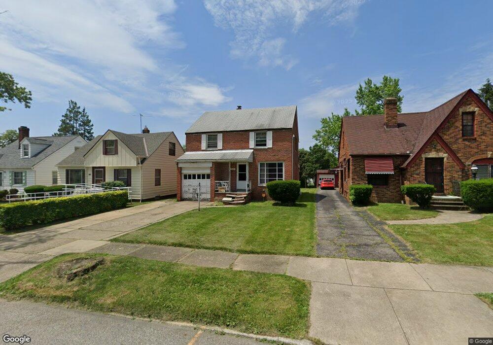
5150 Philip Ave Maple Heights, OH 44137
Estimated Value: $111,073 - $127,000
3
Beds
1
Bath
1,254
Sq Ft
$96/Sq Ft
Est. Value
About This Home
This home is located at 5150 Philip Ave, Maple Heights, OH 44137 and is currently estimated at $120,768, approximately $96 per square foot. 5150 Philip Ave is a home located in Cuyahoga County with nearby schools including Abraham Lincoln Elementary School, Rockside/ J.F. Kennedy School, and Barack Obama School.
Ownership History
Date
Name
Owned For
Owner Type
Purchase Details
Closed on
Mar 6, 1997
Sold by
Cook Clevelle
Bought by
Gardner Roger K and Amoss Rachelle
Current Estimated Value
Purchase Details
Closed on
Nov 29, 1989
Sold by
Egle Ronald L and Egle Gail M
Bought by
Cook Clevelle
Purchase Details
Closed on
Apr 3, 1986
Sold by
Coulter John Calvin
Bought by
Egle Ronald L and Egle Gail M
Purchase Details
Closed on
Oct 20, 1982
Sold by
Darlene A Ross
Bought by
Coulter John Calvin
Purchase Details
Closed on
Sep 7, 1982
Sold by
Ross John F
Bought by
Darlene A Ross
Purchase Details
Closed on
Aug 25, 1976
Sold by
Baus Donald C and Baus A
Bought by
Ross John F
Purchase Details
Closed on
Jan 1, 1975
Bought by
Baus Donald C and Baus A
Create a Home Valuation Report for This Property
The Home Valuation Report is an in-depth analysis detailing your home's value as well as a comparison with similar homes in the area
Home Values in the Area
Average Home Value in this Area
Purchase History
| Date | Buyer | Sale Price | Title Company |
|---|---|---|---|
| Gardner Roger K | $74,500 | -- | |
| Cook Clevelle | $58,900 | -- | |
| Egle Ronald L | $51,500 | -- | |
| Coulter John Calvin | -- | -- | |
| Darlene A Ross | -- | -- | |
| Ross John F | $24,700 | -- | |
| Baus Donald C | -- | -- |
Source: Public Records
Mortgage History
| Date | Status | Borrower | Loan Amount |
|---|---|---|---|
| Closed | Gardner Roger K | -- |
Source: Public Records
Tax History Compared to Growth
Tax History
| Year | Tax Paid | Tax Assessment Tax Assessment Total Assessment is a certain percentage of the fair market value that is determined by local assessors to be the total taxable value of land and additions on the property. | Land | Improvement |
|---|---|---|---|---|
| 2024 | $3,230 | $35,840 | $7,140 | $28,700 |
| 2023 | $2,228 | $20,620 | $4,340 | $16,280 |
| 2022 | $2,927 | $20,620 | $4,340 | $16,280 |
| 2021 | $3,234 | $20,620 | $4,340 | $16,280 |
| 2020 | $2,023 | $15,610 | $3,290 | $12,320 |
| 2019 | $2,012 | $44,600 | $9,400 | $35,200 |
| 2018 | $2,169 | $15,610 | $3,290 | $12,320 |
| 2017 | $1,876 | $14,110 | $3,010 | $11,100 |
| 2016 | $1,815 | $14,110 | $3,010 | $11,100 |
| 2015 | $1,851 | $14,110 | $3,010 | $11,100 |
| 2014 | $1,851 | $15,510 | $3,330 | $12,180 |
Source: Public Records
Map
Nearby Homes
- 5185 Clement Ave
- 5231 Philip Ave
- 5110 Philip Ave
- 5208 Clement Ave
- 5082 Philip Ave
- 5257 Philip Ave
- 5212 Catherine St
- 5061 Philip Ave
- 5199 Arch St
- 5239 Arch St
- 5320 Clement Ave
- 5031 Cato St
- 5210 Theodore St
- 5234 Erwin St
- 17916 North Blvd
- 17912 North Blvd
- 17204 Maple Heights Blvd
- 5425 Grasmere Ave
- 16712 Kollin Ave
- 5247 Henry St
- 5154 Philip Ave
- 5146 Philip Ave
- 5158 Philip Ave
- 5142 Philip Ave
- 5138 Philip Ave
- 5162 Philip Ave
- 5141 Catherine St
- 5137 Catherine St
- 5133 Catherine St
- 5145 Catherine St
- 5166 Philip Ave
- 5136 Philip Ave
- 5129 Catherine St
- 5149 Catherine St
- 5151 Philip Ave
- 5147 Philip Ave
- 5157 Philip Ave
- 5170 Philip Ave
- 5130 Philip Ave
- 5143 Philip Ave