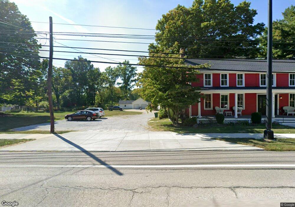
5152 Darrow Rd Hudson, OH 44236
Estimated Value: $330,000 - $998,000
9
Beds
5
Baths
4,727
Sq Ft
$156/Sq Ft
Est. Value
About This Home
This home is located at 5152 Darrow Rd, Hudson, OH 44236 and is currently estimated at $737,387, approximately $155 per square foot. 5152 Darrow Rd is a home located in Summit County with nearby schools including Ellsworth Hill Elementary School, East Woods Intermediate School, and Hudson Middle School.
Ownership History
Date
Name
Owned For
Owner Type
Purchase Details
Closed on
Jun 19, 1997
Sold by
James L Nichols Trst
Bought by
Kurtz James H
Current Estimated Value
Home Financials for this Owner
Home Financials are based on the most recent Mortgage that was taken out on this home.
Original Mortgage
$320,000
Interest Rate
8.01%
Mortgage Type
New Conventional
Create a Home Valuation Report for This Property
The Home Valuation Report is an in-depth analysis detailing your home's value as well as a comparison with similar homes in the area
Home Values in the Area
Average Home Value in this Area
Purchase History
| Date | Buyer | Sale Price | Title Company |
|---|---|---|---|
| Kurtz James H | $380,000 | -- |
Source: Public Records
Mortgage History
| Date | Status | Borrower | Loan Amount |
|---|---|---|---|
| Previous Owner | Kurtz James H | $320,000 |
Source: Public Records
Tax History Compared to Growth
Tax History
| Year | Tax Paid | Tax Assessment Tax Assessment Total Assessment is a certain percentage of the fair market value that is determined by local assessors to be the total taxable value of land and additions on the property. | Land | Improvement |
|---|---|---|---|---|
| 2025 | $7,361 | $182,228 | $33,975 | $148,253 |
| 2024 | $7,361 | $182,228 | $33,975 | $148,253 |
| 2023 | $5,839 | $137,530 | $33,975 | $103,555 |
| 2022 | $5,839 | $96,292 | $23,758 | $72,534 |
| 2021 | $5,748 | $96,292 | $23,758 | $72,534 |
| 2020 | $3,492 | $96,200 | $23,760 | $72,440 |
| 2019 | $3,568 | $52,600 | $26,930 | $25,670 |
| 2018 | $4,285 | $52,600 | $26,930 | $25,670 |
| 2017 | $3,593 | $52,610 | $26,930 | $25,680 |
| 2016 | $3,593 | $52,860 | $26,930 | $25,930 |
| 2015 | $3,593 | $53,590 | $26,930 | $26,660 |
| 2014 | $3,603 | $53,590 | $26,930 | $26,660 |
| 2013 | $5,777 | $85,790 | $26,930 | $58,860 |
Source: Public Records
Map
Nearby Homes
- V/L Lawnmark Dr
- 1620 Sapphire Dr
- 4891 Cedar Crest Ln
- 4877 Cedar Crest Ln
- 1664 Cypress Ct
- 1470 Mac Dr
- 1884 Village Ct Unit X66
- 0 Hibbard Dr
- V/L Norton Rd
- 1808 Higby Dr Unit A
- 1627 Cypress Ct
- 4630 Red Willow Rd
- 1938 Higby Dr
- 5217 Beckett Ridge
- 1590 Amboy Dr
- 1511 Apollo Dr
- 2327 Crockett Cir
- 5974 Anna Lee Dr
- 0 Stow Rd Unit 5102979
- 2380 Port Williams Dr Unit 2380
- 5152 Darrow Rd
- 5152 5156 Darrow Rd
- 5170 Darrow Rd
- 5182 Darrow Rd
- 5114 Darrow Rd
- 5114 5122 Darrow Rd
- 5153 Darrow Rd
- 5108 Darrow Rd Unit 5114
- 5108 Darrow Rd
- 5100 Darrow Rd
- 5200 Darrow Rd
- 5133 Darrow Rd
- V/L Lawnmark Dr
- 5107 Darrow Rd
- 5084 Darrow Rd
- 5194 Darrow Rd
- 1465 Norton Rd
- 0 V L Norton Rd
- 5225 5257 Darrow Rd
- 5235 Darrow Rd