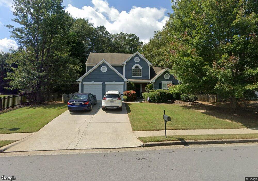
5152 Running Doe Dr Unit 2 Suwanee, GA 30024
Estimated Value: $487,594 - $547,000
3
Beds
3
Baths
2,482
Sq Ft
$209/Sq Ft
Est. Value
About This Home
This home is located at 5152 Running Doe Dr Unit 2, Suwanee, GA 30024 and is currently estimated at $518,649, approximately $208 per square foot. 5152 Running Doe Dr Unit 2 is a home located in Gwinnett County with nearby schools including Riverside Elementary School, North Gwinnett Middle School, and North Gwinnett High School.
Ownership History
Date
Name
Owned For
Owner Type
Purchase Details
Closed on
Mar 27, 2003
Sold by
Matthews Patricia
Bought by
Mcguire John R and Mcguire Courtney
Current Estimated Value
Home Financials for this Owner
Home Financials are based on the most recent Mortgage that was taken out on this home.
Original Mortgage
$164,886
Outstanding Balance
$69,946
Interest Rate
5.82%
Mortgage Type
New Conventional
Estimated Equity
$448,703
Purchase Details
Closed on
Jun 25, 1997
Sold by
Horton D R
Bought by
Matthews Patricia
Home Financials for this Owner
Home Financials are based on the most recent Mortgage that was taken out on this home.
Original Mortgage
$126,150
Interest Rate
7.87%
Mortgage Type
FHA
Create a Home Valuation Report for This Property
The Home Valuation Report is an in-depth analysis detailing your home's value as well as a comparison with similar homes in the area
Home Values in the Area
Average Home Value in this Area
Purchase History
| Date | Buyer | Sale Price | Title Company |
|---|---|---|---|
| Mcguire John R | $167,500 | -- | |
| Matthews Patricia | $135,000 | -- |
Source: Public Records
Mortgage History
| Date | Status | Borrower | Loan Amount |
|---|---|---|---|
| Open | Mcguire John R | $164,886 | |
| Previous Owner | Matthews Patricia | $126,150 |
Source: Public Records
Tax History
| Year | Tax Paid | Tax Assessment Tax Assessment Total Assessment is a certain percentage of the fair market value that is determined by local assessors to be the total taxable value of land and additions on the property. | Land | Improvement |
|---|---|---|---|---|
| 2025 | $4,700 | $182,680 | $38,000 | $144,680 |
| 2024 | $4,979 | $188,640 | $40,000 | $148,640 |
| 2023 | $4,979 | $192,400 | $40,000 | $152,400 |
| 2022 | $4,462 | $165,120 | $33,200 | $131,920 |
| 2021 | $3,546 | $117,960 | $23,280 | $94,680 |
| 2020 | $3,572 | $117,960 | $23,280 | $94,680 |
| 2019 | $3,325 | $110,120 | $20,000 | $90,120 |
| 2018 | $3,329 | $110,120 | $20,000 | $90,120 |
| 2016 | $2,656 | $91,880 | $23,600 | $68,280 |
| 2015 | $2,696 | $78,920 | $18,400 | $60,520 |
| 2014 | $2,566 | $72,440 | $16,400 | $56,040 |
Source: Public Records
Map
Nearby Homes
- 570 White Stag Ct
- 412 Antler Ln
- 510 Running Fawn Dr
- 5295 Antler Ct Unit 1
- 535 Running Fawn Dr
- 5395 Harbury Ln
- 972 Harvest Park Ln
- 5428 Glencastle Way
- 5232 Tormeall Trace
- 5013 Briar Rose Ct
- 243 Wedmore Ct
- 5135 Amberden Hall Dr
- 3681 Trevi Ln
- 811 Woodvale Point
- 262 Sandhurst Ct
- 600 Grimsby Ct
- 4863 Rosemoore Ct
- 0 Johnson Rd Unit 7677593
- 0 Johnson Rd Unit 10638841
- 0 Johnson Rd Unit CL344832
- 5162 Running Doe Dr
- 505 White Stag Ct
- 515 White Stag Ct
- 525 White Stag Ct
- 526 Broad Head Point
- 5157 Running Doe Dr
- 5167 Running Doe Dr
- 5147 Running Doe Dr
- 535 White Stag Ct
- 5177 Running Doe Dr
- 506 Broad Head Point
- 5137 Running Doe Dr
- 5122 Running Doe Dr
- 536 Broad Head Point
- 536 Broad Head Point Unit 311
- 5187 Running Doe Dr Unit 2
- 510 White Stag Ct
- 545 White Stag Ct Unit 3
- 5127 Running Doe Dr Unit 2
- 520 White Stag Ct
Your Personal Tour Guide
Ask me questions while you tour the home.