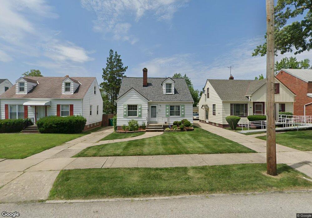
5158 Philip Ave Maple Heights, OH 44137
Estimated Value: $109,051 - $132,000
3
Beds
1
Bath
1,293
Sq Ft
$92/Sq Ft
Est. Value
About This Home
This home is located at 5158 Philip Ave, Maple Heights, OH 44137 and is currently estimated at $119,513, approximately $92 per square foot. 5158 Philip Ave is a home located in Cuyahoga County with nearby schools including Abraham Lincoln Elementary School, Rockside/ J.F. Kennedy School, and Barack Obama School.
Ownership History
Date
Name
Owned For
Owner Type
Purchase Details
Closed on
Jan 24, 2005
Sold by
Vincent Carolyn and Vincent James
Bought by
Munroe Lynford A and Munroe Allmarie C
Current Estimated Value
Home Financials for this Owner
Home Financials are based on the most recent Mortgage that was taken out on this home.
Original Mortgage
$76,396
Outstanding Balance
$39,035
Interest Rate
5.83%
Mortgage Type
FHA
Estimated Equity
$80,478
Purchase Details
Closed on
Nov 3, 1998
Sold by
Hirt Genevieve R
Bought by
Vincent Carolyn
Purchase Details
Closed on
Feb 8, 1989
Sold by
Hirt Genevieve R
Bought by
Hirt Genevieve R
Purchase Details
Closed on
Jan 1, 1975
Bought by
Hirt Genevieve R
Create a Home Valuation Report for This Property
The Home Valuation Report is an in-depth analysis detailing your home's value as well as a comparison with similar homes in the area
Home Values in the Area
Average Home Value in this Area
Purchase History
| Date | Buyer | Sale Price | Title Company |
|---|---|---|---|
| Munroe Lynford A | $77,000 | Executive Title Agency | |
| Vincent Carolyn | -- | -- | |
| Hirt Genevieve R | -- | -- | |
| Hirt Genevieve R | -- | -- |
Source: Public Records
Mortgage History
| Date | Status | Borrower | Loan Amount |
|---|---|---|---|
| Open | Munroe Lynford A | $76,396 |
Source: Public Records
Tax History Compared to Growth
Tax History
| Year | Tax Paid | Tax Assessment Tax Assessment Total Assessment is a certain percentage of the fair market value that is determined by local assessors to be the total taxable value of land and additions on the property. | Land | Improvement |
|---|---|---|---|---|
| 2024 | $3,239 | $35,945 | $7,140 | $28,805 |
| 2023 | $2,130 | $19,530 | $4,340 | $15,190 |
| 2022 | $2,122 | $19,530 | $4,340 | $15,190 |
| 2021 | $2,259 | $19,530 | $4,340 | $15,190 |
| 2020 | $1,938 | $14,810 | $3,290 | $11,520 |
| 2019 | $1,927 | $42,300 | $9,400 | $32,900 |
| 2018 | $1,821 | $14,810 | $3,290 | $11,520 |
| 2017 | $1,823 | $13,270 | $3,010 | $10,260 |
| 2016 | $1,764 | $13,270 | $3,010 | $10,260 |
| 2015 | $1,759 | $13,270 | $3,010 | $10,260 |
| 2014 | $1,759 | $14,600 | $3,330 | $11,270 |
Source: Public Records
Map
Nearby Homes
- 5185 Clement Ave
- 5231 Philip Ave
- 5110 Philip Ave
- 5208 Clement Ave
- 5082 Philip Ave
- 5257 Philip Ave
- 5212 Catherine St
- 5061 Philip Ave
- 5199 Arch St
- 5239 Arch St
- 5320 Clement Ave
- 5031 Cato St
- 5210 Theodore St
- 5234 Erwin St
- 17916 North Blvd
- 17912 North Blvd
- 17204 Maple Heights Blvd
- 5425 Grasmere Ave
- 16712 Kollin Ave
- 5247 Henry St
- 5154 Philip Ave
- 5162 Philip Ave
- 5150 Philip Ave
- 5166 Philip Ave
- 5146 Philip Ave
- 5170 Philip Ave
- 5145 Catherine St
- 5149 Catherine St
- 5141 Catherine St
- 5142 Philip Ave
- 5174 Philip Ave
- 5153 Catherine St
- 5137 Catherine St
- 5157 Philip Ave
- 5163 Philip Ave
- 5138 Philip Ave
- 5157 Catherine St
- 5151 Philip Ave
- 5178 Philip Ave
- 5167 Philip Ave