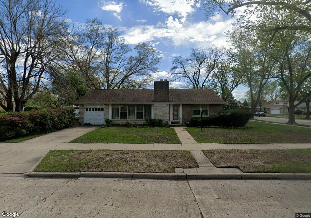
5159 Greenleaf St Skokie, IL 60077
Southwest Skokie NeighborhoodEstimated Value: $357,000 - $462,000
3
Beds
2
Baths
1,170
Sq Ft
$361/Sq Ft
Est. Value
About This Home
This home is located at 5159 Greenleaf St, Skokie, IL 60077 and is currently estimated at $421,893, approximately $360 per square foot. 5159 Greenleaf St is a home located in Cook County with nearby schools including Madison Elementary School, Thomas Edison Elementary School, and Lincoln Junior High School.
Ownership History
Date
Name
Owned For
Owner Type
Purchase Details
Closed on
Feb 21, 2001
Sold by
Isberto Juanito
Bought by
Isberto Cheryl P
Current Estimated Value
Purchase Details
Closed on
Jan 18, 1999
Sold by
Jung Munchul G
Bought by
Isberto Juanito and Isberto Cheryl
Home Financials for this Owner
Home Financials are based on the most recent Mortgage that was taken out on this home.
Original Mortgage
$175,750
Outstanding Balance
$40,764
Interest Rate
6.76%
Estimated Equity
$381,129
Create a Home Valuation Report for This Property
The Home Valuation Report is an in-depth analysis detailing your home's value as well as a comparison with similar homes in the area
Home Values in the Area
Average Home Value in this Area
Purchase History
| Date | Buyer | Sale Price | Title Company |
|---|---|---|---|
| Isberto Cheryl P | -- | -- | |
| Isberto Juanito | $185,000 | Chicago Title Insurance Co |
Source: Public Records
Mortgage History
| Date | Status | Borrower | Loan Amount |
|---|---|---|---|
| Open | Isberto Juanito | $175,750 |
Source: Public Records
Tax History Compared to Growth
Tax History
| Year | Tax Paid | Tax Assessment Tax Assessment Total Assessment is a certain percentage of the fair market value that is determined by local assessors to be the total taxable value of land and additions on the property. | Land | Improvement |
|---|---|---|---|---|
| 2024 | $4,359 | $15,306 | $5,243 | $10,063 |
| 2023 | $4,344 | $15,306 | $5,243 | $10,063 |
| 2022 | $4,344 | $15,306 | $5,243 | $10,063 |
| 2021 | $3,630 | $11,356 | $3,226 | $8,130 |
| 2020 | $3,637 | $11,356 | $3,226 | $8,130 |
| 2019 | $3,624 | $12,645 | $3,226 | $9,419 |
| 2018 | $3,522 | $11,211 | $2,923 | $8,288 |
| 2017 | $3,546 | $11,211 | $2,923 | $8,288 |
| 2016 | $3,460 | $11,211 | $2,923 | $8,288 |
| 2015 | $2,885 | $9,128 | $2,520 | $6,608 |
| 2014 | $2,828 | $9,128 | $2,520 | $6,608 |
| 2013 | $3,016 | $9,579 | $2,520 | $7,059 |
Source: Public Records
Map
Nearby Homes
- 8605 Laramie Ave
- 5109 Greenleaf St
- 8717 Gross Point Rd
- 5309 Crain St
- 8461 Gross Point Rd
- 8534 Terminal Ave
- 8464 Gross Point Rd
- 8655 Harms Rd
- 8541 Lotus Ave Unit 914
- 4901 Carol Unit F St
- 5001 Madison St Unit 3A
- 5500 Lincoln Ave Unit 407W
- 5500 Lincoln Ave Unit 116E
- 5500 Lincoln Ave Unit 109W
- 5247 Suffield Ct
- 8836 Bronx Ave
- 8232 Niles Center Rd Unit 304
- 8232 Niles Center Rd Unit 202
- 8232 Niles Center Rd Unit 317
- 5317 Suffield Ct
- 5159 Greenleaf St
- 8553 Laramie Ave
- 5156 Greenleaf St
- 5143 Greenleaf St
- 8545 Laramie Ave
- 5139 Greenleaf St
- 8541 Laramie Ave
- 5144 Greenleaf St
- 5201 Greenleaf St
- 8611 Laramie Ave
- 8552 Laramie Ave
- 5142 Wright Terrace
- 5200 Greenleaf St
- 5200 Greenleaf St
- 5138 Greenleaf St
- 8546 Laramie Ave
- 8546 Laramie Ave
- 5135 Greenleaf St
- 5135 Greenleaf St
- 8535 Laramie Ave