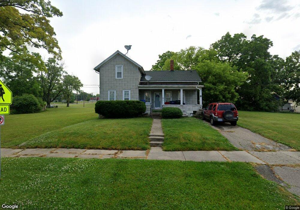
516 Mathewson St Flint, MI 48504
University Avenue Neighborhood NeighborhoodEstimated Value: $38,000 - $64,000
3
Beds
1
Bath
869
Sq Ft
$59/Sq Ft
Est. Value
About This Home
This home is located at 516 Mathewson St, Flint, MI 48504 and is currently estimated at $51,284, approximately $59 per square foot. 516 Mathewson St is a home located in Genesee County with nearby schools including Durant-Tuuri-Mott Elementary School, St John Vianney Catholic School, and St. Paul Lutheran School.
Ownership History
Date
Name
Owned For
Owner Type
Purchase Details
Closed on
May 12, 2023
Sold by
Leitgeb Ronald W
Bought by
Leitgeb Ronald W
Current Estimated Value
Purchase Details
Closed on
Oct 9, 2006
Sold by
Fannie Mae
Bought by
Leitgeb Ronald W
Purchase Details
Closed on
Jun 21, 2005
Sold by
Gmac Mortgage Corp
Bought by
Federal National Mortgage Association
Purchase Details
Closed on
Apr 20, 2005
Sold by
Lenard Anthony
Bought by
Gmac Mortgage Corp
Purchase Details
Closed on
Feb 1, 2002
Sold by
Blue Stella and Trembley Judy
Bought by
Lenard Anthony
Create a Home Valuation Report for This Property
The Home Valuation Report is an in-depth analysis detailing your home's value as well as a comparison with similar homes in the area
Home Values in the Area
Average Home Value in this Area
Purchase History
| Date | Buyer | Sale Price | Title Company |
|---|---|---|---|
| Leitgeb Ronald W | -- | None Listed On Document | |
| Leitgeb Ronald W | $6,500 | Guaranty Title Company | |
| Federal National Mortgage Association | -- | Parks Title | |
| Gmac Mortgage Corp | $25,512 | -- | |
| Lenard Anthony | $26,000 | Metropolitan Title Company |
Source: Public Records
Tax History
| Year | Tax Paid | Tax Assessment Tax Assessment Total Assessment is a certain percentage of the fair market value that is determined by local assessors to be the total taxable value of land and additions on the property. | Land | Improvement |
|---|---|---|---|---|
| 2025 | $714 | $19,400 | $0 | $0 |
| 2024 | $671 | $18,100 | $0 | $0 |
| 2023 | $664 | $15,100 | $0 | $0 |
| 2022 | $0 | $13,900 | $0 | $0 |
| 2021 | $668 | $13,300 | $0 | $0 |
| 2020 | $625 | $11,700 | $0 | $0 |
| 2019 | $703 | $8,000 | $0 | $0 |
| 2018 | $586 | $8,100 | $0 | $0 |
| 2017 | $574 | $0 | $0 | $0 |
| 2016 | $571 | $0 | $0 | $0 |
| 2015 | -- | $0 | $0 | $0 |
| 2014 | -- | $0 | $0 | $0 |
| 2012 | -- | $6,800 | $0 | $0 |
Source: Public Records
Map
Nearby Homes
- 1016 Dupont St
- 2008 University Ave
- 1900 Cadillac St
- 1025 Frost St
- 2026 Monteith St
- 913 Perry St
- 607 Thayer St
- 2023 Cadillac St
- 825 Frank St
- 407 W 2nd Ave
- 1409 Prospect St
- 416 W 2nd Ave Unit 4
- 913 Davis St
- 1114 Christopher St
- 971 N Chevrolet Ave
- 1717 Wolcott St
- 2310 Gibson St
- 2124 Swayze St
- 2437 Zimmerman St
- 2410 Corunna Rd
- 518 Mathewson St
- 511 McAras Ct
- 505 McAras Ct
- 524 Mathewson St
- 521 McAras Ct
- 502 Mathewson St
- 504 Mathewson St
- 501 McAras Ct
- 525 McAras Ct
- 505 Mathewson St
- 429 McAras Ct
- 511 Mathewson St
- 1435 University Ave
- 425 McAras Ct
- 1429 University Ave
- 514 McAras Ct
- 510 McAras Ct
- 518 McAras Ct
- 501 Mathewson St
- 506 McAras Ct
Your Personal Tour Guide
Ask me questions while you tour the home.