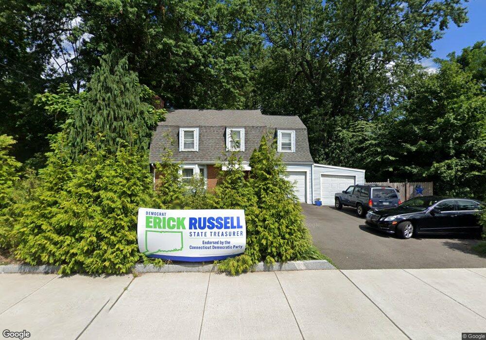
516 Park Rd West Hartford, CT 06107
Estimated Value: $377,000 - $533,000
3
Beds
2
Baths
1,938
Sq Ft
$236/Sq Ft
Est. Value
About This Home
This home is located at 516 Park Rd, West Hartford, CT 06107 and is currently estimated at $457,933, approximately $236 per square foot. 516 Park Rd is a home located in Hartford County with nearby schools including Webster Hill School, Sedgwick Middle School, and Conard High School.
Ownership History
Date
Name
Owned For
Owner Type
Purchase Details
Closed on
Jul 19, 1995
Sold by
Ford Consumer Fin Co
Bought by
Mcintosh Leon and Mcintosh Marion
Current Estimated Value
Home Financials for this Owner
Home Financials are based on the most recent Mortgage that was taken out on this home.
Original Mortgage
$96,954
Interest Rate
7.49%
Mortgage Type
Unknown
Purchase Details
Closed on
Feb 27, 1987
Sold by
Honis J J
Bought by
Ouellette A L
Create a Home Valuation Report for This Property
The Home Valuation Report is an in-depth analysis detailing your home's value as well as a comparison with similar homes in the area
Home Values in the Area
Average Home Value in this Area
Purchase History
| Date | Buyer | Sale Price | Title Company |
|---|---|---|---|
| Mcintosh Leon | $96,000 | -- | |
| Ouellette A L | $114,500 | -- |
Source: Public Records
Mortgage History
| Date | Status | Borrower | Loan Amount |
|---|---|---|---|
| Open | Ouellette A L | $240,000 | |
| Closed | Ouellette A L | $30,000 | |
| Closed | Ouellette A L | $208,000 | |
| Closed | Ouellette A L | $96,954 |
Source: Public Records
Tax History Compared to Growth
Tax History
| Year | Tax Paid | Tax Assessment Tax Assessment Total Assessment is a certain percentage of the fair market value that is determined by local assessors to be the total taxable value of land and additions on the property. | Land | Improvement |
|---|---|---|---|---|
| 2025 | $7,202 | $160,830 | $79,000 | $81,830 |
| 2024 | $6,811 | $160,830 | $79,000 | $81,830 |
| 2023 | $6,581 | $160,830 | $79,000 | $81,830 |
| 2022 | $6,543 | $160,830 | $79,000 | $81,830 |
| 2021 | $6,494 | $153,090 | $61,400 | $91,690 |
| 2020 | $6,399 | $153,090 | $57,500 | $95,590 |
| 2019 | $6,399 | $153,090 | $57,540 | $95,550 |
| 2018 | $6,670 | $162,680 | $67,130 | $95,550 |
| 2017 | $6,676 | $162,680 | $67,130 | $95,550 |
| 2016 | $6,804 | $172,200 | $59,850 | $112,350 |
| 2015 | $6,597 | $172,200 | $59,850 | $112,350 |
| 2014 | $6,435 | $172,200 | $59,850 | $112,350 |
Source: Public Records
Map
Nearby Homes
- 395 Park Rd
- 1640 Boulevard
- 85 Memorial Rd Unit 512
- 61 Woodmere Rd
- 25 Ellsworth Rd
- 2 Arapahoe Rd Unit 313
- 2 Arapahoe Rd Unit 308
- 2 Arapahoe Rd Unit 611
- 2 Arapahoe Rd Unit 601
- 2 Arapahoe Rd Unit 510
- 2 Arapahoe Rd Unit 505
- 2 Arapahoe Rd Unit 604
- 2 Arapahoe Rd Unit 609
- 2 Arapahoe Rd Unit 607
- 2 Arapahoe Rd Unit 312
- 2 Arapahoe Rd Unit 603
- 2 Arapahoe Rd Unit 605
- 2 Arapahoe Rd Unit 613
- 2 Arapahoe Rd Unit 612
- 2 Arapahoe Rd Unit 310
- 236 Raymond Rd
- 528 Park Rd
- 232 Raymond Rd
- 226 Raymond Rd
- 222 Raymond Rd
- 218 Raymond Rd
- 231 Raymond Rd
- 214 Raymond Rd
- 220 Raymond Rd
- 227 Raymond Rd
- 223 Raymond Rd
- 544 Park Rd
- 210 Raymond Rd
- 210 Raymond Rd Unit 1
- 210 Raymond Rd
- 210 Raymond Rd Unit 2
- 217 Raymond Rd
- 4 Overbrook Rd
- 204 Raymond Rd
- 215 Raymond Rd