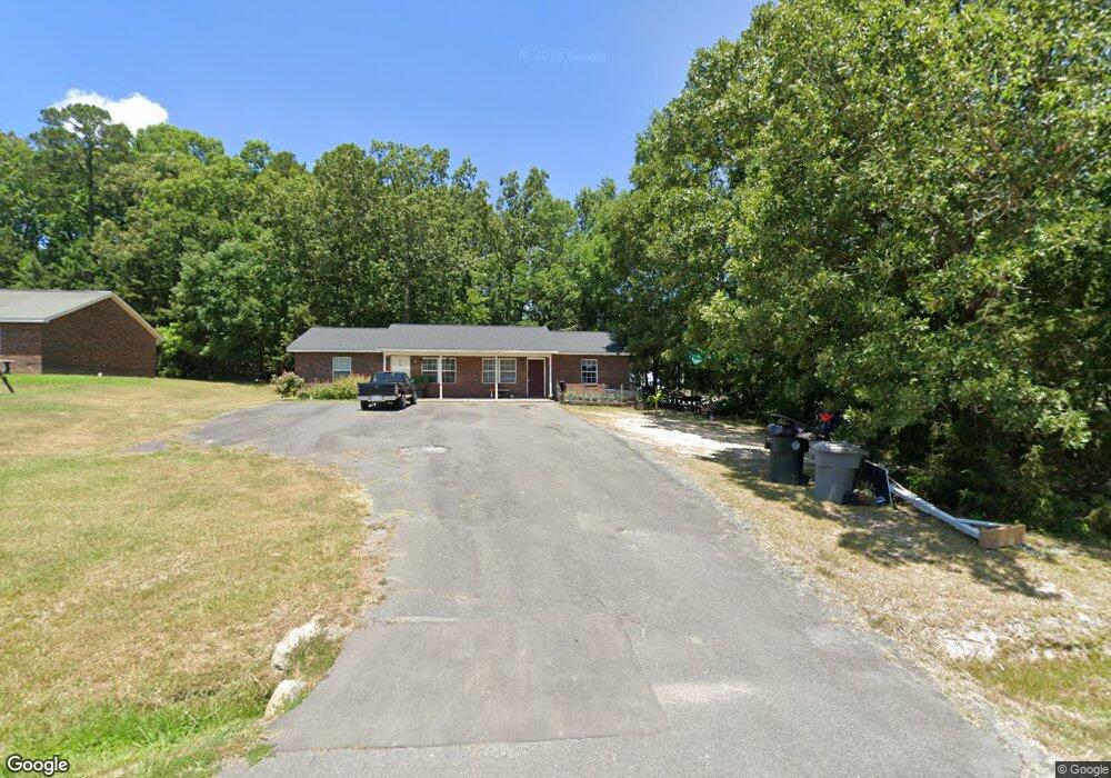
516 Sherwood Ave Asheboro, NC 27205
Estimated Value: $218,000 - $325,549
--
Bed
4
Baths
1,624
Sq Ft
$172/Sq Ft
Est. Value
About This Home
This home is located at 516 Sherwood Ave, Asheboro, NC 27205 and is currently estimated at $279,637, approximately $172 per square foot. 516 Sherwood Ave is a home with nearby schools including Guy B. Teachey Elementary School, South Asheboro Middle School, and Asheboro High School.
Ownership History
Date
Name
Owned For
Owner Type
Purchase Details
Closed on
Dec 4, 2008
Sold by
Walker Michael L and Walker Beth C
Bought by
Walker Chad D and Walker Richard C
Current Estimated Value
Home Financials for this Owner
Home Financials are based on the most recent Mortgage that was taken out on this home.
Original Mortgage
$345,000
Outstanding Balance
$225,681
Interest Rate
6.01%
Mortgage Type
Future Advance Clause Open End Mortgage
Estimated Equity
$53,956
Create a Home Valuation Report for This Property
The Home Valuation Report is an in-depth analysis detailing your home's value as well as a comparison with similar homes in the area
Home Values in the Area
Average Home Value in this Area
Purchase History
| Date | Buyer | Sale Price | Title Company |
|---|---|---|---|
| Walker Chad D | $230,000 | None Available |
Source: Public Records
Mortgage History
| Date | Status | Borrower | Loan Amount |
|---|---|---|---|
| Open | Walker Chad D | $345,000 |
Source: Public Records
Tax History Compared to Growth
Tax History
| Year | Tax Paid | Tax Assessment Tax Assessment Total Assessment is a certain percentage of the fair market value that is determined by local assessors to be the total taxable value of land and additions on the property. | Land | Improvement |
|---|---|---|---|---|
| 2025 | $4,055 | $291,150 | $38,460 | $252,690 |
| 2024 | $4,055 | $291,150 | $38,460 | $252,690 |
| 2023 | $4,055 | $291,150 | $38,460 | $252,690 |
| 2022 | $2,930 | $203,240 | $24,480 | $178,760 |
| 2021 | $2,930 | $203,240 | $24,480 | $178,760 |
| 2020 | $2,930 | $203,240 | $24,480 | $178,760 |
| 2019 | $2,930 | $203,240 | $24,480 | $178,760 |
| 2018 | $2,851 | $194,290 | $22,110 | $172,180 |
| 2016 | $2,851 | $194,287 | $22,110 | $172,177 |
| 2015 | $2,856 | $194,287 | $22,110 | $172,177 |
| 2014 | -- | $194,287 | $22,110 | $172,177 |
Source: Public Records
Map
Nearby Homes
- 811 Sherwood Ave
- 1922 Oak Dr
- 724 Sherwood Rd
- 481 McLarkling Ln
- 2006 Lambert Dr
- 406 Ashmont Ct
- 7808 State Highway 49
- 386 Sherwood Oaks Dr
- 01 Mack Rd
- 1037 Robbins St
- 841 Hollings Rd
- 960 Lee St
- 737 Britt Ave
- 1427 S Fayetteville St
- 481 Nc Highway 49 S
- 272 Cheyenne Cir
- 228 Anchor Dr
- 287 Eldorado Rd
- 261 Charles Ave
- 855 Lee St
- 287 Harvell Street Extension
- 275 Harvell Street Extension
- 527 Sherwood Ave
- 527 Sherwood Ave
- 269 Harvell Street Extension
- 286 Harvell Street Extension
- 260 Harvell Street Extension
- 255 Harvell Street Extension
- 255 Harvell Street Extension
- 255 Harvell Street Extension
- 849 Sherwood Rd Unit B
- 849 Sherwood Rd Unit A
- 849 Sherwood Rd
- 1731 Harvell St
- 252 Harvell Street Extension
- 711 Sherwood Ave
- 248 Harvell Street Extension
- 1739 Harvell St
- 460 McLarkling Ln
- 853 Sherwood Rd