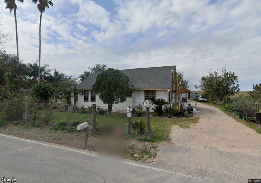
516 W Mile 13 N Weslaco, TX 78599
Estimated Value: $137,461 - $218,000
2
Beds
2
Baths
1,793
Sq Ft
$98/Sq Ft
Est. Value
About This Home
This home is located at 516 W Mile 13 N, Weslaco, TX 78599 and is currently estimated at $175,865, approximately $98 per square foot. 516 W Mile 13 N is a home with nearby schools including Raul A Gonzalez Jr Elementary School, Beatriz G. Garza Middle School, and Weslaco High School.
Ownership History
Date
Name
Owned For
Owner Type
Purchase Details
Closed on
Nov 22, 2017
Sold by
Perez Delia and Bazaldua Angela Renee
Bought by
Bazaldua Angela Renee
Current Estimated Value
Purchase Details
Closed on
Apr 4, 2016
Sold by
Adobe Unlimited L L C
Bought by
Perez Tomas and Perez Priscilla Pena
Home Financials for this Owner
Home Financials are based on the most recent Mortgage that was taken out on this home.
Original Mortgage
$19,000
Interest Rate
3.65%
Mortgage Type
New Conventional
Create a Home Valuation Report for This Property
The Home Valuation Report is an in-depth analysis detailing your home's value as well as a comparison with similar homes in the area
Home Values in the Area
Average Home Value in this Area
Purchase History
| Date | Buyer | Sale Price | Title Company |
|---|---|---|---|
| Bazaldua Angela Renee | -- | None Available | |
| Perez Tomas | -- | None Available | |
| Perez Tomas | -- | None Available |
Source: Public Records
Mortgage History
| Date | Status | Borrower | Loan Amount |
|---|---|---|---|
| Previous Owner | Perez Tomas | $19,000 | |
| Previous Owner | Perez Tomas | $19,500 |
Source: Public Records
Tax History Compared to Growth
Tax History
| Year | Tax Paid | Tax Assessment Tax Assessment Total Assessment is a certain percentage of the fair market value that is determined by local assessors to be the total taxable value of land and additions on the property. | Land | Improvement |
|---|---|---|---|---|
| 2025 | $1,265 | $102,547 | $27,220 | $75,327 |
| 2024 | $1,265 | $67,514 | $27,220 | $40,294 |
| 2023 | $1,254 | $67,514 | $27,220 | $40,294 |
| 2022 | $1,101 | $58,472 | $27,220 | $31,252 |
| 2021 | $1,124 | $58,472 | $27,220 | $31,252 |
| 2020 | $1,047 | $52,578 | $27,220 | $25,358 |
| 2019 | $783 | $37,624 | $18,240 | $19,384 |
| 2018 | $785 | $37,624 | $18,240 | $19,384 |
| 2017 | $782 | $37,624 | $18,240 | $19,384 |
| 2016 | $603 | $28,994 | $14,967 | $14,027 |
| 2015 | $210 | $28,994 | $14,967 | $14,027 |
| 2014 | $210 | $31,801 | $14,967 | $16,834 |
Source: Public Records
Map
Nearby Homes
- 420 N Beto Garcia Dr
- 217 N Beto Garcia Dr
- 843 W Mile 13 N
- 893 W Mile 13 N
- 917 W Mile 13 N
- 869 W Mile 13 N
- 0000 Mile 13
- 607 Palos Altos St
- 705 Palo Verde St
- 1307 Lore Dr
- 7909 Big Valley Dr
- 707 W Mile 14 N
- 1311 San Vicente Norte
- 1206 San Vicente Norte St
- 7511 Big Valley Dr Unit 13
- 1503 W Mile 14 N
- 11213 N Farm To Market 88
- 7514 Shilo Dr
- 305 Sonoma St
- 208 Napa St
- 13 E Mile N
- 710 W 13 1/2 N
- 412 Amistad Ln
- 400 Amistad Ln
- 2700 Kingdom Dr
- 2709 Kingdom Dr
- 322 Amistad Ln
- 508 Amistad Ln
- 419 Amistad Ln
- 413 Amistad Ln
- 407 Amistad Ln
- 310 Amistad Ln
- 510 N Beto Garcia Dr
- 414 N Beto Garcia Dr
- 317 Amistad Ln
- 408 N Beto Garcia Dr
- 220 Amistad Ln
- 220 Amistad Ln
- 402 N Beto Garcia Dr
- 8715 W Beto Garcia Dr