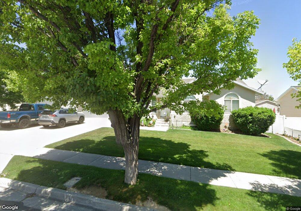
5160 Castle Peak Dr Riverton, UT 84096
Estimated Value: $558,200 - $603,000
3
Beds
2
Baths
1,262
Sq Ft
$461/Sq Ft
Est. Value
About This Home
This home is located at 5160 Castle Peak Dr, Riverton, UT 84096 and is currently estimated at $581,550, approximately $460 per square foot. 5160 Castle Peak Dr is a home located in Salt Lake County with nearby schools including Foothills School, South Hills Middle School, and Mountain Ridge High School.
Ownership History
Date
Name
Owned For
Owner Type
Purchase Details
Closed on
May 13, 1997
Sold by
Halliday Shane W and Halliday Angela C
Bought by
Halliday Shane W and Halliday Angela C
Current Estimated Value
Home Financials for this Owner
Home Financials are based on the most recent Mortgage that was taken out on this home.
Original Mortgage
$126,738
Outstanding Balance
$17,554
Interest Rate
8.13%
Mortgage Type
FHA
Estimated Equity
$563,996
Purchase Details
Closed on
Jan 15, 1997
Sold by
Majestic Homes
Bought by
Halliday Shane W and Halliday Angela C
Home Financials for this Owner
Home Financials are based on the most recent Mortgage that was taken out on this home.
Original Mortgage
$99,000
Interest Rate
7.46%
Mortgage Type
Construction
Purchase Details
Closed on
Oct 24, 1996
Sold by
Millard Gerald E and Millard Steven C
Bought by
Mortgage Investment Trust Of Utah
Create a Home Valuation Report for This Property
The Home Valuation Report is an in-depth analysis detailing your home's value as well as a comparison with similar homes in the area
Home Values in the Area
Average Home Value in this Area
Purchase History
| Date | Buyer | Sale Price | Title Company |
|---|---|---|---|
| Halliday Shane W | -- | -- | |
| Halliday Shane W | -- | -- | |
| Mortgage Investment Trust Of Utah | -- | -- |
Source: Public Records
Mortgage History
| Date | Status | Borrower | Loan Amount |
|---|---|---|---|
| Open | Halliday Shane W | $126,738 | |
| Previous Owner | Halliday Shane W | $99,000 |
Source: Public Records
Tax History Compared to Growth
Tax History
| Year | Tax Paid | Tax Assessment Tax Assessment Total Assessment is a certain percentage of the fair market value that is determined by local assessors to be the total taxable value of land and additions on the property. | Land | Improvement |
|---|---|---|---|---|
| 2025 | -- | $544,100 | $195,600 | $348,500 |
| 2024 | -- | $485,400 | $179,700 | $305,700 |
| 2023 | $3,054 | $484,200 | $166,400 | $317,800 |
| 2022 | $3,054 | $488,900 | $163,100 | $325,800 |
| 2021 | $2,539 | $361,800 | $125,800 | $236,000 |
| 2020 | $2,452 | $325,800 | $97,900 | $227,900 |
| 2019 | $2,377 | $310,500 | $93,200 | $217,300 |
| 2018 | $2,265 | $291,300 | $86,100 | $205,200 |
| 2017 | $2,151 | $269,600 | $86,100 | $183,500 |
| 2016 | $2,058 | $247,500 | $86,100 | $161,400 |
| 2015 | $1,982 | $231,100 | $86,200 | $144,900 |
| 2014 | $1,908 | $218,100 | $82,100 | $136,000 |
Source: Public Records
Map
Nearby Homes
- 13878 S Shaggy Peak Dr
- 13908 S 5180 W
- 5036 W Cedar Point Peak Dr
- 5248 Little Water Peak Dr
- 5030 Little Water Peak Dr
- 14054 Elk Horn Peak Dr
- 14048 van Cott Peak Cir
- 14032 Lewiston Peak Dr
- 5288 Shaggy Peak Dr
- 14049 S van Cott Peak Cir
- 14121 Elk Horn Peak Dr
- 13863 S Kessler Peak Dr
- 14254 S Amber Rose Ln
- 13597 S Firetip Ct
- 14322 Pepper Grass Ln
- 14347 S Mount Ogden Peak Dr
- 4722 W Cillian Ln Unit 2411
- 13842 Pioneer Peak Cir
- 4714 W Cillian Ln Unit 2410
- 4952 W Atala Way
- 5170 W Castle Peak Dr
- 5170 Castle Peak Dr
- 5148 Castle Peak Dr
- 5148 W Castle Peak Dr
- 13928 Shaggy Peak Dr
- 13913 Little Water Peak Cir
- 13913 S Little Water Peak Cir
- 13913 S Little Water Peak Cir Unit 314
- 5180 Castle Peak Dr
- 13909 Little Water Peak Cir
- 14060 Lowe Peak Dr
- 14062 Lowe Peak Dr
- 14064 Lowe Peak Dr
- 5153 W Castle Peak Dr
- 14066 Lowe Peak Dr
- 13912 S Shaggy Peak Dr
- 13912 Shaggy Peak Dr
- 5169 Castle Peak Dr
- 5169 W Castle Peak Dr
- 13909 S Little Water Peak Cir Unit 316