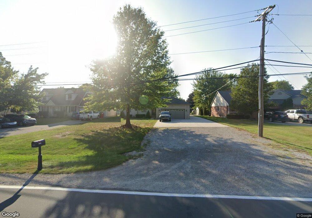
51627 Sass Rd Chesterfield, MI 48047
Estimated Value: $383,000 - $445,000
--
Bed
1
Bath
1,876
Sq Ft
$218/Sq Ft
Est. Value
About This Home
This home is located at 51627 Sass Rd, Chesterfield, MI 48047 and is currently estimated at $408,891, approximately $217 per square foot. 51627 Sass Rd is a home located in Macomb County with nearby schools including Sugarbush Elementary School, Oxford Middle School, and Anchor Bay Middle School South.
Ownership History
Date
Name
Owned For
Owner Type
Purchase Details
Closed on
Sep 14, 2023
Sold by
Barker Randy
Bought by
Barker Randy and Barker Denise
Current Estimated Value
Purchase Details
Closed on
Jan 7, 2011
Sold by
Barker Heather Marie
Bought by
Barker Randy James
Purchase Details
Closed on
Oct 28, 1999
Sold by
Disano Antonio
Bought by
Barker Randy J
Purchase Details
Closed on
Dec 8, 1995
Sold by
Zaleski S and Zaleski S
Bought by
Pettigrew A and Pettigrew G
Create a Home Valuation Report for This Property
The Home Valuation Report is an in-depth analysis detailing your home's value as well as a comparison with similar homes in the area
Home Values in the Area
Average Home Value in this Area
Purchase History
| Date | Buyer | Sale Price | Title Company |
|---|---|---|---|
| Barker Randy | -- | None Listed On Document | |
| Barker Randy James | -- | None Available | |
| Barker Randy J | $50,000 | -- | |
| Pettigrew A | $134,900 | -- |
Source: Public Records
Tax History Compared to Growth
Tax History
| Year | Tax Paid | Tax Assessment Tax Assessment Total Assessment is a certain percentage of the fair market value that is determined by local assessors to be the total taxable value of land and additions on the property. | Land | Improvement |
|---|---|---|---|---|
| 2025 | $5,014 | $201,200 | $0 | $0 |
| 2024 | $2,887 | $199,800 | $0 | $0 |
| 2023 | $2,737 | $188,000 | $0 | $0 |
| 2022 | $4,537 | $163,700 | $0 | $0 |
| 2021 | $4,411 | $161,100 | $0 | $0 |
| 2020 | $2,515 | $162,300 | $0 | $0 |
| 2019 | $4,081 | $152,700 | $0 | $0 |
| 2018 | $4,001 | $145,800 | $25,600 | $120,200 |
| 2017 | $3,918 | $130,150 | $25,550 | $104,600 |
| 2016 | $3,791 | $130,150 | $0 | $0 |
| 2015 | $1,762 | $118,800 | $0 | $0 |
| 2014 | $1,762 | $110,800 | $19,650 | $91,150 |
| 2012 | -- | $0 | $0 | $0 |
Source: Public Records
Map
Nearby Homes
- 51204 Cathryn Ct Unit 6
- 51133 Sarah Ct
- 51728 Mitchell Dr
- 31736 William Dr
- 31676 Breezeway
- 51903 N Adele Cir
- 52047 Sycamore Dr
- 52117 Pebble Creek Dr
- 31450 23 Mile Rd
- 32922 Oakwood Dr Unit 10
- 51901 D W Seaton Dr
- 50402 Oakbrooke Dr
- 51433 Fox Hill Trail Unit NO
- 53173 Woodland Meadows
- 15 Harmony Rd
- 53211 Woodland Meadows
- 51687 Johns Dr
- 53176 Woodland Meadows
- 53195 Woodland Meadows
- 51635 Laurel Oak Ln
- 51644 Julies Dr
- 51677 Sass Rd
- 51672 Julies Dr
- 51700 Julies Dr
- 51675 Sass Rd
- 51705 Sass Rd
- 51613 Sass Rd
- 51707 Sass Rd
- 51616 Julies Dr
- 51728 Julies Dr
- 51588 Julies Dr
- 51599 Sass Rd
- 51735 Sass Rd
- 51737 Sass Rd
- 51661 Julies Dr
- 51756 Julies Dr
- 51585 Sass Rd
- 51560 Julies Dr
- 51635 Julies Dr
- 51687 Julies Dr
