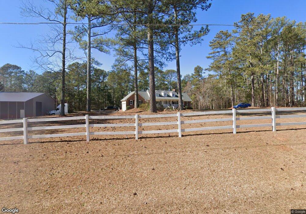
5163 Kent Rock Rd Loganville, GA 30052
Walnut Grove NeighborhoodEstimated Value: $415,436 - $474,000
5
Beds
--
Bath
3,021
Sq Ft
$148/Sq Ft
Est. Value
About This Home
This home is located at 5163 Kent Rock Rd, Loganville, GA 30052 and is currently estimated at $447,359, approximately $148 per square foot. 5163 Kent Rock Rd is a home located in Walton County with nearby schools including Walnut Grove Elementary School, Youth Middle School, and Walnut Grove High School.
Ownership History
Date
Name
Owned For
Owner Type
Purchase Details
Closed on
Oct 26, 2020
Sold by
Opendoor Property Trust I
Bought by
Cerberus Sfr Holdings V Lp
Current Estimated Value
Purchase Details
Closed on
Sep 30, 2020
Sold by
Smith Bobby H
Bought by
Opendoor Property Trust I
Purchase Details
Closed on
Oct 27, 2005
Sold by
Williams James A and Williams Jane
Bought by
Smith Bobby H and Smith Stacey
Home Financials for this Owner
Home Financials are based on the most recent Mortgage that was taken out on this home.
Original Mortgage
$212,800
Interest Rate
5.71%
Mortgage Type
New Conventional
Purchase Details
Closed on
Aug 17, 2000
Sold by
Ferguson John U
Bought by
Williams James A and Williams Jane H
Home Financials for this Owner
Home Financials are based on the most recent Mortgage that was taken out on this home.
Original Mortgage
$195,597
Interest Rate
8.11%
Mortgage Type
VA
Create a Home Valuation Report for This Property
The Home Valuation Report is an in-depth analysis detailing your home's value as well as a comparison with similar homes in the area
Home Values in the Area
Average Home Value in this Area
Purchase History
| Date | Buyer | Sale Price | Title Company |
|---|---|---|---|
| Cerberus Sfr Holdings V Lp | $255,700 | -- | |
| Opendoor Property Trust I | $256,900 | -- | |
| Smith Bobby H | $224,000 | -- | |
| Williams James A | $189,900 | -- |
Source: Public Records
Mortgage History
| Date | Status | Borrower | Loan Amount |
|---|---|---|---|
| Previous Owner | Smith Bobby H | $212,800 | |
| Previous Owner | Williams James A | $195,597 |
Source: Public Records
Tax History Compared to Growth
Tax History
| Year | Tax Paid | Tax Assessment Tax Assessment Total Assessment is a certain percentage of the fair market value that is determined by local assessors to be the total taxable value of land and additions on the property. | Land | Improvement |
|---|---|---|---|---|
| 2024 | $4,237 | $143,724 | $14,740 | $128,984 |
| 2023 | $4,359 | $143,724 | $14,740 | $128,984 |
| 2022 | $4,544 | $143,724 | $13,600 | $130,124 |
| 2021 | $3,332 | $122,804 | $10,000 | $112,804 |
| 2020 | $3,511 | $116,204 | $8,000 | $108,204 |
| 2019 | $3,365 | $103,124 | $6,400 | $96,724 |
| 2018 | $3,232 | $103,124 | $6,400 | $96,724 |
| 2017 | $3,422 | $99,324 | $5,200 | $94,124 |
| 2016 | $2,724 | $82,740 | $5,200 | $77,540 |
| 2015 | $2,549 | $76,380 | $5,200 | $71,180 |
| 2014 | $2,558 | $74,800 | $0 | $0 |
Source: Public Records
Map
Nearby Homes
- 5145 Kent Rock Rd
- 0 Emmett Still-Lot 4 Rd
- 5460 Emmett Still Rd
- 1393 Silver Thorne Ct
- 1006 Silver Thorne Dr
- 4951 Center Hill Church Rd
- 1030 Silver Thorne Dr
- 1050 Silver Thorne Dr
- 2391 Rabbit Farm Cir
- 2431 Rabbit Farm Cir
- 5330 Waterport Dr
- 2000 Sage Ct
- 2035 Gum Creek Ln
- 1841 Harvest Way Unit 2
- 1015 Carriage Way
- 5319 Haynes Creek Dr
- 5171 Kent Rock Rd
- 5159 Kent Rock Rd
- 5155 Kent Rock Rd
- 5155 Kent Rock Rd Unit 3
- 5149 Kent Rock Rd
- 1028 Honey Ln
- 1025 Honey Ln
- 1024 Honey Ln
- 1021 Honey Ln
- 2708 Honey Locust
- 2771 Honey Locust Ct
- 2748 Honey Locust Ct
- 2701 Honey Locust
- 2768 Honey Locust Ct
- 2781 Honey Locust
- 2778 Honey Locust Ct
- 2738 Honey Locust Unit 59
- 2708 Honey Locust Unit 62
- 2701 Honey Locust Unit 63
- 2801 Honey Locust Ct Unit 71