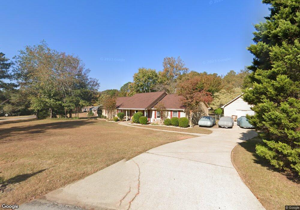
5163 Paul Cir SW Conyers, GA 30094
Estimated Value: $292,925 - $331,000
3
Beds
2
Baths
1,701
Sq Ft
$182/Sq Ft
Est. Value
About This Home
This home is located at 5163 Paul Cir SW, Conyers, GA 30094 and is currently estimated at $309,981, approximately $182 per square foot. 5163 Paul Cir SW is a home located in Rockdale County with nearby schools including Lorraine Elementary School, Gen. Ray Davis Middle School, and Salem High School.
Ownership History
Date
Name
Owned For
Owner Type
Purchase Details
Closed on
Feb 24, 2006
Sold by
Simoes Dennis and Simoes Cynthia
Bought by
Gugliuzza Robert F and Gugliuzza Dianne K
Current Estimated Value
Home Financials for this Owner
Home Financials are based on the most recent Mortgage that was taken out on this home.
Original Mortgage
$188,100
Outstanding Balance
$105,488
Interest Rate
6.04%
Mortgage Type
New Conventional
Estimated Equity
$204,493
Create a Home Valuation Report for This Property
The Home Valuation Report is an in-depth analysis detailing your home's value as well as a comparison with similar homes in the area
Home Values in the Area
Average Home Value in this Area
Purchase History
| Date | Buyer | Sale Price | Title Company |
|---|---|---|---|
| Gugliuzza Robert F | $198,000 | -- |
Source: Public Records
Mortgage History
| Date | Status | Borrower | Loan Amount |
|---|---|---|---|
| Open | Gugliuzza Robert F | $188,100 |
Source: Public Records
Tax History Compared to Growth
Tax History
| Year | Tax Paid | Tax Assessment Tax Assessment Total Assessment is a certain percentage of the fair market value that is determined by local assessors to be the total taxable value of land and additions on the property. | Land | Improvement |
|---|---|---|---|---|
| 2024 | $1,961 | $110,840 | $28,960 | $81,880 |
| 2023 | $1,497 | $97,520 | $27,600 | $69,920 |
| 2022 | $1,382 | $80,760 | $23,000 | $57,760 |
| 2021 | $1,048 | $65,520 | $17,200 | $48,320 |
| 2020 | $965 | $63,560 | $14,920 | $48,640 |
| 2019 | $854 | $58,840 | $12,280 | $46,560 |
| 2018 | $642 | $51,840 | $10,560 | $41,280 |
| 2017 | $481 | $46,480 | $10,800 | $35,680 |
| 2016 | $405 | $46,480 | $10,800 | $35,680 |
| 2015 | $337 | $44,040 | $8,360 | $35,680 |
| 2014 | $247 | $44,040 | $8,360 | $35,680 |
| 2013 | -- | $67,040 | $19,000 | $48,040 |
Source: Public Records
Map
Nearby Homes
- 5170 Paul Cir SW
- 5190 Paul Cir SW
- 1590 Colonial South Dr SW
- 5162 Kurt Ln SW
- 1459 Highway 212 SW
- 4970 Hull Rd SE
- 1709 Elizabeth Ct SW
- 1433 Cotton Trail SW
- 4980 W Lake Dr SE
- 1721 Windsong Dr SW
- 1740 Elizabeth Ct SW
- 5515 Deer Run Dr SW
- 4731 Shadybrook Way SE Unit 2
- 1769 Elizabeth Ct SW
- 1765 Elizabeth Ct SW
- 4931 W Lake Dr SE
- 1821 Holmes Dr SW
- 5142 Fawn Ln SW
- 1840 Holmsey Cir
- 307 Winding Stream Trail SW
- 1611 Holmes Dr SW
- 1590 Holmes Dr SW
- 5135 Wendwood Rd SW
- 5160 Paul Cir SW
- 5150 Paul Cir SW
- 1610 Holmes Dr SW
- 1629 Colonial
- 1634 Holmes Dr SW
- 5050 Bailey Rd SW
- 5175 Wendwood Rd SW
- 1645 Holmes Dr SW
- 5115 Wendwood Rd SW
- 5173 Paul Cir SW
- 5205 Annie Mitchell Dr SW
- 5130 Wendwood Rd SW
- 1661 Holmes Dr SW
- 5085 Wendwood Rd SW
- 5174 Paul Cir SW
- 1660 Holmes Dr SW
- 5160 Wendwood Rd SW Unit 6