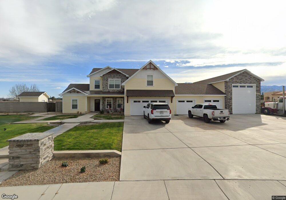
5165 W Central Loop Rd Central, AZ 85531
Estimated Value: $673,456 - $859,000
Studio
--
Bath
3,460
Sq Ft
$212/Sq Ft
Est. Value
About This Home
This home is located at 5165 W Central Loop Rd, Central, AZ 85531 and is currently estimated at $732,114, approximately $211 per square foot. 5165 W Central Loop Rd is a home with nearby schools including Jack Daley Primary School, Thatcher Elementary School, and Thatcher Middle School.
Ownership History
Date
Name
Owned For
Owner Type
Purchase Details
Closed on
May 15, 2025
Sold by
Reeds Rental Properties Llc
Bought by
Welker Heston and Welker Melissa
Current Estimated Value
Home Financials for this Owner
Home Financials are based on the most recent Mortgage that was taken out on this home.
Original Mortgage
$450,000
Outstanding Balance
$443,780
Interest Rate
6.03%
Mortgage Type
New Conventional
Estimated Equity
$288,334
Purchase Details
Closed on
Nov 29, 2021
Sold by
Allred Benjmain D and Allred Lisa L
Bought by
Reea S Rental Properties Llc
Purchase Details
Closed on
Dec 11, 2017
Sold by
Allred Land & Cattle Company Llc
Bought by
Allred Benjamin D and Allred Lisa L
Home Financials for this Owner
Home Financials are based on the most recent Mortgage that was taken out on this home.
Original Mortgage
$243,000
Interest Rate
3.94%
Mortgage Type
New Conventional
Create a Home Valuation Report for This Property
The Home Valuation Report is an in-depth analysis detailing your home's value as well as a comparison with similar homes in the area
Home Values in the Area
Average Home Value in this Area
Purchase History
| Date | Buyer | Sale Price | Title Company |
|---|---|---|---|
| Welker Heston | $700,000 | Stewart Title & Trust Of Phoen | |
| Reea S Rental Properties Llc | $500,000 | Stewart Ttl & Tr Of Phoenix | |
| Allred Benjamin D | -- | Stewart Title & Trust |
Source: Public Records
Mortgage History
| Date | Status | Borrower | Loan Amount |
|---|---|---|---|
| Open | Welker Heston | $450,000 | |
| Previous Owner | Allred Benjamin D | $243,000 |
Source: Public Records
Tax History
| Year | Tax Paid | Tax Assessment Tax Assessment Total Assessment is a certain percentage of the fair market value that is determined by local assessors to be the total taxable value of land and additions on the property. | Land | Improvement |
|---|---|---|---|---|
| 2026 | $2,286 | -- | -- | -- |
| 2025 | $2,286 | $49,509 | $4,778 | $44,731 |
| 2024 | $2,247 | $49,585 | $4,778 | $44,807 |
| 2023 | $2,247 | $38,518 | $4,778 | $33,740 |
| 2022 | $2,133 | $34,034 | $4,778 | $29,256 |
| 2021 | $2,408 | $0 | $0 | $0 |
| 2020 | $3,050 | $0 | $0 | $0 |
| 2019 | $3,177 | $0 | $0 | $0 |
| 2018 | $566 | $0 | $0 | $0 |
| 2017 | $513 | $0 | $0 | $0 |
| 2016 | $521 | $0 | $0 | $0 |
| 2015 | $518 | $0 | $0 | $0 |
Source: Public Records
Map
Nearby Homes
- 2320 51st Ave
- 2413 N Webster Rd
- 2261 Ferguson Ln
- 4812 W Abbey Rd
- TBD Ferguson Ln Unit 21
- TBD Ferguson Ln Unit 22
- TBD Ferguson Ln Unit 23
- TBD Holden
- 2682 Shiflet Ave
- 2836 N Shiflet Ave
- 3937 W 1st St
- 3996 W Main St
- TBD Bomza
- 1794 N Cota Ln
- 3520 W Riverwalk Ln
- Split 2
- Split 3
- 1867 N Eloisa Ln
- 1743 N Eloisa Ln
- 1492 N Porter Ln
- 5145 W Central Loop Rd
- 5125 W Central Loop Rd
- 2310 N 52nd Ave
- 2345 N 52nd Ave
- 2340 N 52nd Ave
- 5105 W Central Loop Rd
- 2375 N 52nd Ave
- 5272 W Us Highway 70
- 2380 N 51st Ave
- 2355 N 51st Ave
- 2405 N 52nd St
- 2400 N 52nd Ave
- 2410 N 51st Ave
- 2385 N 51st Ave
- 2334 N Webster Rd
- 2435 N 52nd Ave
- 2286 N Webster Rd
- 2430 N 52nd Ave
- 2440 N 51st Ave
- 2354 N Webster Rd
Your Personal Tour Guide
Ask me questions while you tour the home.